

Ouvre ce point d’intérêt dans l’application pour préparer ta prochaine sortie

Tête du Ruitor
Italie • 3486 m
Source
Historique
- 1re ascension : 16 août 1858 - Johann Jakob Bucher, Jean-Baptiste Frassy, Gottlieb Studer, Johann Jakob Weilenmann. Montée versant SE, descente versant NW.
- 2e ascension : 8 août 1862 - Thomas George Bonney, Jean-Baptiste et Michel Croz, William Mathews. Par l’arête NE.
- 1re ascension hivernale : 17 janvier 1898 - Maurice Bonnier (guide), Paul Moyne, Louis Rivoire et un porteur.
Webographie
- Panorama">https://www.alpen-panoramen.de/panorama.php?pid=19206">Panorama à 360° depuis le sommet, le 11 mars 2012, sur Alpen-Panoramen. ">https://www.alpen-panoramen.de/index.php">Alpen-Panoramen.
Bibliographie
- Der Ruitorgletscher und seine Umgebung in topographischer Beziehung par G. Studer, Mitteilungen">https://www.e-periodica.ch/cntmng?pid=mnb-001%3A1863%3A0%3A%3A14">Mitteilungen der Naturforschenden Gesellschaft Bern, 1853, no531, p.1-19 : récit de la 1re ascension (en allemand).
- In Valgrisanche - Gruppo del Rutor par G. Bobba, Bollettino">https://tecadigitale.cai.it/periodici/PDF/Bollettino/Bollettino%20del%20Club%20Alpino%20Italiano_1890_57.pdf#page=112">Bollettino CAI, vol. 24, 1890, no57, p.94 : mention de la 2e ascension (en italien).
- La Tête du Ruitor par L. Rivoire, Revue">https://books.google.fr/books?id=YCZ5wOGoheMC&pg=PA133#v=onepage&q&f=false">Revue Alpine, Section Lyonnaise CAF, vol 4, 1898, no5, p. 133-139 : récit de la 1re ascension hivernale.

Itinéraires
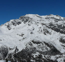
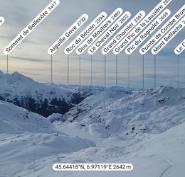
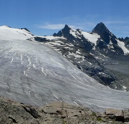

Télécharge l’appli Whympr pour voir ce POI en 3D.
- Recherche d'itinéraires (100 000)
- Retours communautaire
- Prévision météo
- Bulletin d’avalanche
- Carnet de course
- Création de traces
- Carte topographique (dont IGN)