

Open this route in the app to prepare your next outing.

Details
Approach # 20mins
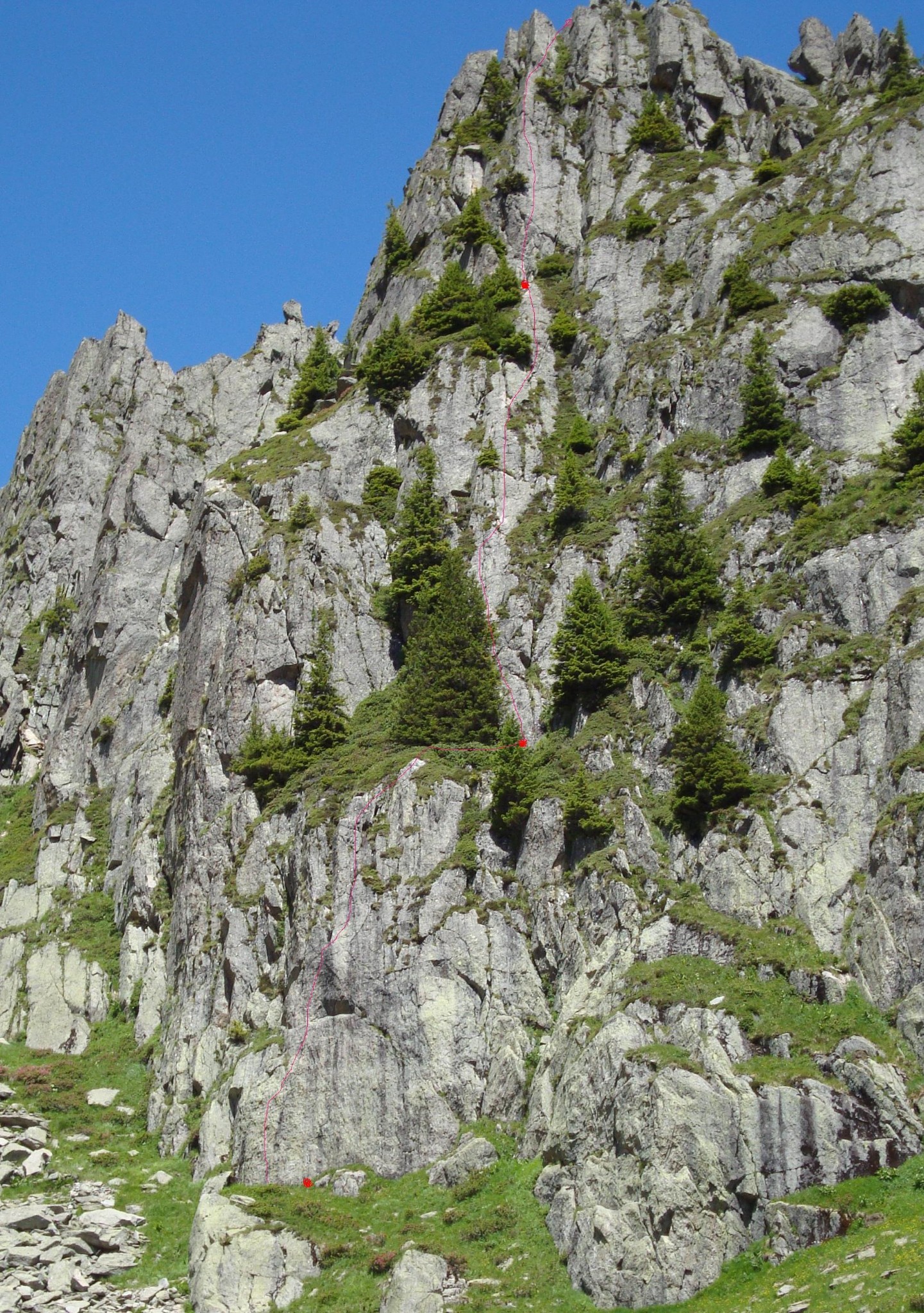
From the Planpraz lift station walk up the main path towards the Brevent. The track passes through a gap in the rock and then a hundred metres further, just as it levels out a bit, there is a path on the right. Follow this for a few minutes until you leave it to go up to the foot of an obvious steep slab. Bolt at the base with a white sling tied through it. (N45º56’31” E006º50’76”)
Route
L# | 5b | 33m | The first bolt is quite far off the ground. At the top of the pitch traverse right to a vegetated corner. L# | 5c | 44m | A surprisingly good and sustained pitch. L# | 5c | 33m | The belay is on the right, above a little corner. (The last bolt has lost its hangar.) At this point it is possible to abseil back down the route, all belays are equipped for abseilling. If not, abseil off the back and walk across to the foot of a ridge. L# | 4c| | Climb the ridge. L# | 4a | | Continue along the crest and abseil (5m), then walk to the foot of the final pinnacle. L# | 5a | | Follow the bolts up the face, (finish shared with Raclette.)
Descent
Abseil from the top of the pinnacle (7m) and walk back down to the top path coming down from the Brevent, keeping well to the right, (looking down) to avoid the worse of the boulders and vegetation

The text and images in this page are available
under a Creative Commons CC-by-sa licence.

Download the Whympr App to view this route in 3D.
- Route search (100 000)
- Community returns
- Weather forecast
- Avalanche bulletin
- Race book
- Creation of tracks
- Topographic map (including IGN)