

Open this route in the app to prepare your next outing.

Details
Approach
1 hour
- Follow the trail leading to col de la Buffaz. Pass the huts of Grosse Pierre.
- Shortly after the huts take a trail to the left. There are signs posted there (the walking times on the signs are longer to the left but take it anyway).
- Intersection in the woods, go straight. After 20m a panel indicates “voie d’escalade su Sappey”. The panel is not visible from the intersection.
- Follow a small track.
- A rock field. The track leads in the forest on the left of it.
- On half way of the rock field a small track with cairns leaves to the right and traverse the rock field horizontally.
- Cairn at the intersection between the rock field and the forest. Follow horizontally (do not go up).
- New rock field (under the Couloir du Feu). Go up to the cliff.
- Follow the cliff to the right.
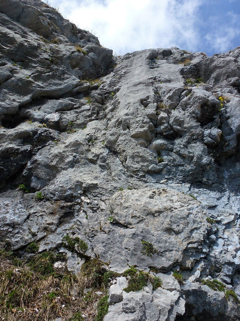
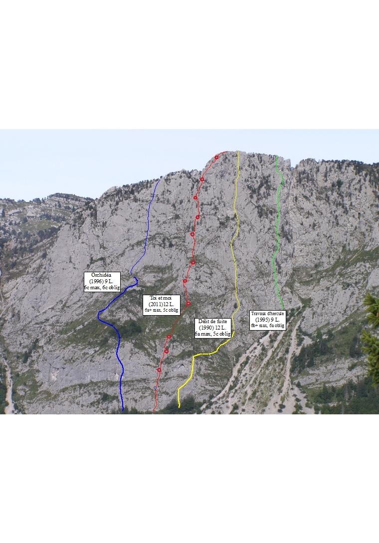
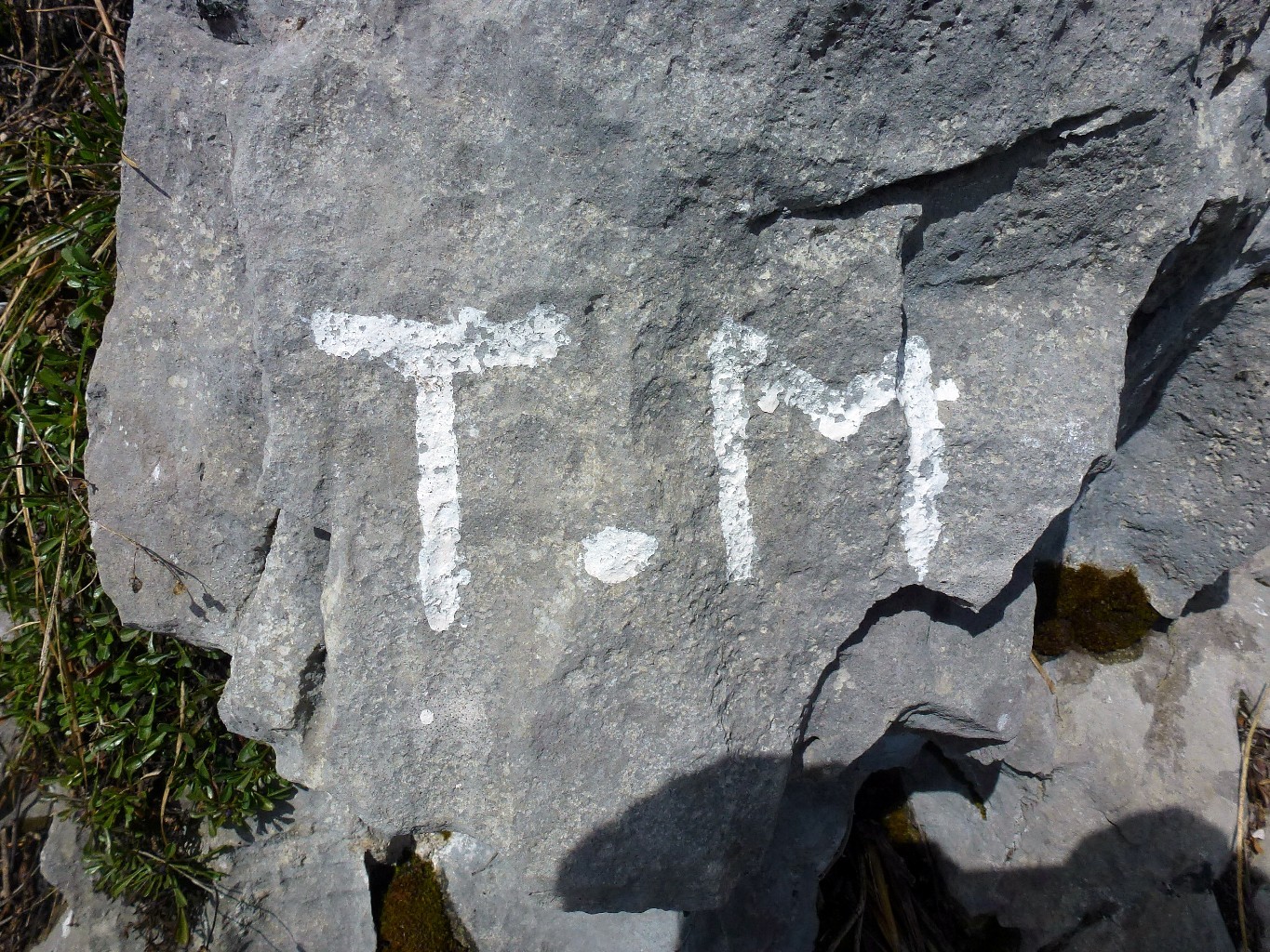
- Toi et moi is situated after the top-rope sector and before a cave. A logo “T&M” has been painted in white colour on the rock (though fading a bit). “Toi et moi” begins 50m on the left of Délit de fuite (50m environ) and starts in a grey diedre.
Route
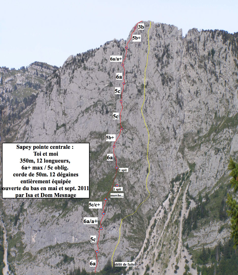
L# | 5c | Begin in the natural weakness and then step to the right and continue. L# | 5c | Fractured slab L# | 6a | Go up a small turn, 2 points on the left and then cross to the right. L# | 5c | Nice sculpted slab.
Follow the grass up, passing the rock outcropping on your right (there’s a spit there). Continue straight up to the pine at the base of the cliff.
L# | 5c | Go straight up and make your way around the roof.
L# | 5b+ | Slabs and runnels.
Go straight up the grass to the slabby wall.
L# | 5c | Slab cut by large crack. L# | 5c | Play with cracks and features in the dihedral… belay is halfway up the dihedral; beautiful pitch. L# | 6a | Continue up the dihedral, past a pine tree and up to the base of a small corner; continuation of a beautiful pitch. L# | 5c | Steep start but with good holds on a pillar, then move right and continue. L# | 5b+ | Straight up and then crossing to the right. L# | 3b | Continue up 10m, scrambling to the summit (take a long sling and maybe a cam; there is not a belay point on top).
Descent
The descend goes through the “couloir du Freu”. This couloir lays between the Pointe centrale du Sapey and les arêtes du Sapey. - Follow the path down the NW side of the ridge. Traverse SSW following the cairns. The path is facing the plateau des Glières. - The trail will pass a small couloir ( where a fixed rope has been spanned in order to avoid people going there since this leads to a cliff). Follow the track to the right to escape from the couloir. - After 20-30 minutes of trail one get to the Col, which gives access to the Couloir du Freu (cairn). - The Couloir du Freu, is steep. Remain on the left side (looking downward). - At the end of the couloir, one reaches the rock field encountered at the approach.

The text and images in this page are available
under a Creative Commons CC-by-sa licence.

Download the Whympr App to view this route in 3D.
- Route search (100 000)
- Community returns
- Weather forecast
- Avalanche bulletin
- Race book
- Creation of tracks
- Topographic map (including IGN)