

Open this route in the app to prepare your next outing.

Details
A beautiful climb following a logical line on good rock with an alpine feel. Recommended in combination with the NW ridge to reach the summit. The combination with the NW ridge is possible as a one day round trip taking the first and last cable car provided that you are efficient and simulclimb the easy parts of the route
Approach
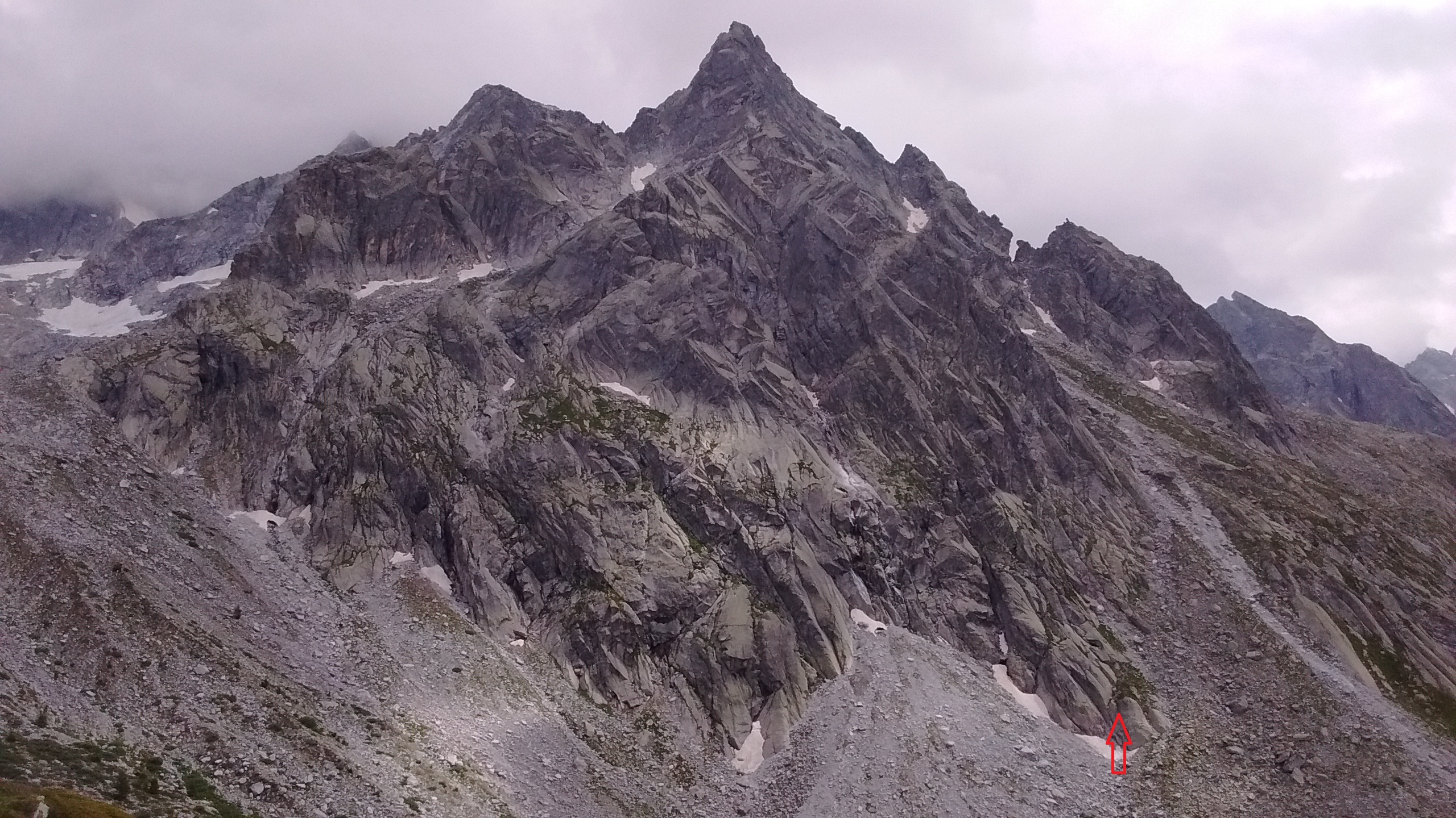
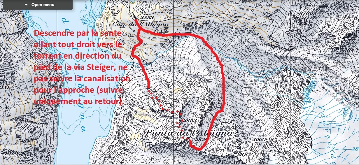
From the parking in Pranzaria, take the cable car or climb by foot (D+900m). to the top station at 2096m. Then follow the road up towards the dam, cross it and go in direction of the Cabane d’Albigninga (sign posts). From the hut descend on the trail towards the lake crossing an old waterpipe. Cross the stream on two logs and aim for the start of the climb. (approximately 770’782.1,">https://map.geo.admin.ch/?X=132743.00&Y=770785.00&zoom=9&lang=en&topic=swisstopo&bgLayer=ch.swisstopo.pixelkarte-farbe&layers_opacity=0.75&crosshair=marker&catalogNodes=1462">770’782.1, 132’734.7 ) which is visible and easy to identify from the topo and pictures. 1,30h
Climb:
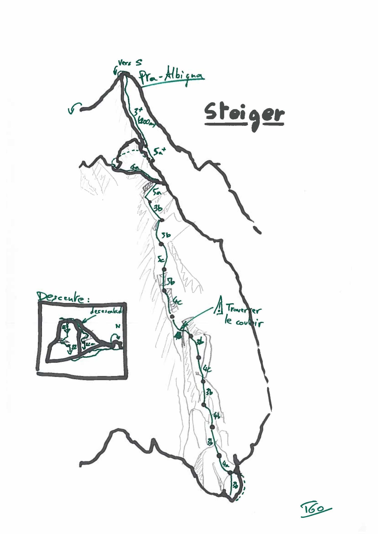
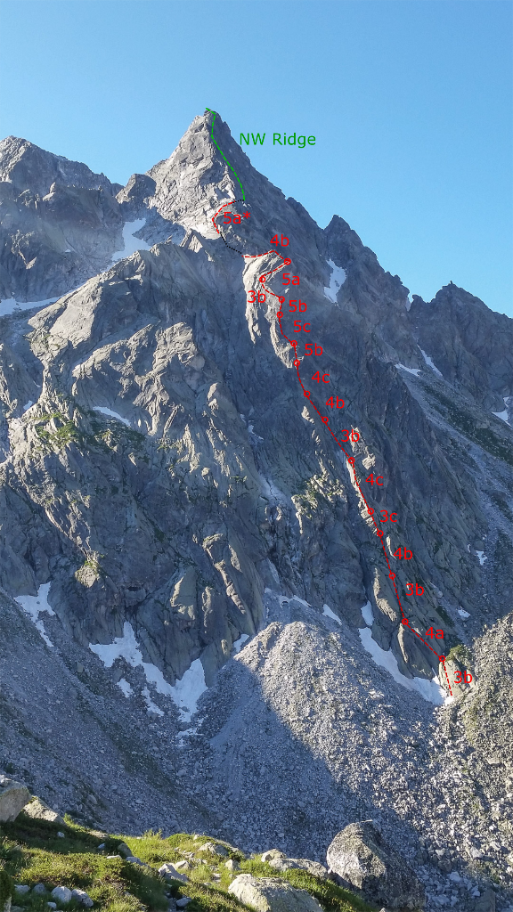
P1 3b, Usually avoided instead pass around the first block to a grassy ledge where you find the first belay. (two bolts on the slab) P2 4a, Nice climbing on the compact slab, then over some grass to the belay. (50m) P3 3b, Easy climbing to reach a small ridge (40m) P4 4b Follow the rigde easy but enjoyable
P5 3c P5-P9 Various easy and enjoyable climbing P6 4c, P7 3b P8 4b P9 4c
P10 5b Mostly easy climbing with a short overhang on small but good holds. The steep part is well bolted. P11 5c Slab climb with small holds with and some balancy moves. Crux pitch. Finish off with easier climbing and find a belay just before going round a corner. (2pitons + bolt) P12 5b Delicate traverse around a corner, then straight up on good layback holds. P13 3b Easy climbing for 20m but no bolts and hard to place gear. P14 5a Go straight up the traverse to the right under a small wall. P15 4b Climb a short section up to a beautiful ridge. Advised to bring up the second climber to the ridge to avoid rope drag. Continue along the ridge and up a debris filled couloir to join the col for either descending or continuing to the summit along the NW ridge. To reach the start of the NW rigde either climb the P16 variation or descend slightly going around the rock wall on the right and join the start of the NW ridge after some easy scrambling (5min).
P16* 5a, Swedish variation, from the col it is possible to connect to the NW ridge by traversing up towards a visible ridge just after the small peak to the right. Includes a 2m down climb midway but with good protection (cam) follow this ridge to the start of the NW ridge.
Descent:
If you finish at the first col descend on foot and rejoin the trail to the hut. Possible snowfield even late in the season but no general need for crampons. If you follow the NW ridge to the summit, descend by two 25m rappels or one 50m rappel then joining a col going down the NE face to join a trail following the stream. Cross the stream and then follow the old waterpipe back towards the hut.

The text and images in this page are available
under a Creative Commons CC-by-sa licence.

Download the Whympr App to view this route in 3D.
- Route search (100 000)
- Community returns
- Weather forecast
- Avalanche bulletin
- Race book
- Creation of tracks
- Topographic map (including IGN)