

Open this route in the app to prepare your next outing.

Details
Approach
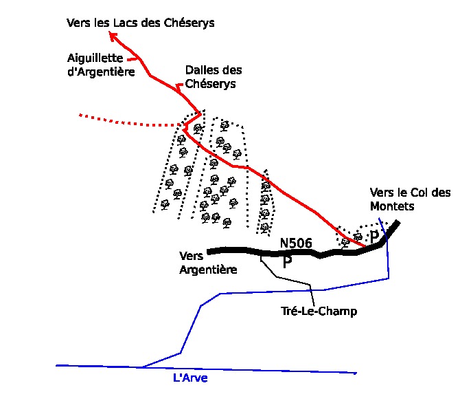
From the roadside parking at Tré les Champs, follow the path leading under the Chéserys slabs and in the direction of Lac Blanc. Before the ladders you arrive at the two Aiguillettes d’Argentière. The two routes climb the taller, (Grand), pinnacle.
Route 1
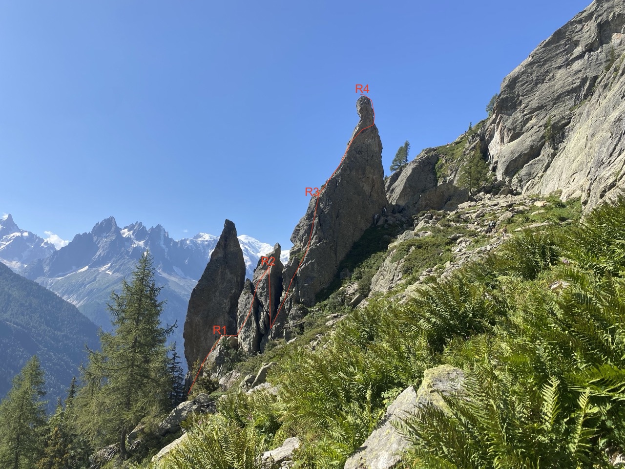
The normal route goes up the SW ridge of the taller pinnacle, 25m 4c
Route 2
The « Biscante » goes up the NE ridge of the taller pinnacle, starting at the foot of a slab.
L# | 4b | 6 bolts | Start up the slab to a « table »boulder. L# | 5a | | A rock fault to step over, (easy), then a 10m abseil. L# | 4c | | Up the slab slightly to the right of the crest, then up to a belay ledge on the crest of the ridge. L# | 5b | Many bolts | Exposed pitch. Continue up the crest of the ridge until it becomes almost vertical. Traverse across the face to the right , around a rib, to reach the SW face and so to the top.
Descent
25m abseil from the big ring on the top.

The text and images in this page are available
under a Creative Commons CC-by-sa licence.

Download the Whympr App to view this route in 3D.
- Route search (100 000)
- Community returns
- Weather forecast
- Avalanche bulletin
- Race book
- Creation of tracks
- Topographic map (including IGN)