

Open this route in the app to prepare your next outing.

Details
Approach
Approach 1, # not recommended
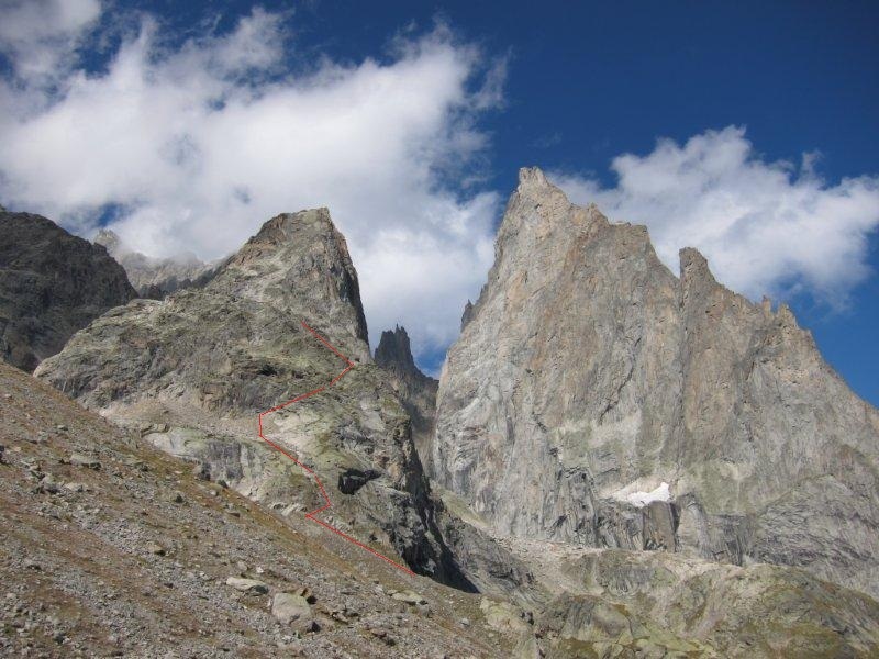
From the Monzino hut, follow the path which climbs the moraine of the Châtelet glacier. Climb up the glacier, (not crevassed,) towards the col de l’Innominata. Around 3000m, take to the rocks on the true left bank. Spot the first belay (slings) 25m above. Climb the rock band to reach the snow slope on the shoulder, (2 pitches : II then III-IV).
Approach 2, # preferable
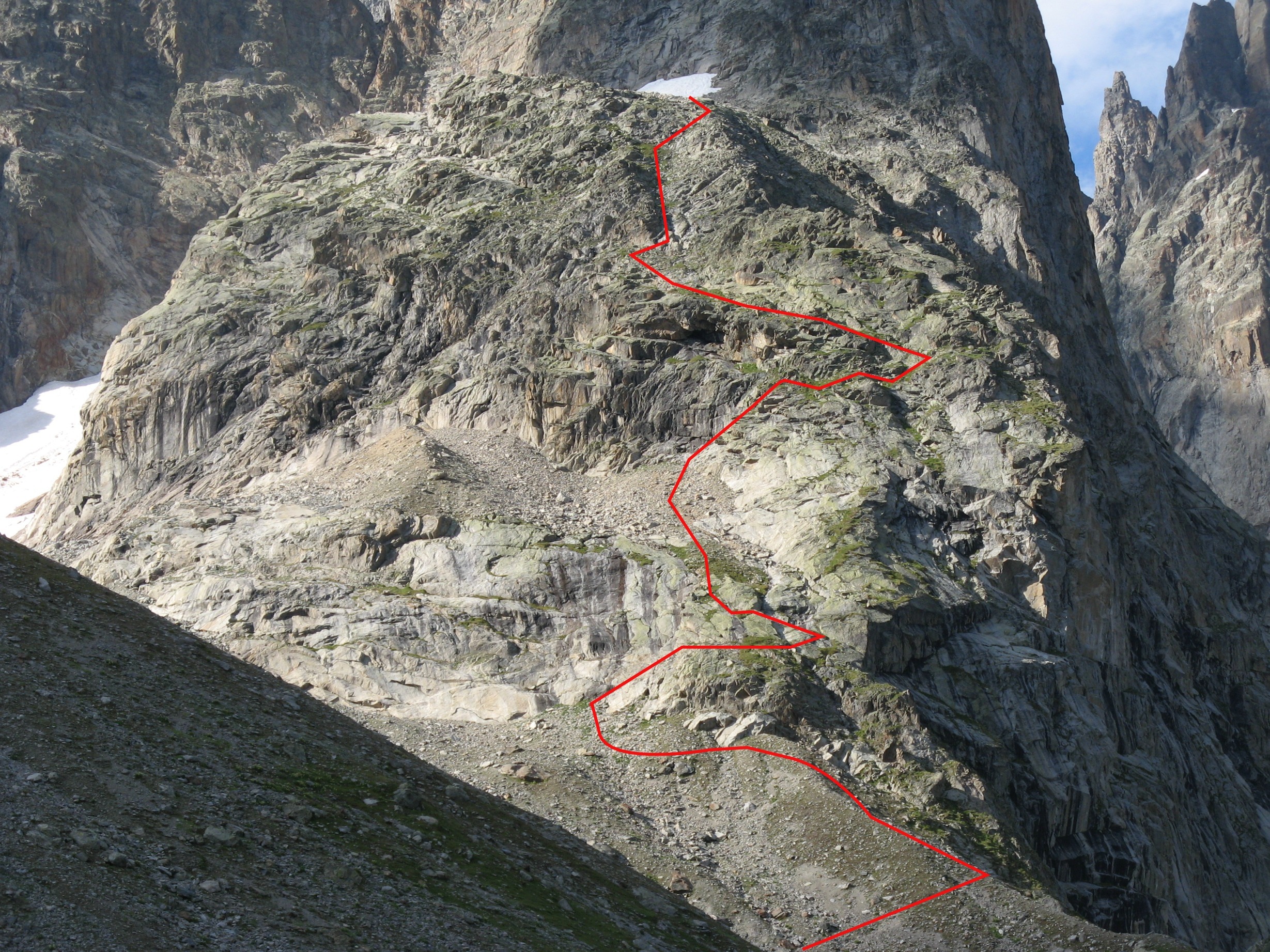
Follow the path to the SE face, (water pipe). Before the path descends to the foot of the SE face, climb up the side of a moraine, (cairns), turn the first rocks on the left (N, ignore the rotten white rope on the right), follow some ledges and screes until a blackish cliff. Climb some ledges to the right (S) and pass two short sections protected by bolts to reach the snow slope on the shoulder. Take time to locate the two abseil points, which allow one to avoid down climbing this section, (see photo below.)
Route
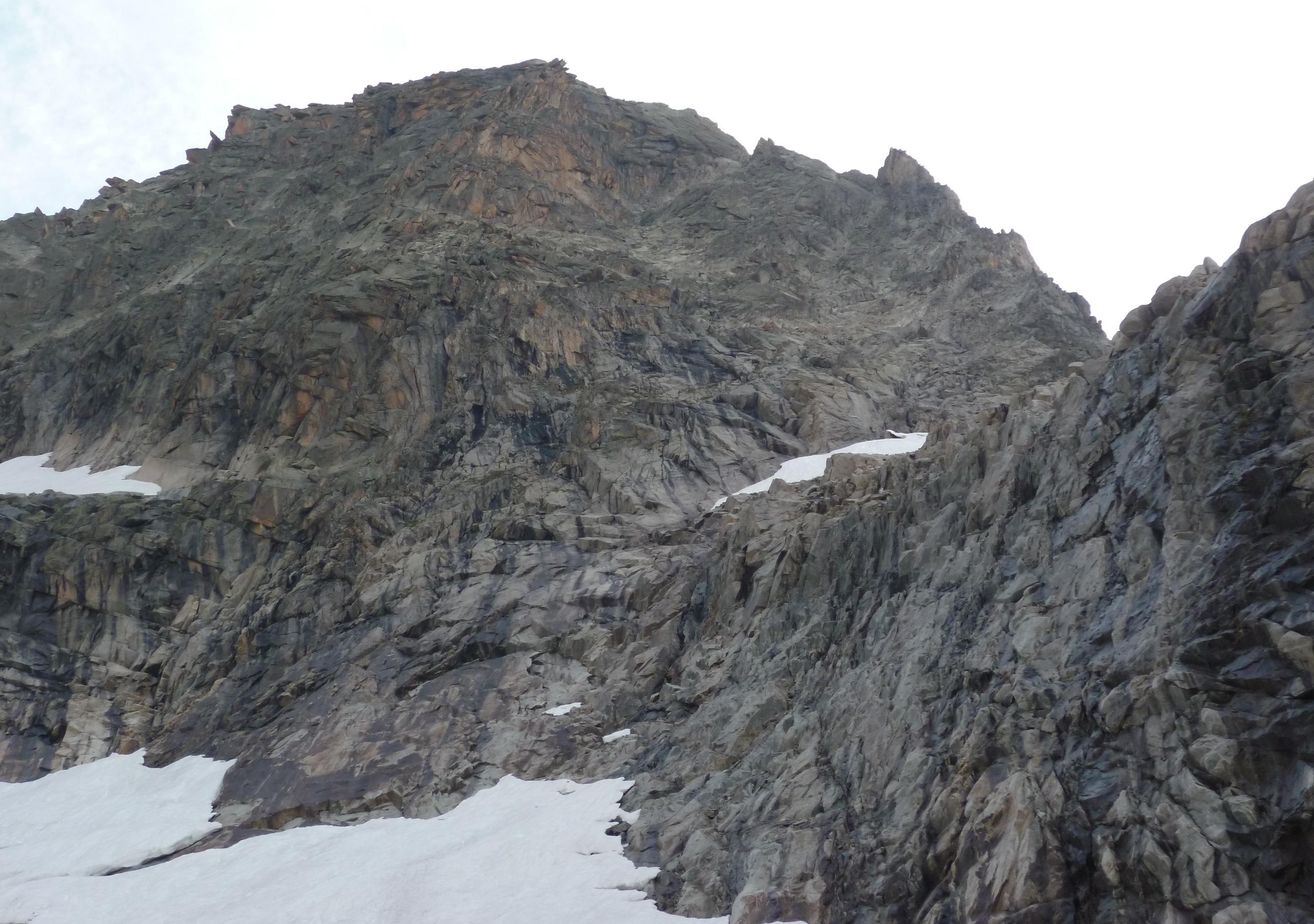
From the snow slope reach a gap in the SW ridge, (first bolt with red sling.) Climb up its left side, (2 pitches III-IV) then climb up more on the face (II-III) and rejoin the ridge at the level of gap to the N pinnacle on the ridge, (belay.) Follw the ridge close to its crest. Reach a slab with 40m vertical cracks and climb these in two pitches, (IV). Then traverse along a slightly descending ledge on the left to climb up again by a short chimney/corner (IV), The belay is 10m higher up on the W side of a large block. From there walk to the summit.
Descent
Descend by the normal route which follows the middle of the W face (grey rocks). From the summit make one abseil from the belay on the large block. Go up the ledge to the left to make two abseils down the 40m slab. Go down an easy ledge for 30m to find a chain belay. From there make a series of abseils (6×25 m?)to reach the snow slope. All the abseil points are equipped with bolts, chains and metal links.
If you used approach 1: from the snow slope follow the cairns, (not many,) which lead to a belay (on slings) to make the first of two abseils to reach the Chatelet glacier. If you used approach 2 (preferable): follow the way up using the two abseil points already described.

The text and images in this page are available
under a Creative Commons CC-by-sa licence.

Download the Whympr App to view this route in 3D.
- Route search (100 000)
- Community returns
- Weather forecast
- Avalanche bulletin
- Race book
- Creation of tracks
- Topographic map (including IGN)