

Open this route in the app to prepare your next outing.
Min / max altitude1870m / 2748m
Main facingN
Route typeReturn the same way
GearEn invierno: casco, cuerda de 50m, 1 o 2 broches, friends variados, 2 piolets.
Source
Details
Acceso
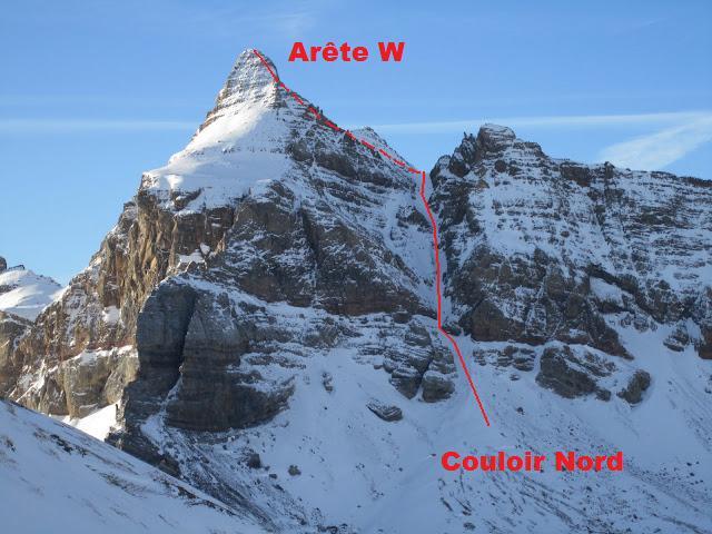
Desde Formigal, parking Sarrios (1870 m), remontar las pistas hasta el Collado de Tres Huegas (o de Izas) (2240 m). bajar vertiente W hasta el pie del pico hacia 2080 m.
Vía
Remontar el corredor N evidente (40°/300 m, pasos 45°)hasta un collado hacia 2600 m. Seguir la aista NW en su flanco SW hasta 2700 m (pasos de II o III inf. según el itinerario). Desde aquel punto (hito) cambiar de vertiente, y pasar en NNE. Seguir placas de dificultad hasta la cumbre.

The text and images in this page are available
under a Creative Commons CC-by-sa licence.

Download the Whympr App to view this route in 3D.
- Route search (100 000)
- Community returns
- Weather forecast
- Avalanche bulletin
- Race book
- Creation of tracks
- Topographic map (including IGN)