

Open this route in the app to prepare your next outing.
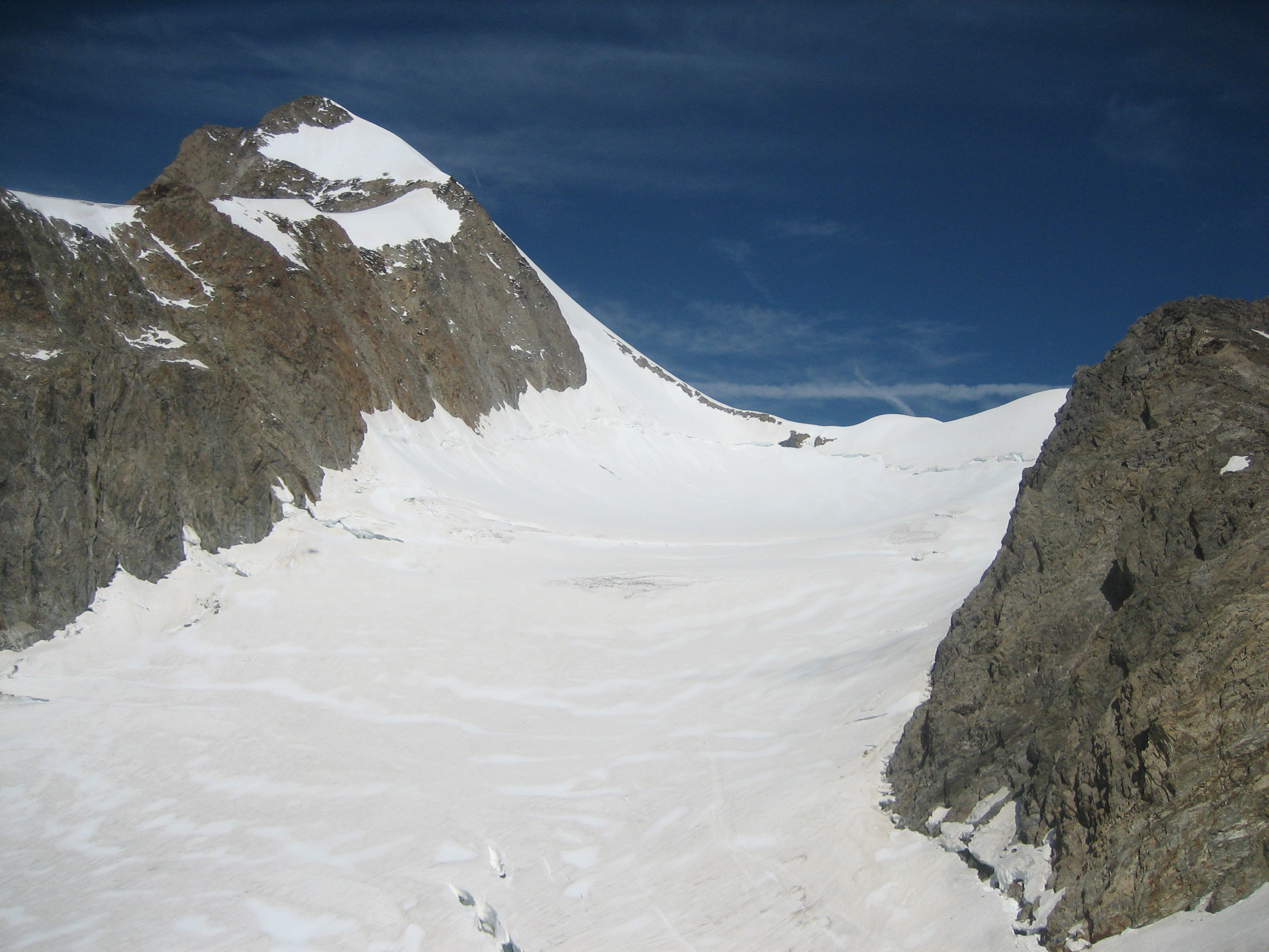
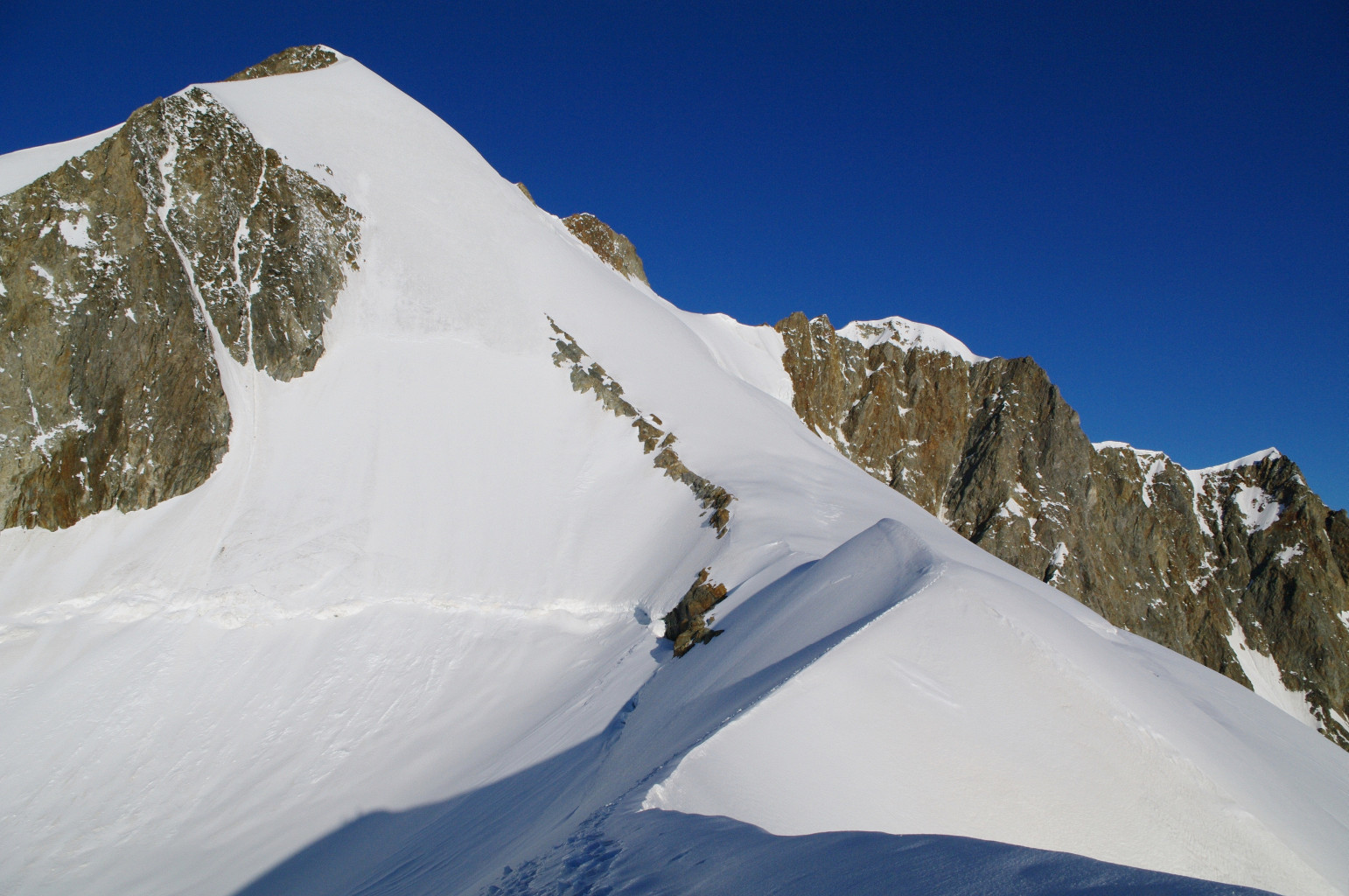
Via Petit Mont Blanc and ENE Arête of Aiguille Orientale (standard ascent)

Details
Approach
Climb up to the Petit Mont Blanc Bivouac (also called Bivouac Rainetto) 3047m +1377m 4h From the Lac Combal, (normally you have to leave the car at the barrier a couple of kilometres lower down,) go up towards the Lac du Miage, until a signpost indicating the path to Bivacco Rainetto (Yellow path n°14). Follow the path which starts up diagonally leftwards and gives access to the cwm between l’Aiguille de Combal and the Mont Tseuc. Go up the cwm. At 2900m, either continue straight up the steep slopes or go to the right to gain a shoulder above. In about 20 mins you arrive at the red bivouac hut which is on the left at 3047m.
It is perhaps a good idea to climb up to the summit of the Petit Mont Blanc (+380m, 45mn) to identify the gully to descend the next morning (30m below the summit, on the W side, cairn at the start).
Route
Petit Mont Blanc 3424m, +380m F 45mn
Go up the snow slopes until 30m below the summit. (The last 50m are a bit steeper, when the angle eases go to the left.)
Descent on to the Petit Mont Blanc Glacier
From the flat area at the base of the summit rocks descend into a vague hollow. A cairn indicates the start of a series of scree covered ledges (15m) which lead to a short steep snow slope (15m) giving access to the glacier. A rope might be useful for this last slope. Continue to descend, keeping to the right to pass the bergshrund, directly underneath the col between the Petit Mont Blanc and l’Aiguille de l’Aigle.
Petit Mont Blanc Glacier and the ENE Ridge of the Aiguille Orientale 3895m
Go up the upper part of the glacier, staying on the true left side and passing underneath the Aig de l’Aigle and under the Point 3561 to reach the base of a large round hump. Climb this by a steep slope (35-40°). The bergshrund is usually easier on the right. This leads to the start of the ENE ridge which you follow to the foot of the summital face and so to the summit of l’Aiguille Orientale de Tré la Tête (350m, 40° then 35°, sometimes bare ice.)
This is the usual end of the route but one can continue on to the next Aiguiulles :
Aiguille Centrale SE 3930m PD+
Follow the ridge to the Aiguille Centrale SE (radio station, partly disused).
Aiguille Centrale NW 3917m AD
From the Aiguille Centrale SE, a snowy and corniced ridge leads to the Aiguille Centrale NW.
Descent
By the same way.

The text and images in this page are available
under a Creative Commons CC-by-sa licence.

Download the Whympr App to view this route in 3D.
- Route search (100 000)
- Community returns
- Weather forecast
- Avalanche bulletin
- Race book
- Creation of tracks
- Topographic map (including IGN)