

Open this route in the app to prepare your next outing.

Details
In 1945, the American climber Arthur Emmons and two companions were the first to climb the S face of Tolosa.
Overview: Because of its altitude, climbing the Nevado Tolosa requires a strategy for acclimatization. Parties usually use a base camp at 4000m and bivi at 5000m. To acclimatize better, you can climb the neighbouring Mirador del Hombre Cojo (which also let’s you check-out the route’s conditions) and/or you can sleep on the edge of the river on the way to the base camp.
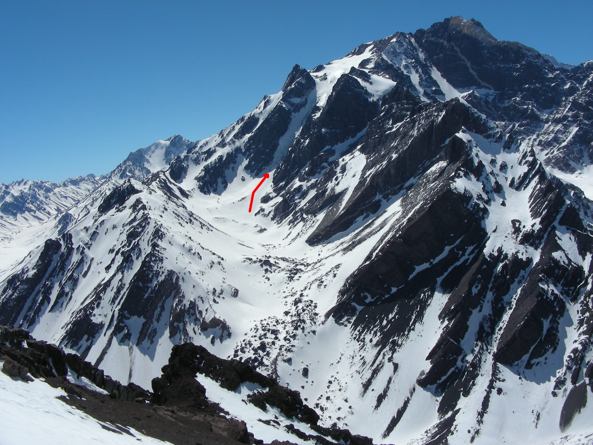
Approach: From Las Cuevas, cross the railway tracks to the N and then the Las Cuevas river, in front of the large dark rocks and boulders straight across. Follow the trail among the rocks, always N, and climb into the valley above the rocks and boulders. After some 4-5h you will reach a cirque at the foot of the glacier. You can set up camp there (4000m).
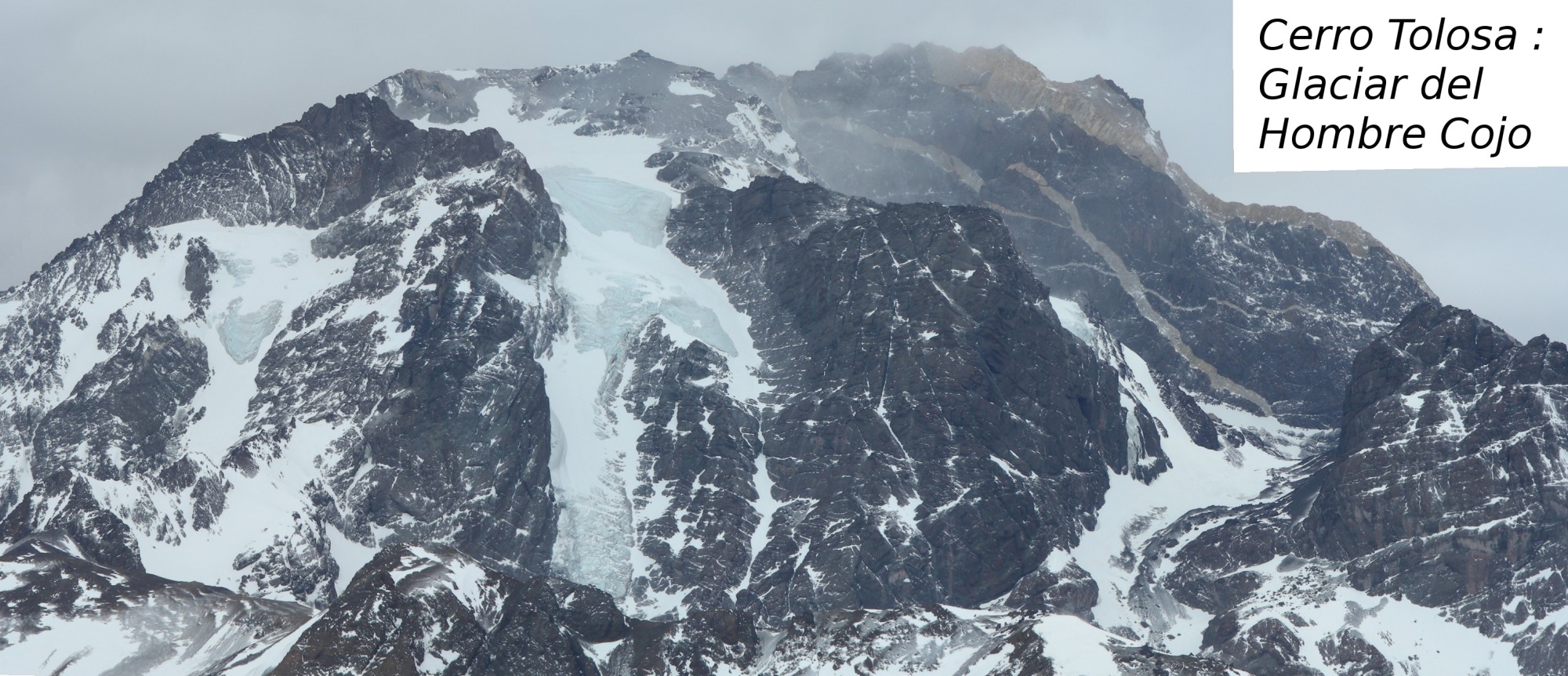
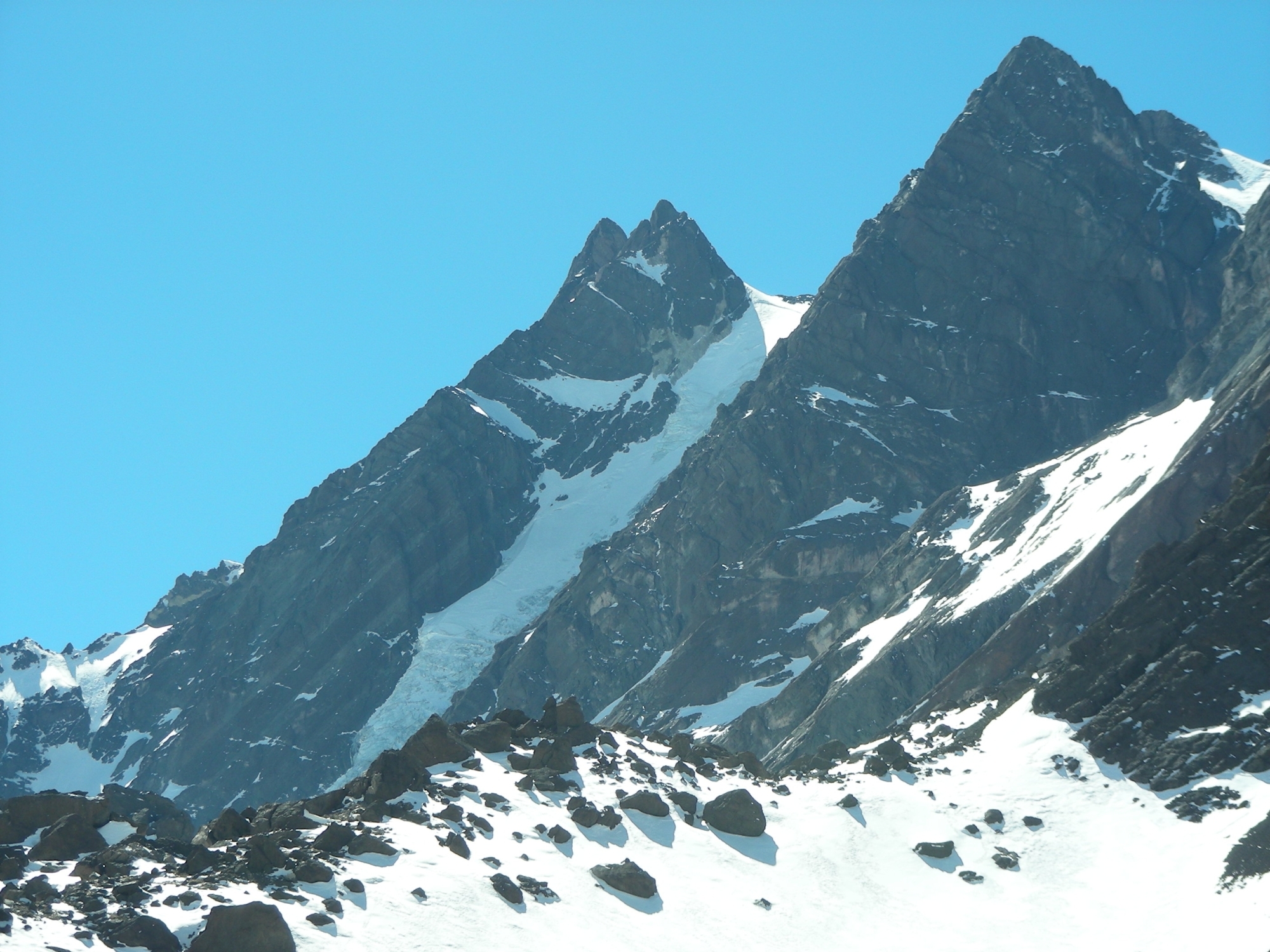
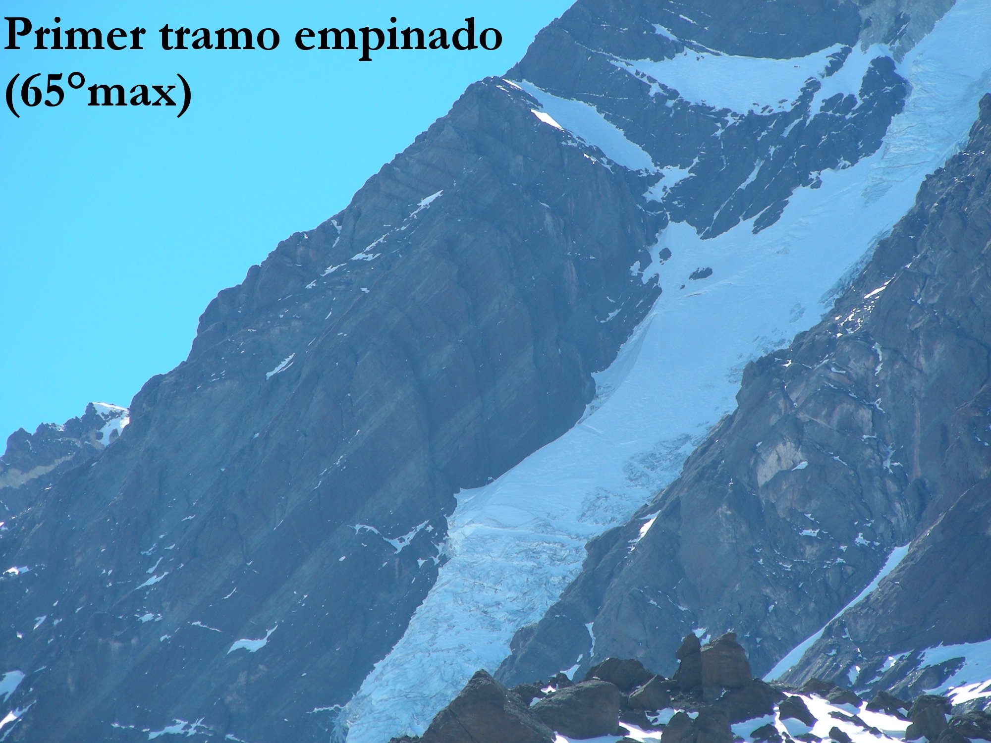
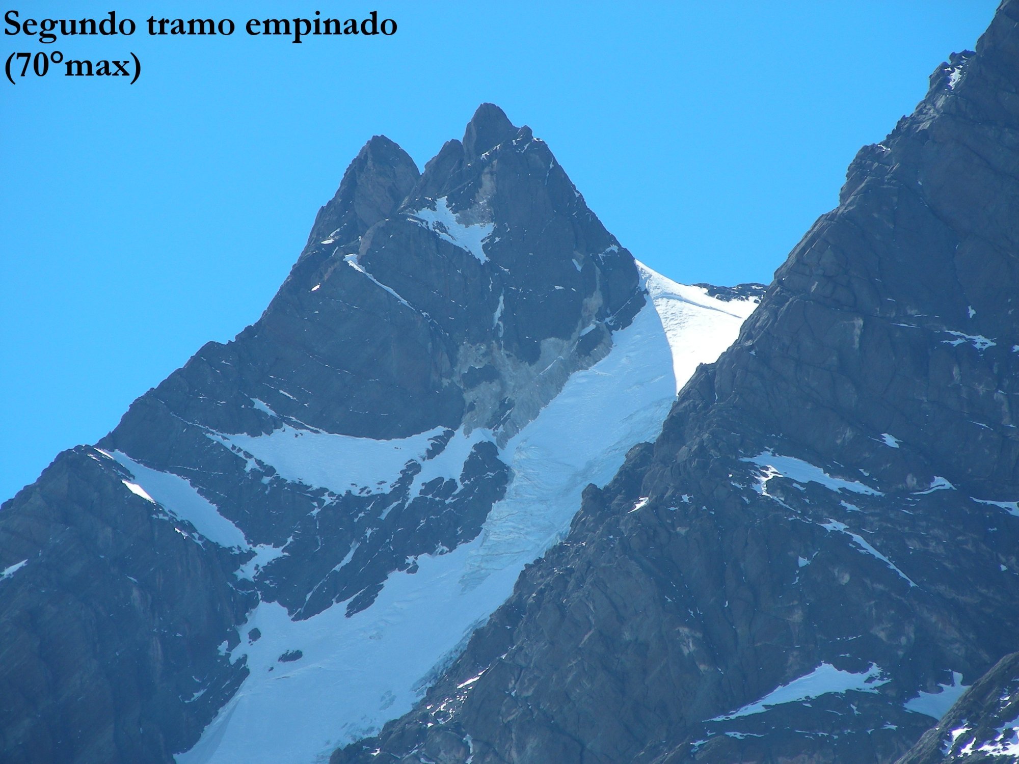
The route: The route goes up the gully on the right hand side of the glacier (to the E), first on easy rocks and then on steeper snow/ice (4 pitches at <65° or WI2). This section takes you to the top of the glacier’s “long leg”. After an easier section (which tends to have penitentes) the route goes up a second set of seracs with one or two ice pitches (approx. 70°, WI3) which bring you to the upper (and flatter) section of the glacier. From there, follow N on the W flank of the glacier towards suitable bivi sites on some rock ledges (5000m).
To reach the summit, go back to the glacier and keep on climbing towards the NNE until you reach the summit ridge. Follow the ridge E to the summit (easy rock sections). The summit day usually involves some 2-3h.
Descent: You can go down the same route but that is quite long and involves setting up rap. anchors on the ice sections. A better alternative is to reach the pass between the Nevado Tolosa and the Cerro México, to the N. From there, go down on the W side of the pass to reach the Matienzo valley and from there go S directly towards Las Cuevas. This option does not take you back to the base camp.

The text and images in this page are available
under a Creative Commons CC-by-sa licence.

Download the Whympr App to view this route in 3D.
- Route search (100 000)
- Community returns
- Weather forecast
- Avalanche bulletin
- Race book
- Creation of tracks
- Topographic map (including IGN)