

Open this route in the app to prepare your next outing.


Details
Approach # to the Mischabeljoch bivouac
From Saas Fee A pleasant approach is from the Mittelallain Metro station and a S-N traverse of the Alphubel. One can also come directly from Langflue but the Fee glacier is very crevassed. (Route 534 in the CAS guide). From Täschalp Climb up by the Weingartengletscher
Route
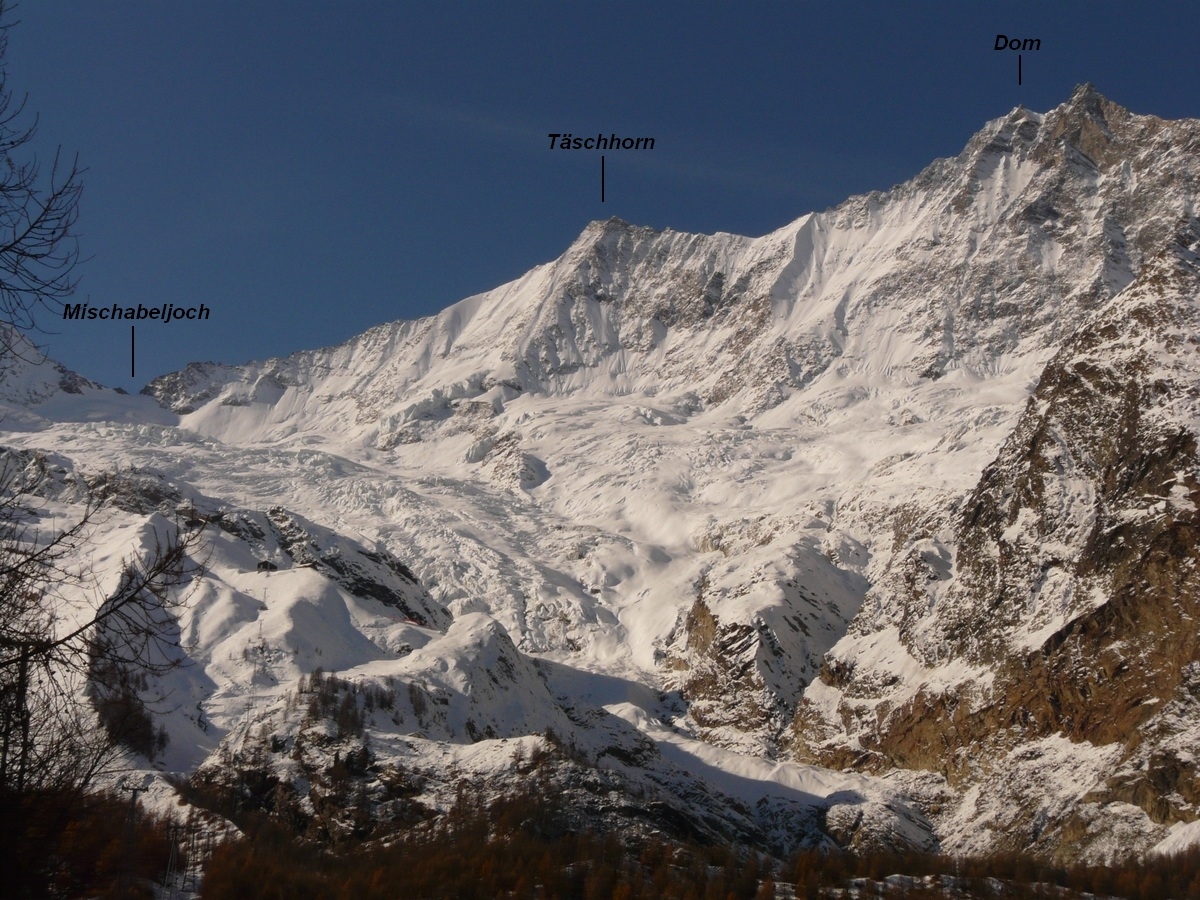
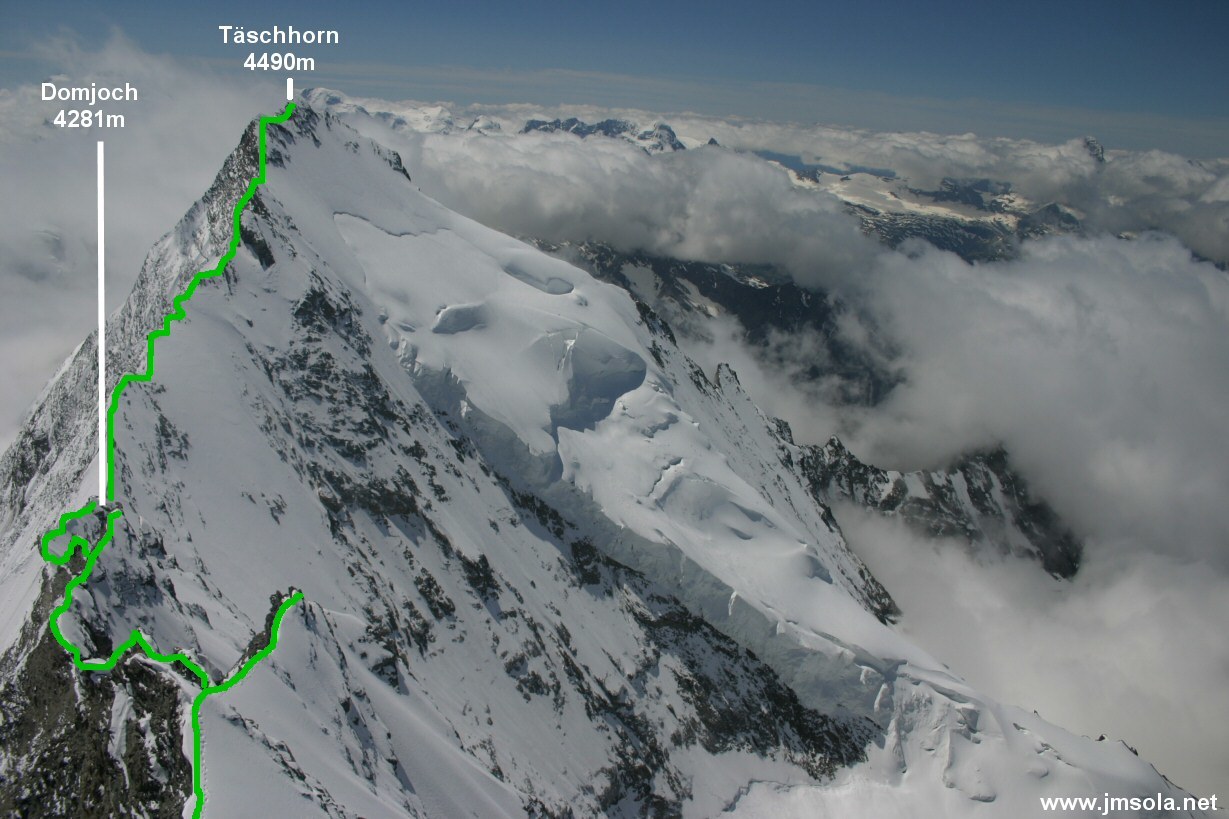
From the bivouac, start directly up the SE ridge of the Taschhorn. Firstly go up the Saas Fee side, numerous cairns, before coming back onto the ridge. Follow this all the way up to below the summit where a final buttress is passed slightly to the right to gain the E ridge (4-5hrs from the bivouac.)
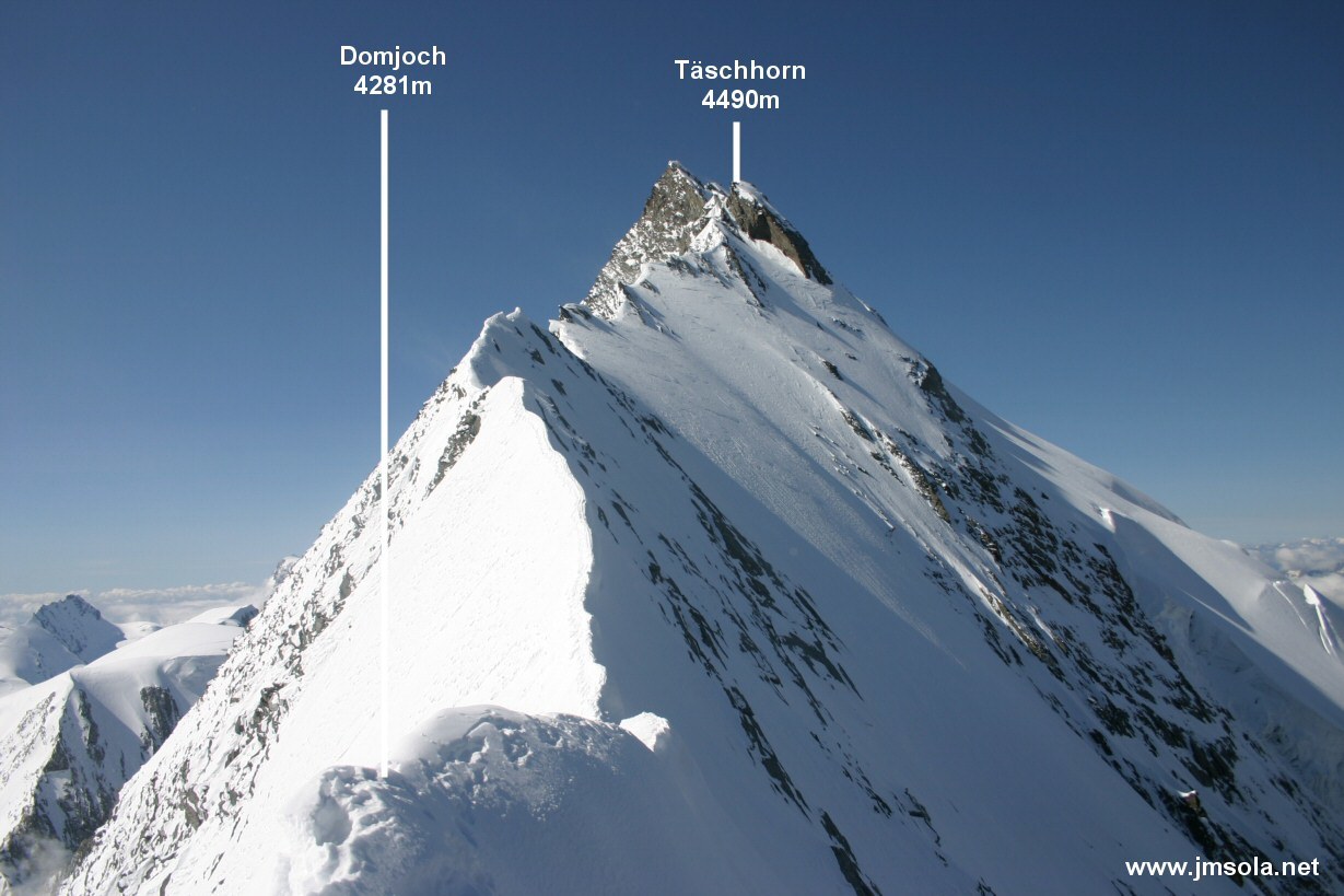
From the summit of the Täschhorn, descend the rock slabs of the N ridge towards the Domjoch, (beware of cornices.) The first part of the ridge, (easy angled,) can be very awkward if there is snow or verglas. (One can avoid some parts of the ridge by going onto steep snow slopes on the Tasch side (W).)
A tower at about two thirds of the way down is by-passed on the Saas Fee side. (Down-climb 3m to a ledge which leads back to the ridge.) In dry conditions, follow the ridge to the col without any major difficulties. If the rocks are snowed up or verglaced, the descent can be very awkward and take a lot of time. Either way, reach the Domjoch 4281m, (2h30 to 3h from the summit of the Taschhorn.)
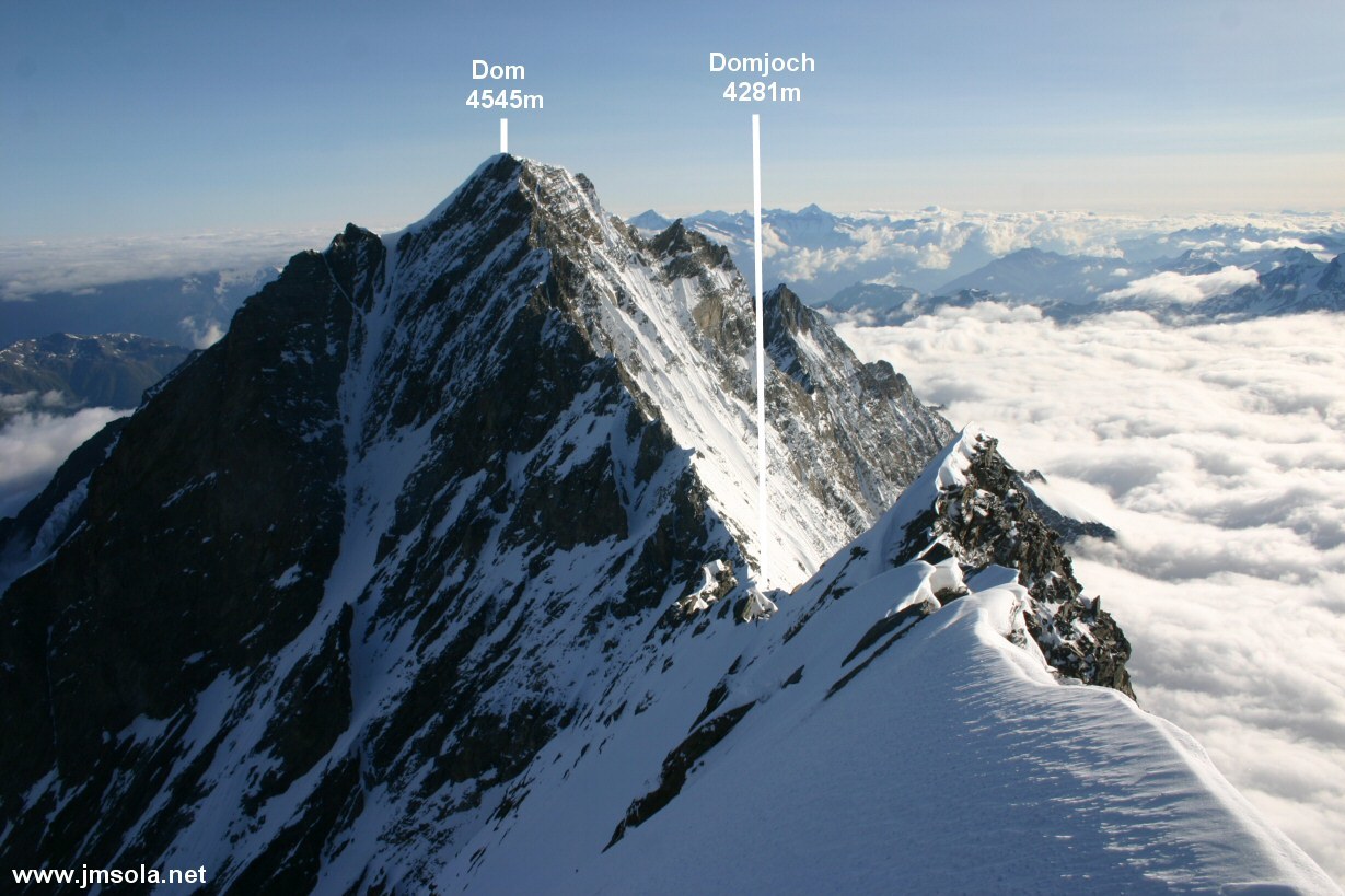
From the Domjoch, Climb up the S ridge, initially easy angled and mostly covered in snow, then loose rock, (for the first two thirds of the ridge.) Keep as much a practical to the crest of the ridge where the rock is better. After a little notch, the ridge is blocked by a slightly overhanging buttress. Pass this on the right, (Saas Fee side,) climbing on very loose rock to regain the ridge.
The last third of the ridge gives good climbing on steeper but more solid rock. This leads to the Dom summit, (2-2.5h from the Domjoch).
Descent
Descend by the normal route down the N face of the Hobarg glacier. To avoid the seracs, hook back to the right until under the Lenzspitze and descend the true right bank of the glacier and at about 3800m cross back to the true left bank and so to the Festjoch 3723m (col.)
Climb the rocky tower of this col to reach a via ferrata and a path which brings one down onto the Festi glacier. Go down the true right bank of this glacier finding a way between the crevasses and the moraine until at about 3200m you reach the footpath to the Dom Hut (cairns).

The text and images in this page are available
under a Creative Commons CC-by-sa licence.

Download the Whympr App to view this route in 3D.
- Route search (100 000)
- Community returns
- Weather forecast
- Avalanche bulletin
- Race book
- Creation of tracks
- Topographic map (including IGN)