

Open this route in the app to prepare your next outing.
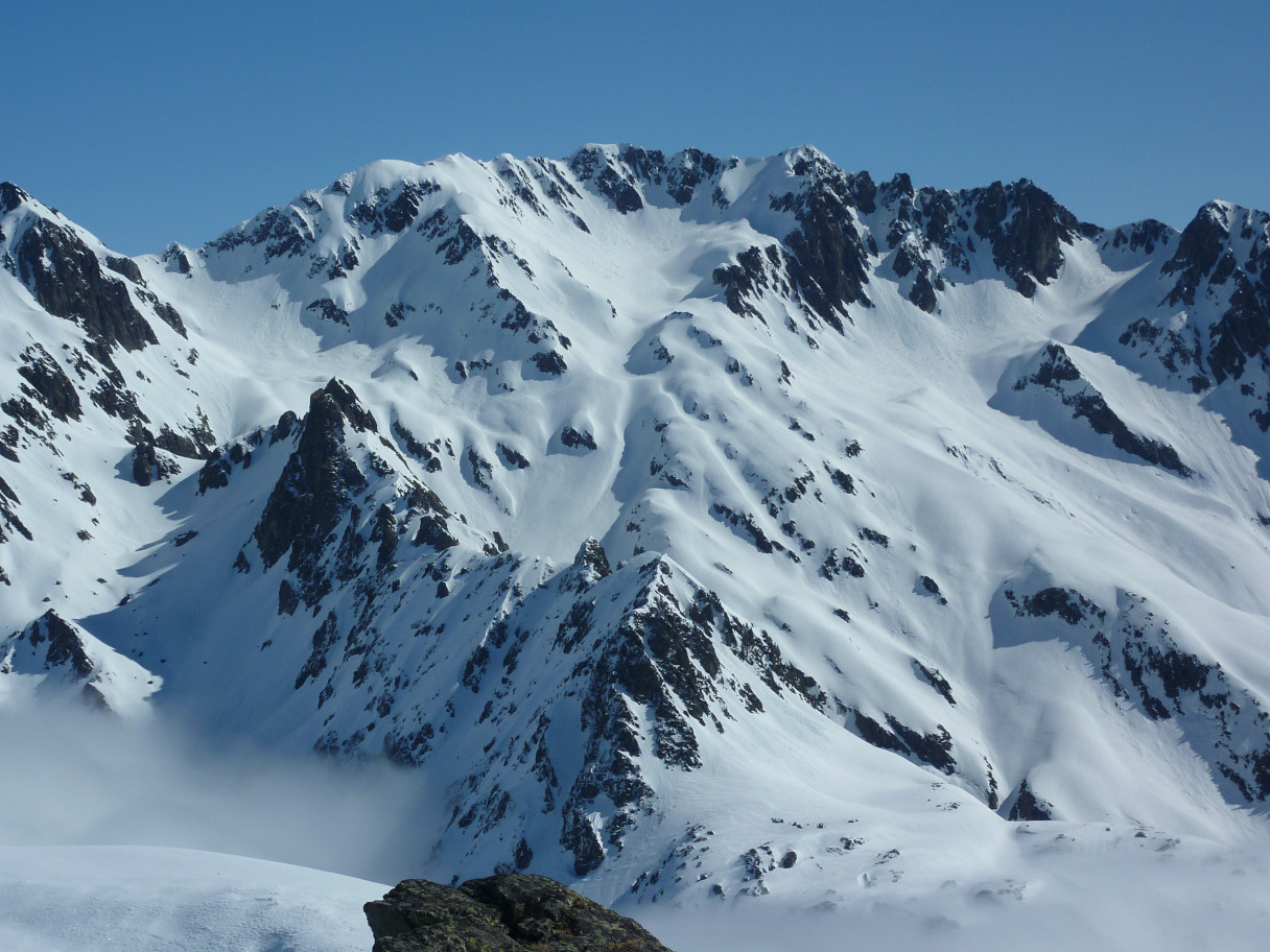
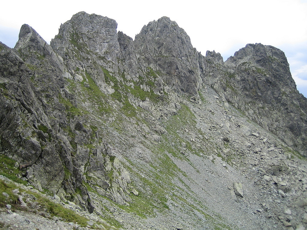
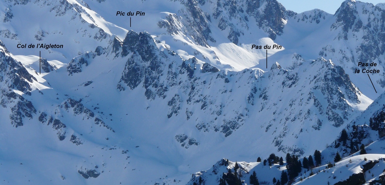
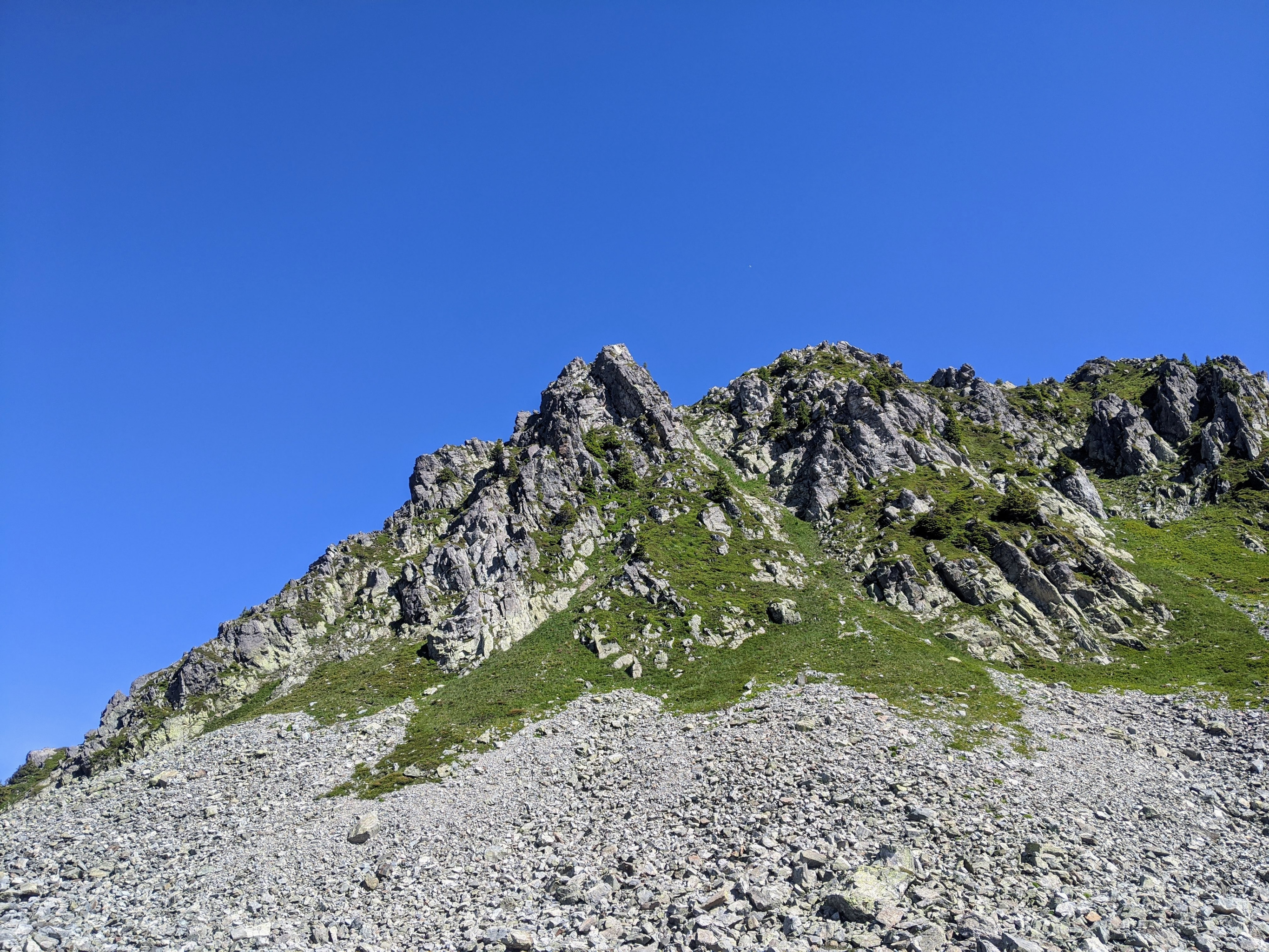

Details
Approach
Parking at the trailhead – GPS latitude longitude approx (N45.2245 E5.9988) . (elev 1340m) – is about 3 km at the end of the asphalt road SE from the village of Prabert, which is usually reached by the D528 road E up from the village of Brignoud by exit 24 of the A41 motorway / interstate. (Some people say they’ve succeeded in driving a 2WD non-high-clearance vehicle higher on the dirt road, which continues sharp left (NW) after the trailhead for 100 meters, then sharp right (ESE) 350m up to a gate by (N45.2238 E6.0014) . (elev 1390m).
Hiking – The objective is to reach the Col de l’Aigleton. The strategy is to avoid the giant talus-filled bowl below the W side of the ridge. The method is to skirt around the W and N sides of most of the talus.
From the trailhead start up E about 220m to meet forest road with gate. Continue on forest road past gate, at first SE 100m, then E 100m, SE 100m, and up E about 1500m on dirt/gravel forest road (with several possible shortcuts) to a junction of trails (N45.2224 E6.0217) . (1725m). Total so far about +385m uphill over 2.0 km distance.
From the junction go Left (N then NW) 175m to the hut Habert d’Aiguebelle (N45.2236 E6.0209) by the “Balcon” trail. But instead turn sharp Right and start up the trail toward the Cime de la Jasse, generally NW for about 800m (with an early water-crossing). Later some switchbacks, and at (N45.2286 E6.0274) . (1950m), see a smaller trail going off Right.
This smaller trail (with entrance “marked” by a yellow X) is an unofficial “users” herd path to the Col de l’Aigleton. Steep NNE 200m, next ENE 200m at first gentler then flat through some rocks (some cairns) with a water crossing. Next bear right SE 150m horizontal across talus, finally E + ENE 500m much steep across a shoulder / mini-col to reach the Col de l’Aigleton (N45.2308 E6.0369) . (elev 2265m).
Total from trailhead about +1050m uphill over 4.8 km distance. Typical range of times 2-3 hours for fit climbers.
Climbing
North forepeak (N45.2299 E6.0369)
P1: From the Col de l’Aigleton about 80m, first scrambling up SE then hiking S to reach a wall.
P2: Wall with cracks on its R side. Start in cracks, finish on R edge of wall, ducking under the dragon’s snout, then easy scrambling left up to summit - (4a, fun + interesting, with positive holds if look carefully).
P3: Down S ridge, at first on E side, then cross over to W side (4a, thoughtful + exposed, with loose rock).
. . > Breche / low break (N45.2297 E6.0369)
North summit of Pic du Pin (N45.2294 E6.0368)
P4: Up N ridge, some to its W side, to summit. (3+, with vegetation).
P5: Down S ridge (scrambling with vegetation + loose rock).
. . > Breche / low break (N45.2292 E6.0365) - perhaps could escape down W or E side?
Central summit (highest) of Pic du Pin (N45.2289 E6.0363) . (elev 2342m)
P6: Up N gully (toward L side of face). Starts positive, gets slopier higher up, could finish to its L side, up to a “mini-col” near summit. (4b).
P7: down S arete on vertical fins and blocks. (4a, with big exposure, positive holds, magnificent).
. . > Breche / low break (N45.22849 E6.03594) - could escape down NW (4a, thoughtful, vegetated + loose rock).
. . Descent from early exit / escape from northern part of this traverse: After successfully descending some less-steep part of the W side of the Pic du Pin ridge, aim N and make a high traverse above the E side of the “bowl” of talus. Then cross a smaller section of talus and meet the approach trail around (N45.2305 E6.0355). Turn Left (W) and go back down the trail sections used for the Approach.
Gendarme #3 (N45.22842 E6.03586)
P8: scramble SE down left (E) side a bit, then up L side of steep gully in middle of E face to top. (4c, thoughtful, sustained, with positive holds if look for them and know how to use them).
. . > variation: Avoid the gendarme below its W side, by scrambling way down SW on grassy ramp, then E up gully (3) to reach the next Breche.
P9: down S ridge then SE face (3 on nice enough rock).
. . > Breche / low break (N45.2284 E6.0357)
South summit of Pic du Pin (N45.2282 E6.0353) - has three distinct high points N, S, W.
P10: N arete - most interesting climbing directly on the edge of the arete - (can take the lower section “à cheval” (riding the horse). Otherwise find footholds directly in the edge of the arete) - (4a, fun + thoughtful). … (or can avoid some difficulties by climbing some off the arete to E side, 3c).
P11: down S ridges: start down the obvious arete. When that runs out, cross left (E) to continue down another arete.
P12: Along crest 150m S then SSW, scrambling up and over some high points along the way, and reach a steep N wall.
Gendarme #2 (N45.2264 E6.0341)
P13: N + E faces … First up to the right end of the big flake across the lower N face. Traverse Left (E) on the flake (more exciting if hang outside). Then exit up left edge of N face through a little overhang (4c, with big holds) around the corner onto E face, and up the slab to the top.
. . Variation: can avoid this gendarme by traversing below its W side, to reach the next low point.
P14: down S arete (3+), then scramble W up along bottom of S face to regain the crest, then continue along the crest 100m roughly S to …
. . > low break: Pas du Pin (N45.2249 E6.0337)
Gendarme #1 - Pinnacle du Pin (N45.2247 E6.0337)
P15: traverse below its W side on steep vegetated slopes + ledges (exposed to dangerous long sliding fall when wet), then continue 150m SSW along crest to its southern end. . . Variation optional side-trip: After bypassing below its W side, turn back left and scramble up SW ridge to summit, return the same way.
Pointe 2197m : (N45.2234 E6.0325) - S end of the crest
P16: hike down on crest about 100m SW, then climb down SSW on one of two rock ribs (3+). . . Variation: Instead turn left off crest and steep down S gully (40 degrees, vegetated, slippery).
Descent
From the base (N45.2222 E6.0307) of the rock of the SW ridge of Pointe 2197, hike about 430m straight S down into talus bowl with lake, straight across its bottom and up the other side, and through some irregularities generally S down to meet main hiking trail (near electric power line) just E of …
. . > Pas de la Coche (N45.2177 E6.0295) . (elev 1990m)
Turn Right (W) onto trail, across the pass and down trail (roughly along under electric power line) about 1000m WNW then NW to the major junction (N45.2224 E6.0217) with the dirt/gravel forest road used on approach. Turn Left and go about 1500m generally W on forest road, a little up at first, then down and down, with several possible shortcuts. Road gets gentle, and just after walking over cattle bars and through gate (N45.2238 E6.0015), turn off the road Left onto trail down NW to trailhead parking (N45.2245 E5.9988).

The text and images in this page are available
under a Creative Commons CC-by-sa licence.

Download the Whympr App to view this route in 3D.
- Route search (100 000)
- Community returns
- Weather forecast
- Avalanche bulletin
- Race book
- Creation of tracks
- Topographic map (including IGN)