

Open this route in the app to prepare your next outing.

Details
Approach
From the Couvercle hut, go up the right bank of the Talèfre glacier (under the Moine), pass under the Whymper Gully to reach the bergschrund below the Col de l’Aiguille Verte.
Route
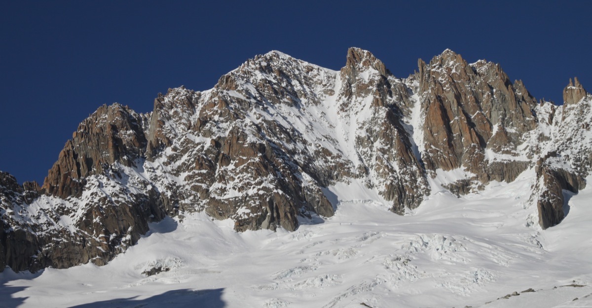
Cross the bergschrund and climb up the main couloir (45°), to the left of the Clochetons, until about three quarters of the way up then take a gully to the left between two large ridges. (Note: there are two gullies at this height, the lower one is more technical and often iced up, the right route takes the higher one.) Climb this gully until it comes up against large vertical wall. Take the little gully on the left, pass a jammed block (3b) an just afterwards, reach a vertical wall with lots of cracks, (4b), climb it. This brings you to a little col to the right of a large pinnacle.
Pass under a jammed boulder, (chimney 3b, not easy with large shoulders), then up leftwards under the fore-summit of the Aiguille du Jardin, some “runnels” at 3b. Reach this summit of the Aiguille du Jardin from the right by a snow slope.
Climb down the crest of the ridge (some passages of mixed but never too difficult.) to reach the first slopes of the Col Armand Charlet. The first part of the col is traversed, then descend obliquely and finally a less steep traverse. The route up the Grande Rocheuse follows the crest of the ridge. The descent towards the Col de la Grande Rocheuse is made either by down climbing or by a 25m abseil on the right. Another 30 mins from the col up the snow ridge leads to the summit of the Aiguille Verte.
The crux of the route is the exit to the little col to the right of the large pinnacle, in the access gullies to the Aiguille du Jardin. In the first gully do not be afraid of going too high and in the second finish well to the left.
For the ridges, route finding could not be more logical, it is straight on, enjoy!
Descent
2 possibilities:
- Whymper couloir From the col drop into the Whymper couloir (600m, 50º max) There are abseil points on the true left side of the couloir (often at 60m intervals.). In the last quarter of the descent, go again to the left, (looking downwards) to join a secondary gully which leads to the bergschrund. Abseil point on the true left bank. Once on the Talèfre glacier (very crevassed), get back to the Couvercle hut by keeping to the true right side of the glacier, traversing under the Aig du Moine. The time taken has varied from 55mins to 7hrs depending on conditions and technique.
- Moine ridge This descent is recommended if the Whymper is too dry or in bad condition, for example late in the day. The route is mixed, never difficult but long and sustained, starts directly from the summit of the Verte in the direction of the Moine ridge, to the south. Do not start down the line of abseils more or less equipped on the Talèfre face. Bypass a pointed pinnacle by the Talèfre face, then stay on this face, under the ridge just to the point 3850 m. Descend a chimney gully, 1 abseil from a metal ring, then continue by slabs and snow bands. Traverse to the right to a little col, but do not descend the deep gully, instead go to a second little col on a secondary ridge. Continue to traverse on ledges to the right (S). Head down towards the bergschrund on the Talèfre glacier, the slope steepens. Go to the left, (abseils possible to reach the glacier). Once on the glacier (very crevassed) regain the Couvercle hut by taking the true right bank under the Aig du Moine . 4h00 to 6h00 from the summit to the hut.
Comments for the descent: The descent by the Whymper should not be undertaken unless all the conditions are correct. The descent by the Moine ridge is preferable during the summer season, or if the snow conditions are bad, i.e. too dry, too much (unstable) snow, or if after 08.00am.

The text and images in this page are available
under a Creative Commons CC-by-sa licence.

Download the Whympr App to view this route in 3D.
- Route search (100 000)
- Community returns
- Weather forecast
- Avalanche bulletin
- Race book
- Creation of tracks
- Topographic map (including IGN)