

Open this route in the app to prepare your next outing.


Details
Approach # 1h30
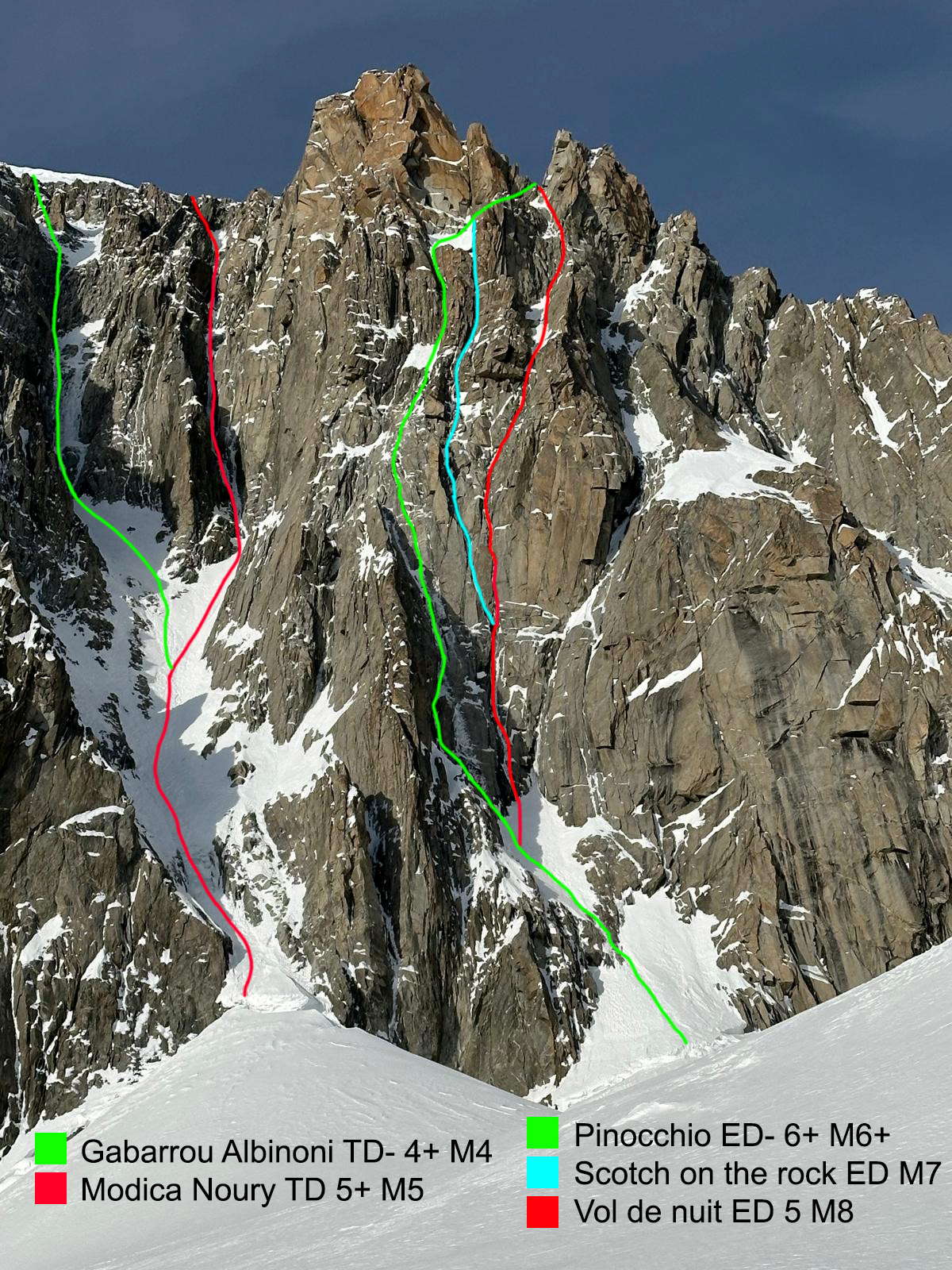
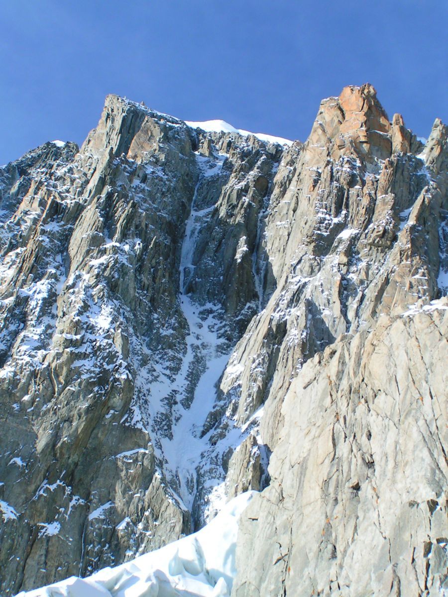
From Aiguille du Midi, descend the ridge completely to the E until the altitude of 3670m. From there, pass the bergschrund and cross the Col du Midi plateau to go between the Grand Rognon and Pointe Lachenal. Skirt the S face of Pointe Lachenal and head towards the base of the ice gully. It is located to the left of Pilier Martinetti (the one that descends the lowest on the E slope of Mont Blanc du Tacul).
Route # 4-6h
Pass the sometimes steep and open bergschrund. Then go up the snow slopes plumb with the ice gullies (300m at 55° with possibility of a steeper section at 70°). Belays are located on the true right bank. Do not take the ice gully first on the right (it is the more difficult Goulotte Modica-Noury), but skirt Pilier Cecchinel for 100m until a widening dominated by a rocky wall, belays on the left (while climbing). From this belay, continue the ice gully by traversing it to get to the true left bank. The latter section is steeper (85°) and may have less ice depending on the season and conditions, belays on the right or left. Continue then either directly (risk of stone falls), or trending to the right, then by a runnel to reach the E ridge of Tacul. From there, continue easily to the summit (4 to 6h).
Descent
From the summit, follow the “Voie Normale”. Head towards the shoulder of Mont Blanc du Tacul and around 4080m, descend completely N then in the direction of the base of the triangle of Tacul by passing successively 2 bergschrunds which can be steep depending on the conditions or the season. From here it is easy to reach Col du Midi then to go back up to Aiguille du Midi (2h30). It is also possible to return by abseiling in the gully at the top of the difficulties. Nevertheless, it is a shame not to top out to the summit.

The text and images in this page are available
under a Creative Commons CC-by-sa licence.

Download the Whympr App to view this route in 3D.
- Route search (100 000)
- Community returns
- Weather forecast
- Avalanche bulletin
- Race book
- Creation of tracks
- Topographic map (including IGN)