

Open this route in the app to prepare your next outing.

Details
Approach
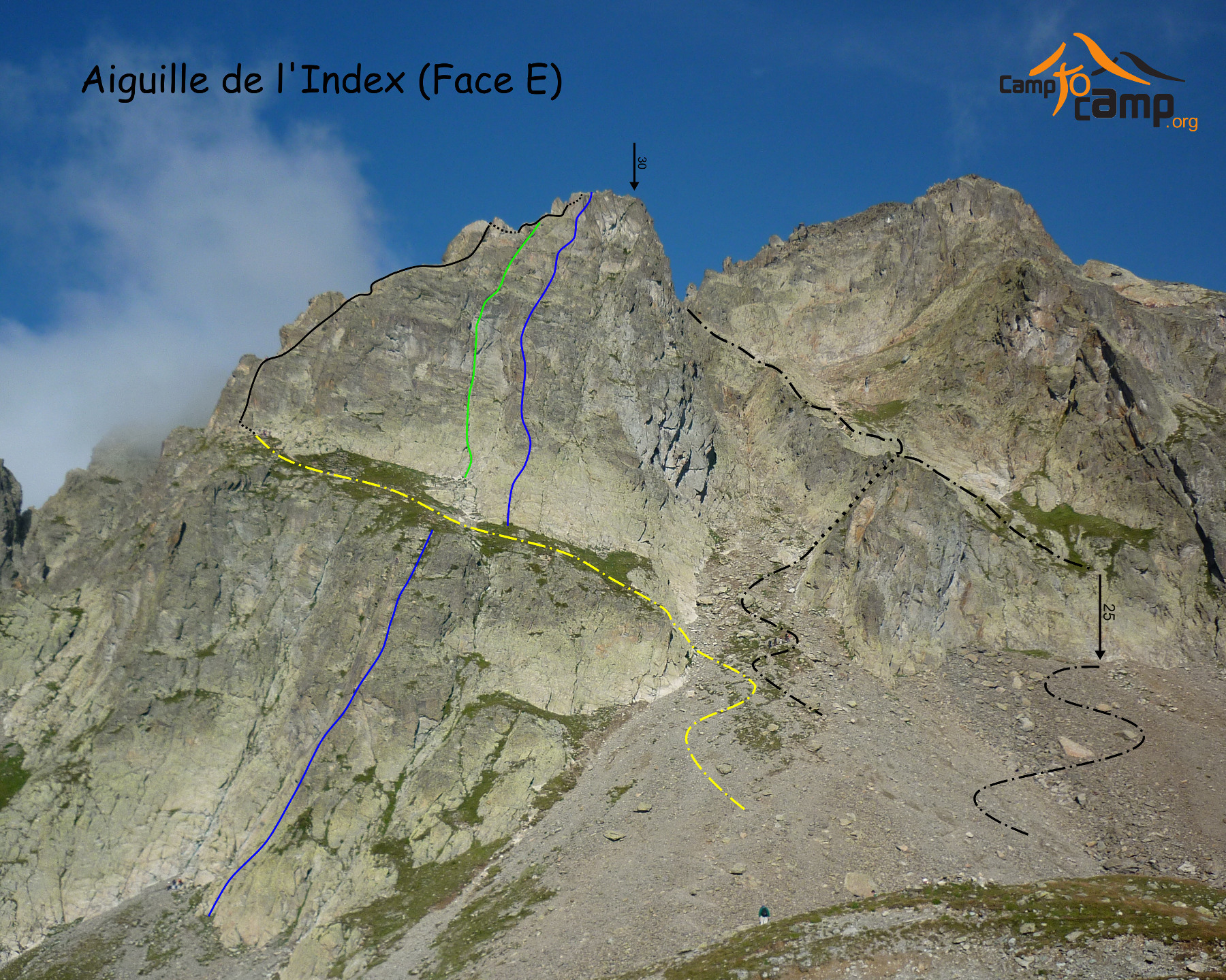
From the top of the Index chairlift, go up to the SE to reach a large grassy ledge that cuts the East face of the Index (marked as “Index de la Glière” on the IGN map). Follow the ledge to its end at the level of a detached boulder. Faint path all the way.
Route
Pass behind this boulder, traverse to the left and climb a polished corner with lots of pegs (4b). Traverse to the right and climb another corner (III) to gain the crest of the ridge. More or less follow the crest of the ridge, passing a small wall (III) and keeping to the East side (3b).
Descent
From the summit traverse NE for 15m towards the col de l’Index (II). Abseil (45m) to this col, (or 25m then easy down climbing.) From the col it is possible to descend a gully directly. However it is recommended to climb up the face opposite, (III, 25m,) to get on the ridge of the true left bank of the gully where there is a faint path. Before you get to the scree slopes it is necessary to do a little down climbing.

The text and images in this page are available
under a Creative Commons CC-by-sa licence.

Download the Whympr App to view this route in 3D.
- Route search (100 000)
- Community returns
- Weather forecast
- Avalanche bulletin
- Race book
- Creation of tracks
- Topographic map (including IGN)