

Open this route in the app to prepare your next outing.

Details
Approach # 10mins
Go N up the grassy mound behind the hut to just to the left of a reddish promontory jutting out from the left side of the S face. (Peg visible at 5m)
Route
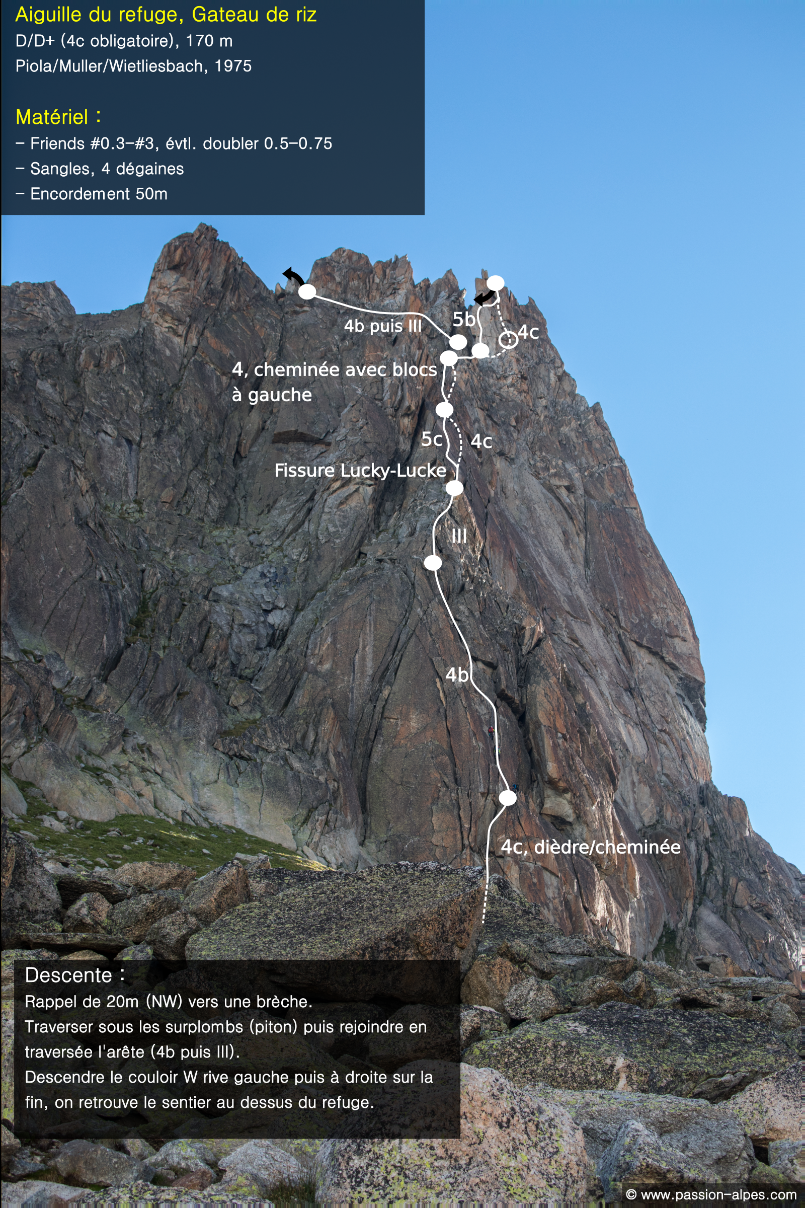
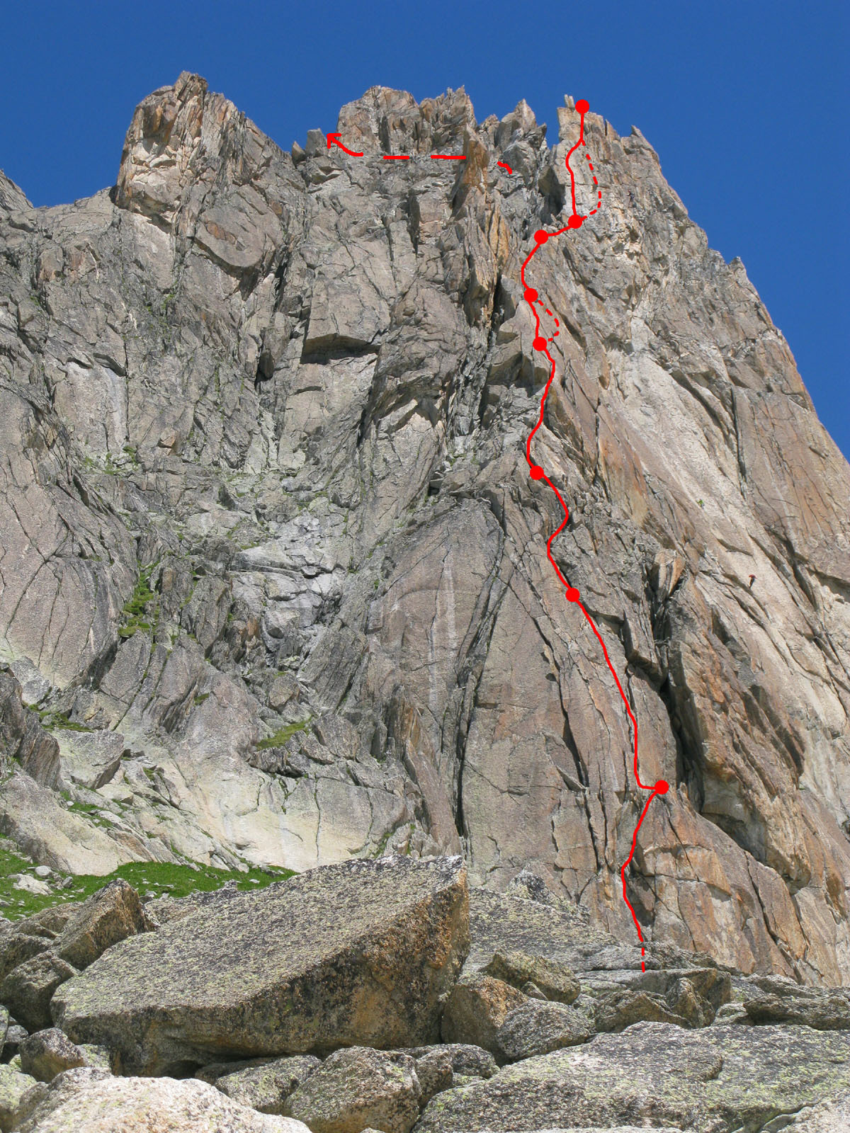
L# | Crack then a chimney 4c, 30m. Belay on a good ledge. L# | Come back to the left to the crest, (do not climb the corner directly above the belay,) 4b, then 4a along a large detached flake. 35m. Belay at a little platform. (1peg). L# | Take the easiest line up the ridge to a belay in a narrow chimney at the foot of the “Lucky Luke” crack, (bolt and drilled thread belay). 3c, 30m. L# | Climb the “Lucky Luke” crack : (clue, a horse riding cowboy cartoon character,) continue trending rightwards along the crack before going up a slab to a wide ledge. 4c, 35m .
L# | Choose the best way at 4b before it gets easier to a gap with a bolt belay. 35m.
L# | Cross the gap, (Bolt belay from which it is possible to descend in 3 abseils, 40m,40m 45m.) and gain the foot of the summit tower 3c, 20m. (pitch 5 and 6 can be done as one pitch if you move together for a few metres) Belay at a block on a little terrace (using the bolt 5m higher up is very uncomfortable). L# | Traverse to the right then straight up 4c, or the crack above the belay 5b (1 peg), 40m.
Descent # 40mins
20m abseil on the NW side leads to the top of a steep gully, which descends the W face. Do not try and abseil down the gully (slings visible), but go to the NW under some overhangs by traversing slightly upwards, (1 peg at the start under the first overhang,) to reach an obvious rocky ridge below the summit. (50m, 3a). You reach a wide scree gully (W) which you go down, keeping to the right near the end. At its foot go SE back to the hut.
For those that prefer to leave a sack/boots at the start, it is possible to abseil back down the slabs to the right of the climb. Good bolted belays every 30-40m.

The text and images in this page are available
under a Creative Commons CC-by-sa licence.

Download the Whympr App to view this route in 3D.
- Route search (100 000)
- Community returns
- Weather forecast
- Avalanche bulletin
- Race book
- Creation of tracks
- Topographic map (including IGN)