

Open this route in the app to prepare your next outing.


Details
Approach # 2h30
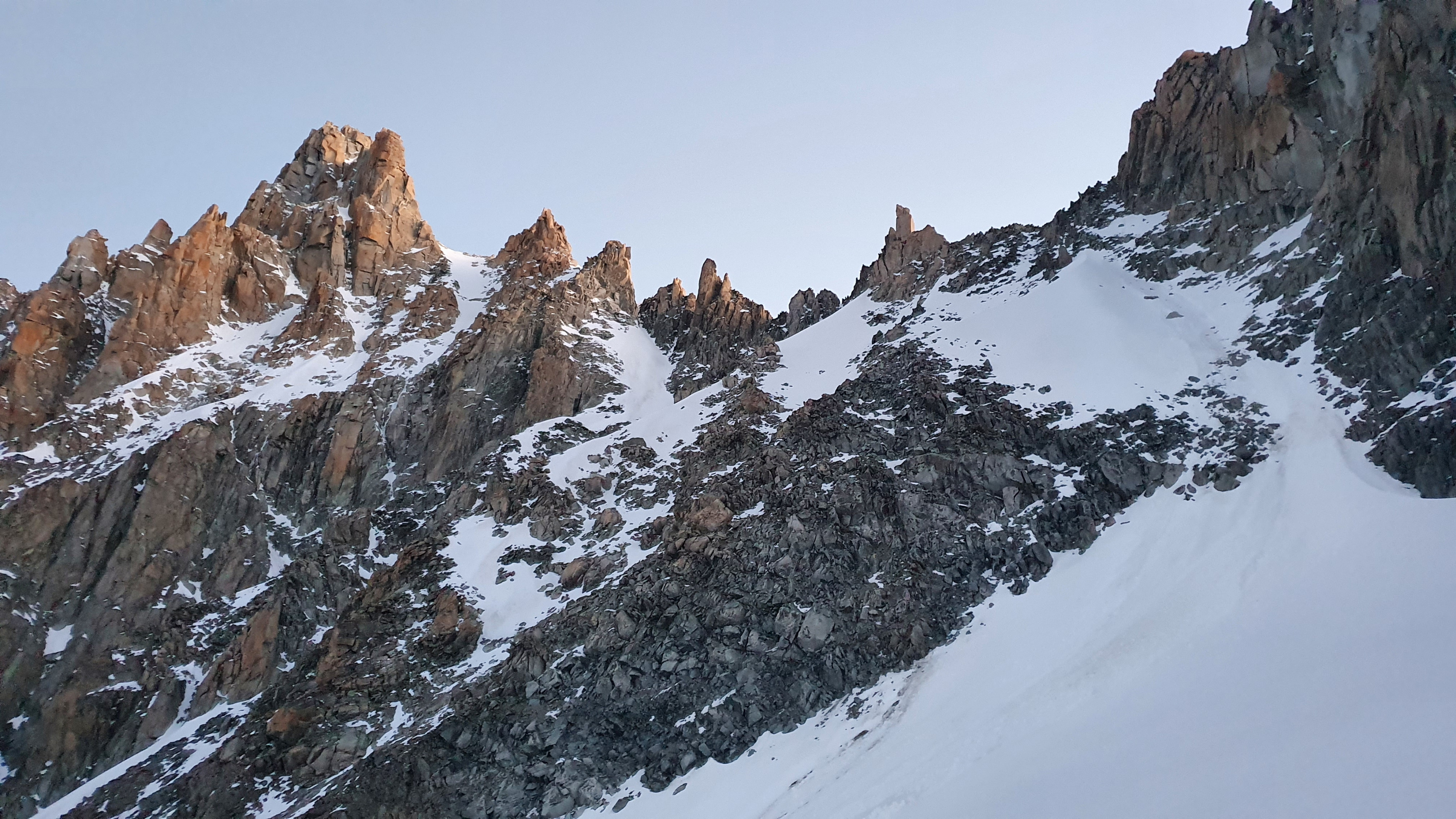
From the hut, follow the water pipes to the NE. Using a faint path ascend to the right of the line of the moraine of the Améthystes glacier . At about 3100m (45mins) at the end of the moraine, go onto on the glacier itself. Climb up its true right bank , pass underneath the ‘Y’ gully and continue to the base of first of the three pinnacles that dominate the left side (N) of the ‘Tour Noir’ col and the start of the ‘Flèche Rousse’ ridge.
Route # 3 to 4h
Begin up the slope that stretches northwards at the rock wall formed by the pinnacles, trend to the left to reach a small col on the ridge by means of a short gully. After going round a pinnacle (on the Saleina side) climb a mixed outcrop and come to a large shoulder. Don’t be tempted to contour the imposing outcrop on the right, instead go down a daunting gully the Améthystes side for 20m, then ascend a steep, slanting chimney opposite, (cairns, 30m 4b, friable rock) on the SE face. Some ledges (200m rising slightly) lead to the right to access a large snow gully with a dogleg higher up. Climb it to gain the crest of the ridge, which is followed, (steep, mixed) to the foot of the « Fleche Rousse ». Go onto the Améthystes face, climb several steep rocks (30m, 5a), turn a rock roof on the left, pass under the very large flake of rock which gives the name « Fleche Rousse » (brownish-red arrow), and reach the top of the flake by some boulders (3879m). Abseil 20m down a smooth bulge on the N side. By a series of steps get to a snowy saddle (3827m), descend to a broad col (exit of the “couloir en Y”) and then up the easy ridge (30m) to the summit of the Aiguille d’Argentière.
Descent
By the Glacier du Milieu From the summit continue along the ridge for about 100m, then descend the snow (40-45°) to a shelf. Stay on the (true) left side until the glacier widens, then, before a crevassed/chaotic zone, traverse to the (true) right side to reach the lower part of the glacier. Traverse to the left, under the snout of the glacier and by a good path and without losing too much height, arrive at the Argentière hut.
By the Whymper Route Follow the ridge and cross the Glacier du Milieu to get above the north face. By a short snowy ridge, gain a rocky ridge. Make two 50m abseils down a steep ice slope to reach an ridge of easy mixed ground. Follow this for 300m to the “Couloir en X”, (X gully). Climb easily down this, mixed terrain, to finally abseil over the bergshrund. Descend the glacier to the path leading back to the hut.

The text and images in this page are available
under a Creative Commons CC-by-sa licence.

Download the Whympr App to view this route in 3D.
- Route search (100 000)
- Community returns
- Weather forecast
- Avalanche bulletin
- Race book
- Creation of tracks
- Topographic map (including IGN)