

Open this route in the app to prepare your next outing.

Details
Access to the “Double Breche”
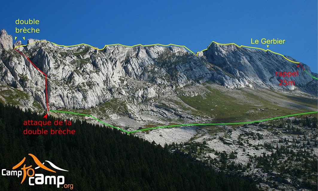
This ridge traverse (usually done N to S) starts near a pair of notches or breaks in the ridge, called the Double Breche (English: Double Break) - (latitude/longitude ~ N45.0326 E5.5922).
From the parking at Les Glovettes]] (altitude 1160m) (GPS latitude/longitude ~ N45.0525 E5.5620). start roughly ESE on a wide road. After less than 50m, bear Left onto a wide trail and go uphill E – follow the markings for GR in the direction of Bergerie de la Fauge and the Pas de l’Oeille. After about 800m the trail hits a wide road at intersection “l’Aversin” (alt 1330m) - (It is also possible to reach this point from parking at [[waypoints/110553|Les Clots). Turn S and go about 300m flat to intersection “La Cote” (alt 1330m), then turn left onto a trail, and with some downhill sections go about 650m ESE then E then SE to another road at intersection “Abri de la Fauge” (alt 1310m - stone hut 100m to SW). Bear R on road and go SE about 200m uphill. Before reaching the top of the hill there is a fork to a side road.
From this point, the next objective is to reach a wide track that goes S across a big field of grass. Three options: (a) The long way is continue on the main road another 130m E to the top of the hill until reach a barb-wire fence. Pass thru gate and turn R onto the wide track and go S about 800m gently downhill to the bottom of the Combe Charbonniere. (b) The official trail avoids the gate (and potential muddy section and most of potential wet grass): Take the R fork onto side road and go up 130m E to hit a barb-wire fence. Then turn R and go S along the W side of fence on a narrow trail, and after the fence ends look for the easiest (least muddy?) way to cross SE from the narrow trail to the wide track S thru the open field about 600m to bottom of Combe Charbonniere. (c) The shortest way (if the grass is dry): Leave both roads and go toward R on grass (no track as of 2013) gently uphill to SE about 130m, then bear L and go S about 50m in an obvious way downhill under trees, then bear L onto big field of grass and go 60m flat on SE to reach the wide track. Bear R on that and go S flat 350m.
Next continue between large trees onto a trail which curves L and climbs SE up the Combe Charbonierre for about 1000m – soon through a cattle gate – last 250m E or NE on scree/talus … Plainly visible ahead are the twin notches of the Double Breche and the narrow gully leading up to it. Meet a roughly horizontal trail (which traverses between Col Vert and Pas de l’Oeille). Turn R to go uphill S toward Pas de l’Oeille. After about 150m, turn L to leave the trail and head roughly E up steep scree to the base of the narrow gully / chimney / couloir.
Climb the narrow gully (much loose rock), soon a section (often wet, sometimes even icy) at difficulty 3 with fixed rope/sling hanging for aid (fixed protection 2 pitons below, 1-bolt anchor), then soon another steep move. Higher up the gully widens (still much loose rock), and the obvious track leads up to another steep 10m section of difficulty 3 (1-bolt anchor above). Above continues steep with grass. It is easier if leave the gully before reaching the top of the Double Breche: turn right (S) on an obvious track for 50m, climb over a sub-ridge, then choose an area (in the next 50-75m of traversing toward S) to climb E up thru grass and rocks to finally reach the ridge. (The bolt anchors of this gully might perhaps also be used for descending with rappels).
Variation - North Access
. (Use this to avoid of rock-fall or delay from other parties in the narrow gully/chimney/couloir, or if wetness or ice makes it really nasty). . (More complicated navigation than main gully/couloir). . (Some moves of difficulty 3, with at least one modern bolt for protection). . (Much on grassy slopes, sometimes exposed, so attempt this only when dry). . (Detail: for much more detail see this Outing report with GPX track).
From the sign-marked trail junction of Combe Charbonniere (alt 1640m) (GPS latitude/longitude ~ N45.0348 E5.5888) just below a rock wall. Around L end of wall + up 70m NE to another wall (N45.0352 E5.5894). Traverse R horizontal 70m S to a rock-slide gully (N45.0345 E5.5893). Up 30m ENE, then diag R 70m SSE, then up 30m ENE to wide gentle grass platform (N45.0342 E5.5902) below rock. L 15m N then up 40m E to cirque (N45.0344 E5.5907).
Steep exit R in narrow gully with at least one new bolt (N45.0343 E5.5908) as of 2016, then further steep R, total 40m SE. Traverse 15m N into center of mini-valley then up 25m E. Exit the mini-valley diagonal R 100m S to small col (N45.0335 E5.5913), down + up 30m S to another small col. Down + traverse 70m S to meet (N45.0327 E5.5916) the obvious track coming up from main couloir. Up this toward the Double Breche for only 15-20m E, then turn off R onto another track which goes S up to the crest of the main Aretes du Gerbier ridge traverse.
Traverse of the ridge N->S from the “Double Breche”
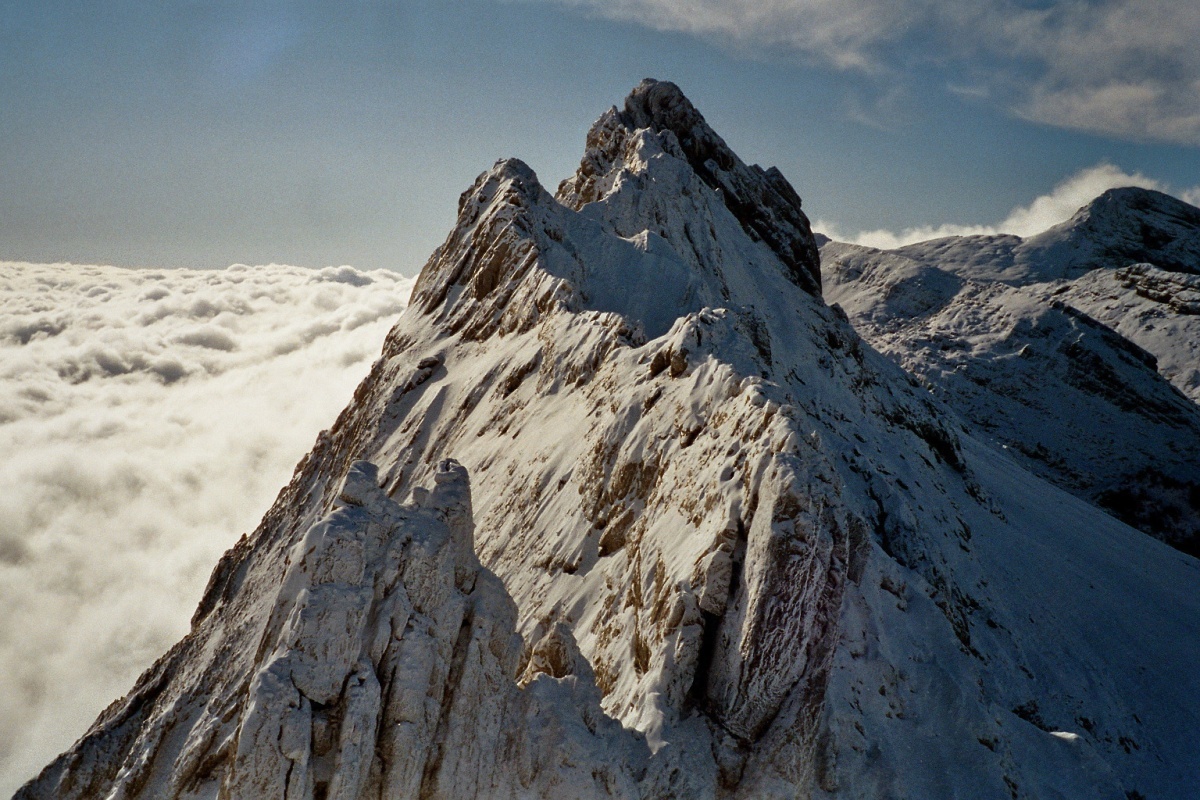
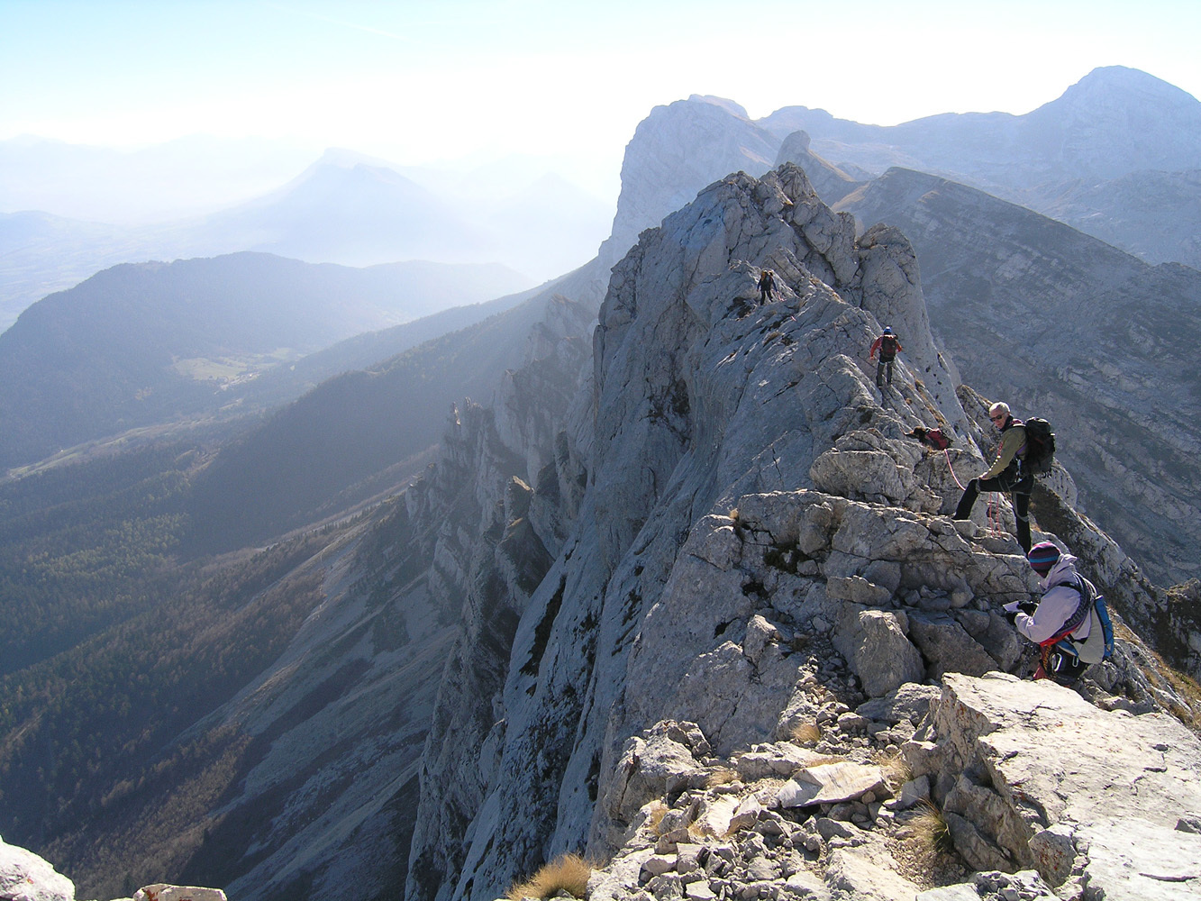
As you follow the line of the ridge going South, it presents some sections delicate or impressive: le Rasoir, le Peigne, and some others which could be rated up to 3c. Some difficulties could be avoided by going more on the W side of the ridge. Later you reach the Gerbier summit (alt 2109m) by a section sufficiently airy and esthetic, on smooth rock (fixed protection 2 bolts).
Continue following the ridge until hit a place where the end drops off vertically. From here there are three options: - down-climb to SE, then turn SW squeezing under a little roof (fixed protection 1 piton above/before the roof); or - rappel 23m directly from end of ridge (anchor is rings with one sling); or - down-climb toward W to find a rappel of 15m (two possible anchors: two pitons with a big ring, or a chain).
Then hike roughly W down a steep grass/gravel slope to meet the trail which leads to the Pas de l’Oeille from Villard de Lans. Go N on that trail about 1000m, then turn left and go down Combe Charbonierre, and return to Villard de Lans by the route of approach.

The text and images in this page are available
under a Creative Commons CC-by-sa licence.

Download the Whympr App to view this route in 3D.
- Route search (100 000)
- Community returns
- Weather forecast
- Avalanche bulletin
- Race book
- Creation of tracks
- Topographic map (including IGN)