

Open this route in the app to prepare your next outing.


Details
Approach # 30-45mins
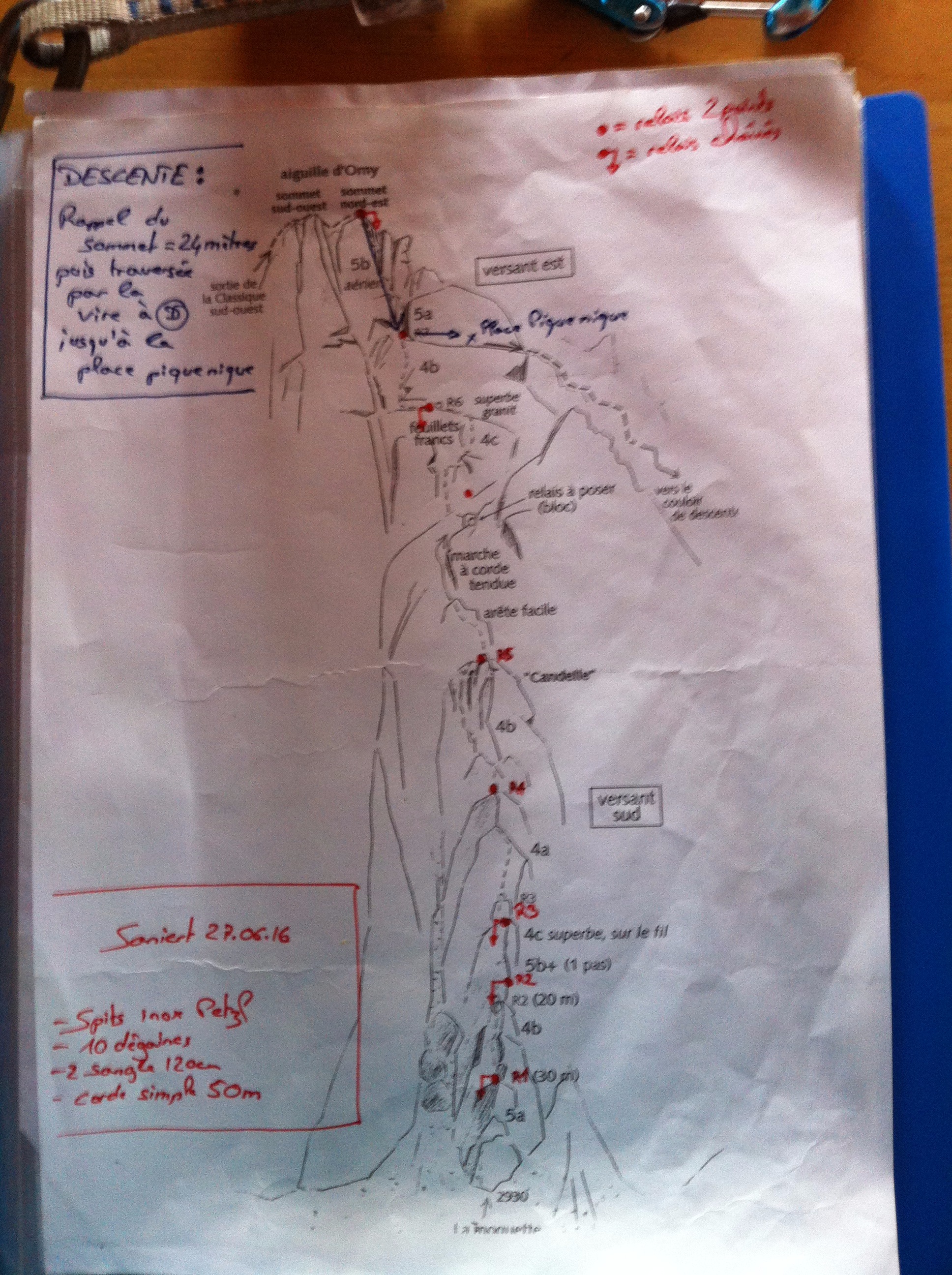
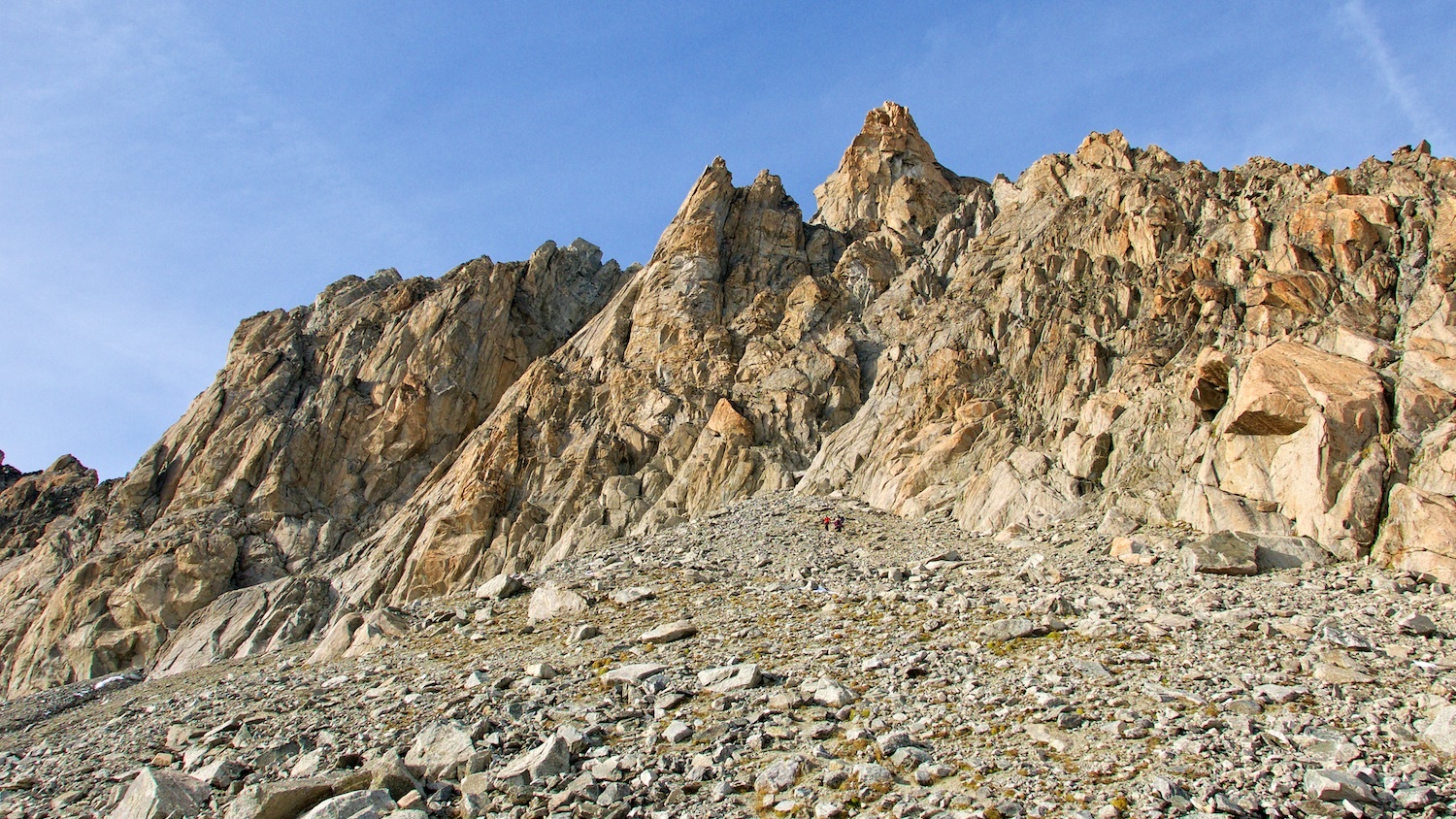
From the Cabane d’Orny, follow the Trient hut path until about 2860m and go up to the foot of the Aiguille d’Orny by a boulder slope, faint track, (30-45min.) On the right, low down, there is a small red buttress topped by an overhang. Further up there is a second red buttress at the foot of the cliff, also topped by an overhang. Immediately to the left of this is a small gully and then a rock ridge with a larger gully to its left. This larger gully runs up underneath the main face below the summit tower. La Moquette climbs the rock ridge between these two gullies
Route
The start is marked by a square of carpet fixed to the rock.
L# | 4c | L# | 4b | L# | 5b | A delicate slab move followed higher up by a difficult move to gain a rib, (well bolted.) L# | 4b | L# | 4c | L# | 3 | Easy ground along a ridge, possible to move together From the top of P6, cross a gully and attack the SE face. (Possible to escape to the right.) L# | 4c | To the right of the gully. Follow the bolts traversing rightwards. Steep on big holds. L# | 4b | Go up leftwards then more direct to a ledge, (where it is possible to walk off to the right.) L# | 5a+ |
Descent
From the summit, an abseil of 25m, brings one back to the ledge at the start of the last pitch, which one can follow to the E. (left looking downwards.) From there follow a faint path through the boulders. There are several cairns indicating two options: •Turn to the right and follow a series of steep gullies to end up about 50m to the E of the foot of the route. (trending to the right at a certain moment, following cairns.) •Turn to the left (E) and find the top of a gully marked with a pair of cairns. This gully is clearly visible from the hut. Descend this steep and delicate gully, then the boulders until you reach the path leading to the hut.

The text and images in this page are available
under a Creative Commons CC-by-sa licence.

Download the Whympr App to view this route in 3D.
- Route search (100 000)
- Community returns
- Weather forecast
- Avalanche bulletin
- Race book
- Creation of tracks
- Topographic map (including IGN)