

Open this route in the app to prepare your next outing.


Details
Approach # 1h
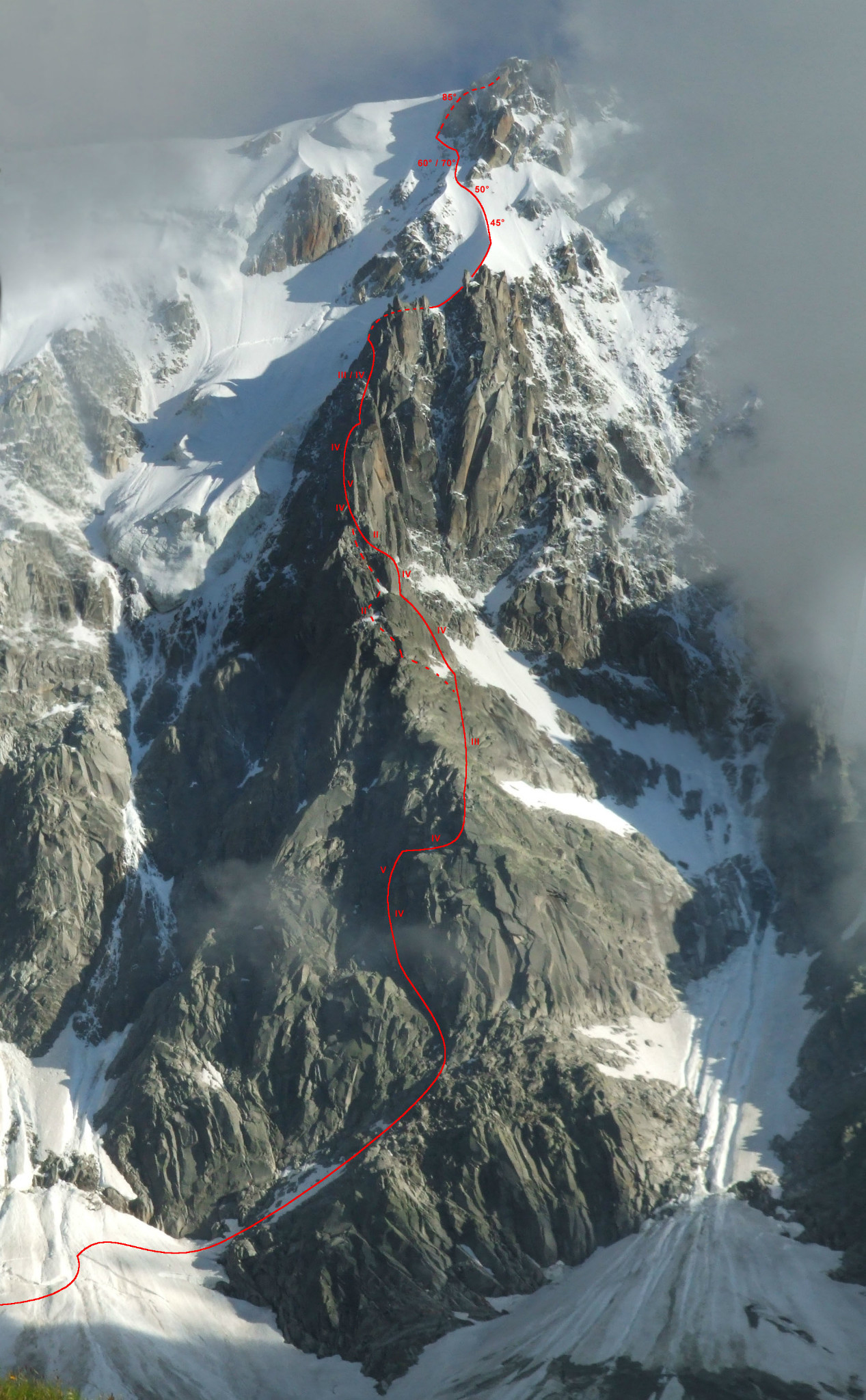
From the intermediate station of the Aiguille du Midi tram, go up the moraine under Aiguille du Peigne towards Plateau des Pélerins and skirt the base of the north face of Aiguille du Midi until the foot of Eperon Frendo (2582 m).
Route # 6-8h
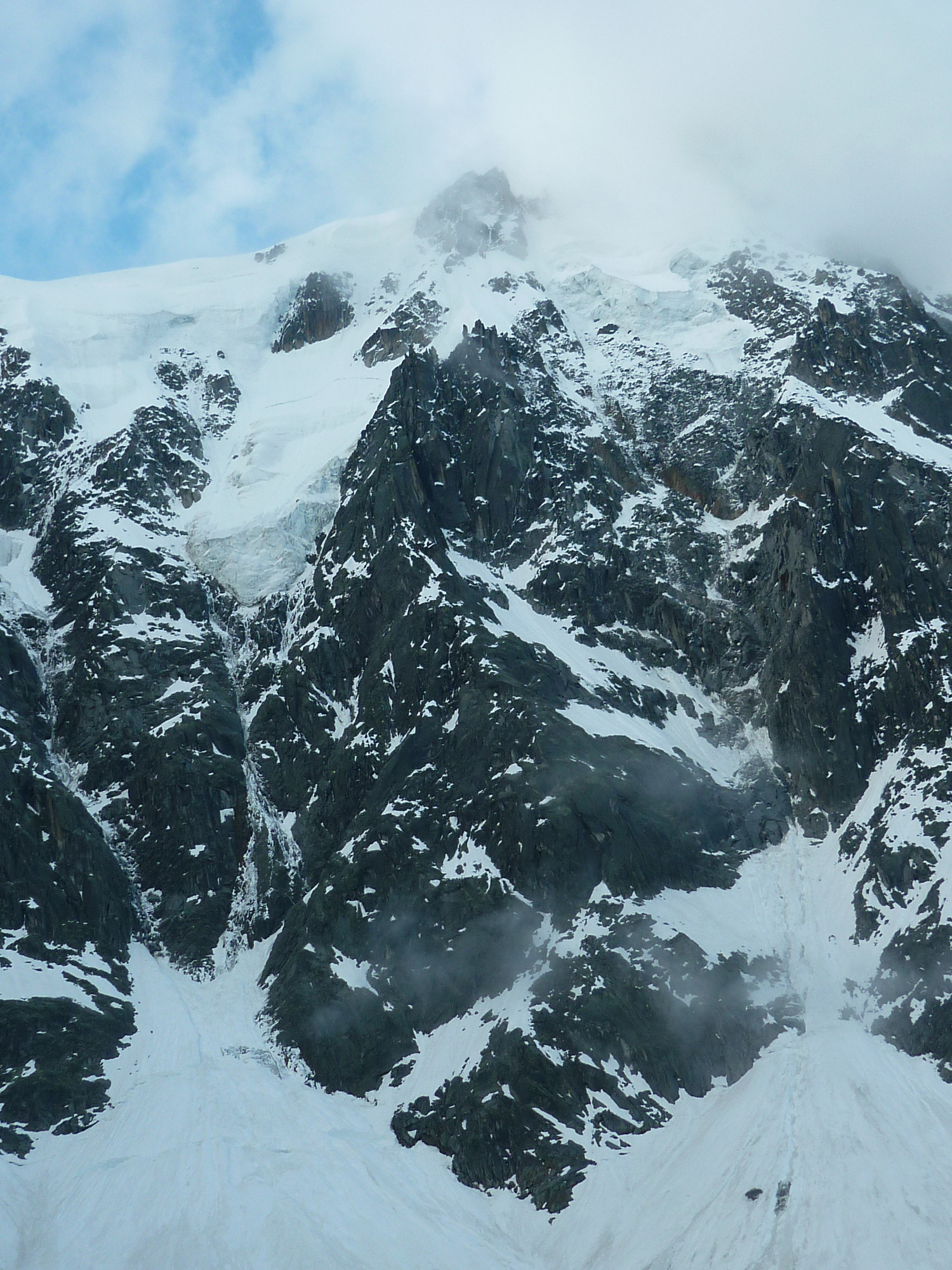
You go up easily on mixed terrain ascending towards the right, then towards the left along a steep ledge, to the foot of a quite visible steep pitch ideal for locating the start of the route. You then approach a vertical chimney crack system. Go up them for approximately 100 m (UK-3a /US-5.3) to reach the ridge. Via systems of ledges and broken slabs, without moving too far from the ridge, you reach a broad horizontal party ledge on a rocky shoulder, under a steep bastion. Keep to the left side of the spur and go up a crack (UK-4a /US-5.5, piton, steep) on splendid rock. Continue on the left side of the spur, then its edge for 2 pitches by series of cracks, foliated rocks and slabs (very varied, UK-4a /US-5.5). You then reach the base of the characteristic snow ridge. Go up a small snow slope towards the left and take foot on the ridge that you go up until the last rocky bastion. Very narrow but not very steep at the start, it widens and steepens gradually.
From the top of the ridge, there are 3 solutions: 1 Usually the quickest option. Pull on the right by skirting the base of the summit spur for 50/60 m. Then go up the steep snow or ice gully which leads directly to the summit ridge of Aiguille du Midi (60/65°). It is possible to pull even more to the right and reach the top out slopes of Mallory-Porter (the easiest option, but the least elegant, careful of the snow conditions). 2- Pull to the left and go up the increasingly steep snow or ice slopes while skirting the rocks. Key sequence: 20m of up to 80°. Kit out belays. 3 Climb the final buttress starting on the left and go up large slabs the foot of an ice corridor. Avoid it on the right, by climbing the first crack (on the left) until it overhangs. Leave it for the crack on the right (difficult, UK-5a /US-5.8) for a few meters, then to return to the left. Traverse horizontally to the left and climb an obvious mixed gully.
Descent
One of the characteristics of this route is the descent, if you keep to the schedule, if the weather does not deteriorate too much, if the wind does not blow too strong it will be done by cable car.
Should you undergo one of the unpleasant surprises quoted above, there are 3 solutions: 1 Spend a night at the Cosmiques refuge. Descend the snow ridge then the snow slopes towards the south. Once at Col du Midi traverse under Arête des Cosmiques and go up a snow slope on the right (west) to easily reach the refuge. 3613 m, 30 minutes from the ice cave of the pinnacle. Telephone: 04 50 54 40 16. 2 - Spend a bad night in the corridors of the top atation, (in theory prohibited, but tolerated in the event of force majeure). 3- Descend via Vallée Blanche and the Mer de Glace; long, long, long… and crevassed!

The text and images in this page are available
under a Creative Commons CC-by-sa licence.

Download the Whympr App to view this route in 3D.
- Route search (100 000)
- Community returns
- Weather forecast
- Avalanche bulletin
- Race book
- Creation of tracks
- Topographic map (including IGN)