

Open this route in the app to prepare your next outing.


Details
Approach # 1-1h30
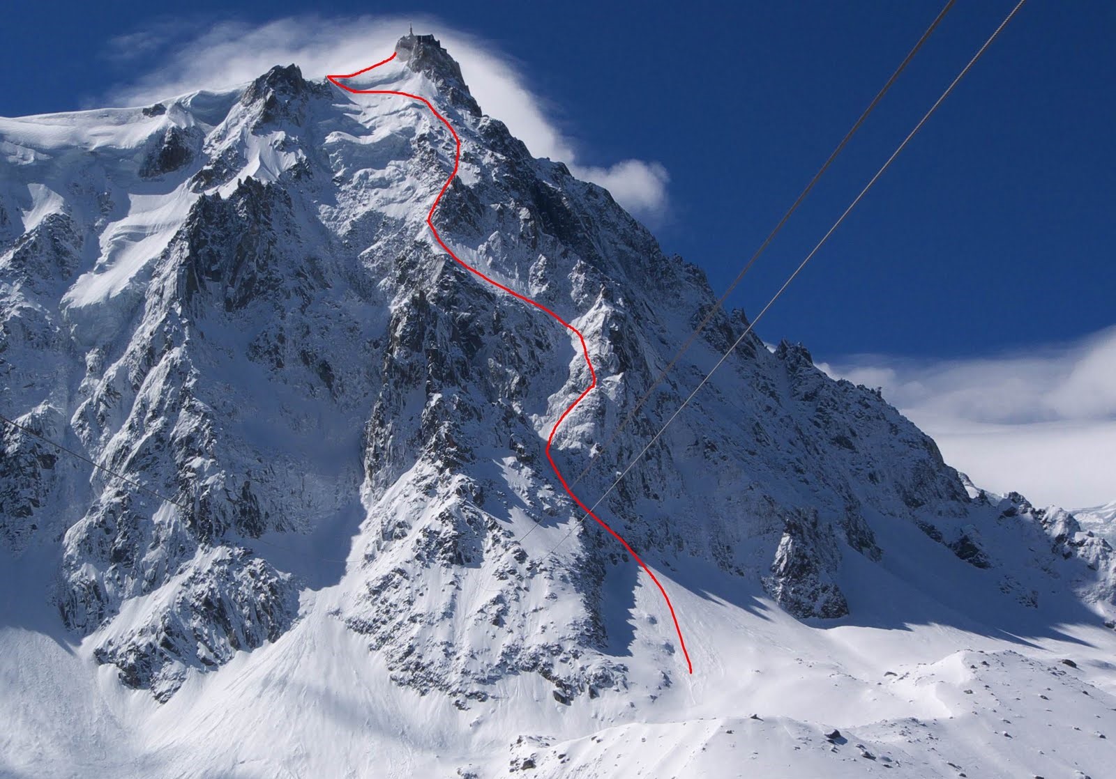
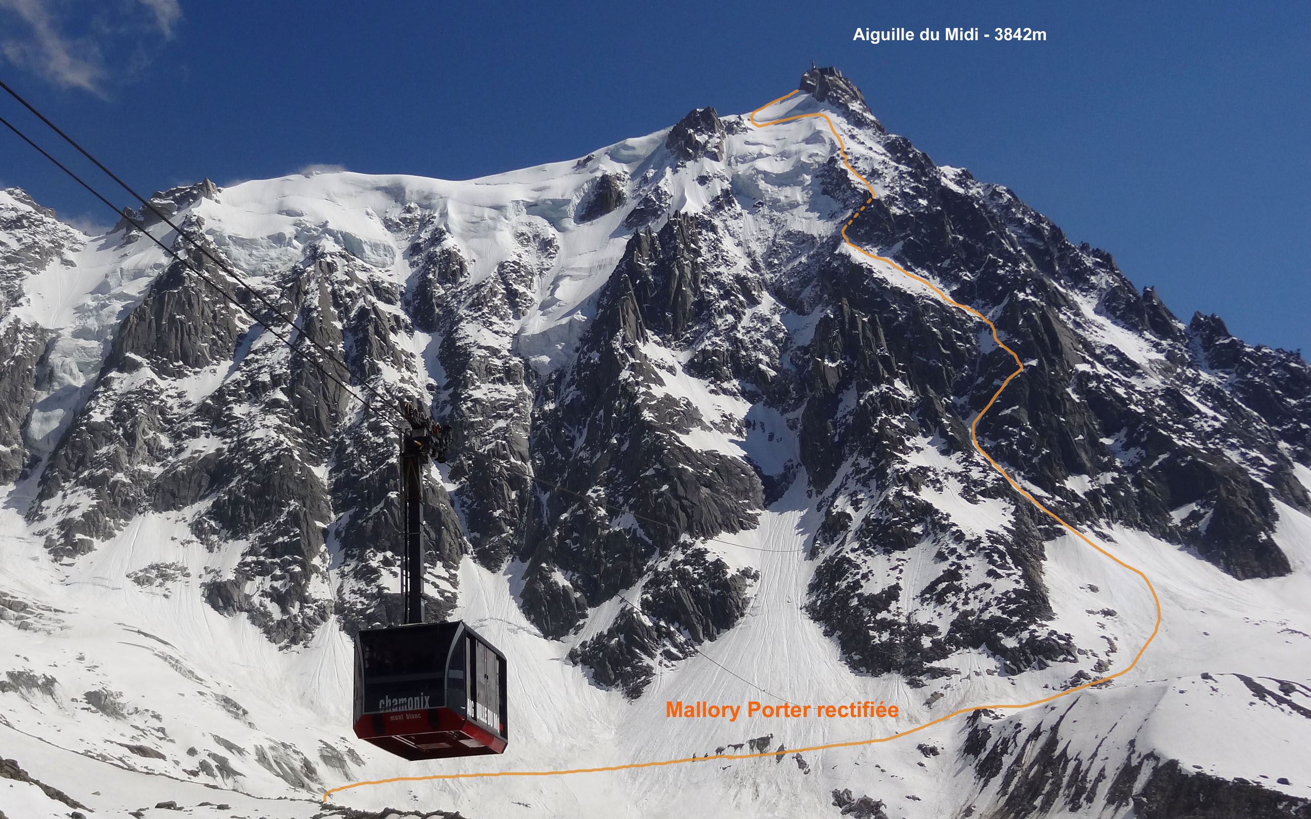
From the intermediate station of the Aiguille du Midi cable car, go up the moraine under Aiguille du Peigne in the direction of the Plateau des Pélerins and skirt entirely the base of the north face of Aiguille du Midi. The route starts just before the lowest rocky spur, behind Eperon Seigneur. Go up the avalanche cone until the bergschrund.
Route # 3-5h
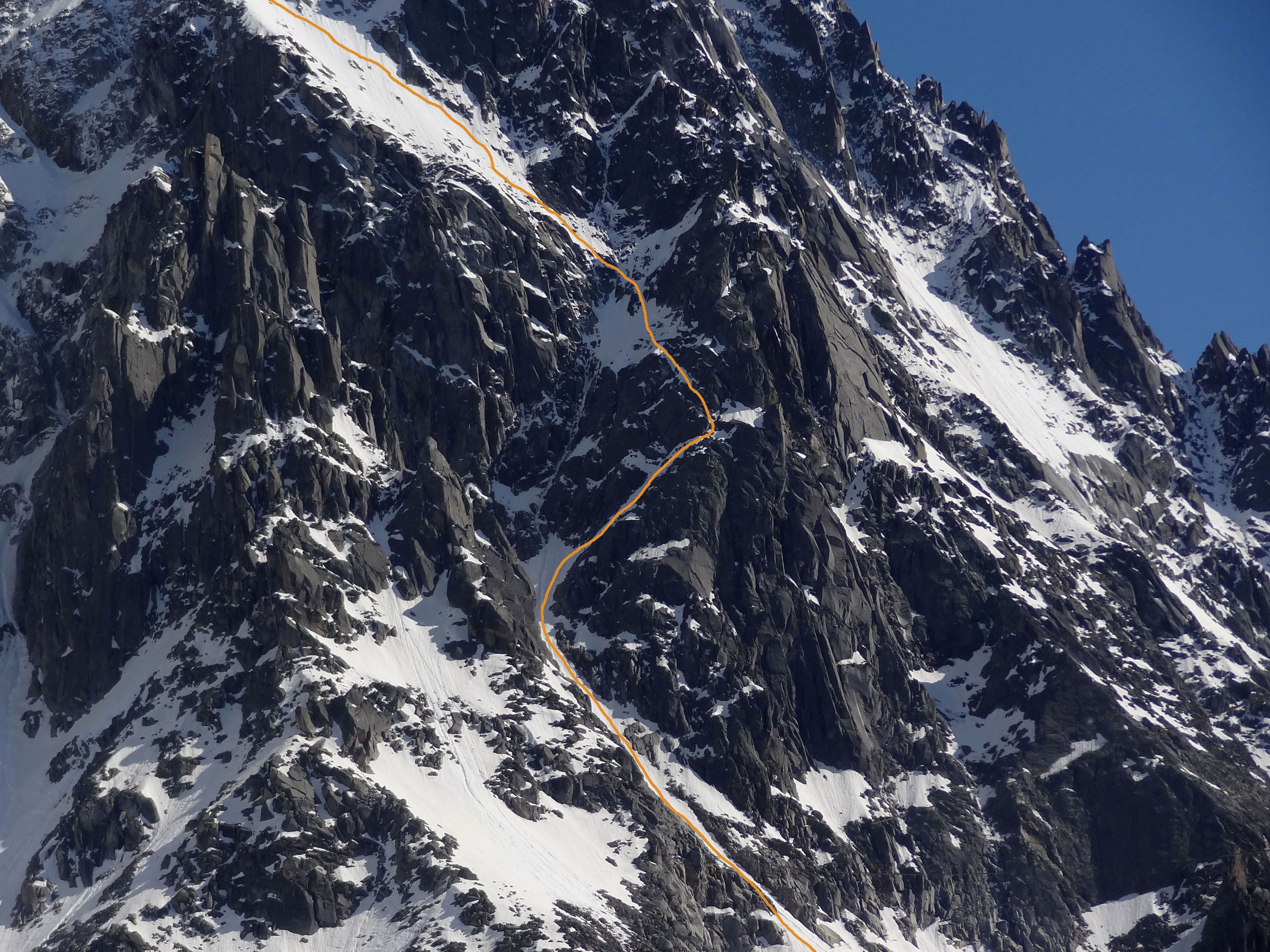
100 m above the bergschrund go up a snow slope on the right (60°). You run into a short rocky sequence. Surmount it traversing up towards the left (UK-4a /US-5.5, 10 m). You emerge on a broad snow slope which traverses towards the left. Go up it and at its left end go up the steep throat behind a broad rocky spur (60°, ice, 30m). A small snow slope leads to a beautiful snow ridge. First follow it vertically, then diagonally on the left until reaching the ridge leading to the ice cave of the upper cable car station. Be careful of the stability of the snow on this last slope it is often weighted or blown. .
Descent
One of the characteristics of this route is the descent, if you keep to the schedule, if the weather does not deteriorate too much, if the wind does not blow too strong it will be done by tram. Should you undergo one of the unpleasant surprises quoted above, there are 3 solutions: 1 Spend a night at the Cosmiques refuge. Descend the snow ridge then the snow slopes towards the south. Once at Col du Midi traverse under Arête des Cosmiques and go up a snow slope on the right (west) to easily reach the refuge. 3613 m, 30 minutes from the ice cave of the pinnacle. Telephone: 04 50 54 40 16. 2 - Spend a bad night in the corridors of the top station, (in theory prohibited, but tolerated in the event of force majeure). 3- Descend via Vallée Blanche and the Mer de Glace; long, long, long… and crevassed!

The text and images in this page are available
under a Creative Commons CC-by-sa licence.

Download the Whympr App to view this route in 3D.
- Route search (100 000)
- Community returns
- Weather forecast
- Avalanche bulletin
- Race book
- Creation of tracks
- Topographic map (including IGN)