

Open this route in the app to prepare your next outing.
Min / max altitude2523m / 3482m
Duration16 hours 32 minutes
Main facingE
Route typeTraverse
Glacier gear required
Lift approach
Gear7 cintas exprés
cuerda 1×50 m (o 2×50 m si bajada por los 9 rápeles
fisureros y friends
Source
Details
Approach # 1h
From the Envers hut, go onto the Trelaporte glacier and traverse northwards under the Tour Rouge. Pass the bergschrund as far right as possible, (delicate) and traverse to the left, passing another bergschrund to gain the rock.
Route # 8 to 10h
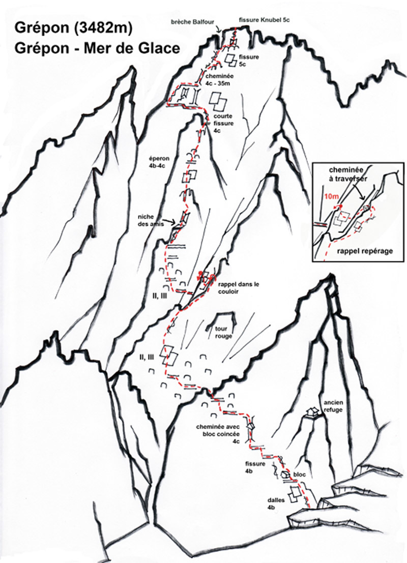
- Climb leftwards up a series of chimneys and ledges, (4a to 4c) until at the level of the summit of the Tour Rouge. Follow a system of terraces obliquely leftwards to join a faint spur in the centre of the face.
- Make a 20m abseil to get into a deep gully which one traverses to gain the line of the East spur, which is the key line of the route.
- Climb this spur (pitches of 4c/5a) until the Balfour gap (some moves of 5c just below the gap). One can leave the sacks here.
- Climb the Knubel crack (5c) to reach the summit virgin.
Descent # 3h to 5h
Descent to the col des Nantillons
- Regain the Balfour gap by a 20m abseil on the E side and pass on to the SW side to gain the descent route
- Follow a series of ledges and abseils to reach an obvious shoulder. A 30m abseil leads to a deep gap, climb up 3m (3c) to a terrace. (CP).
- Descend by a faint path and a system of ledges to near to the col des Nantillons.
Descent to the Plan de l’Aiguille
- Go onto the glacier and descend it in the middle, (crevasses), pass under the Grand Charmoz and traverse (rapidly) under a band of threatening seracs.
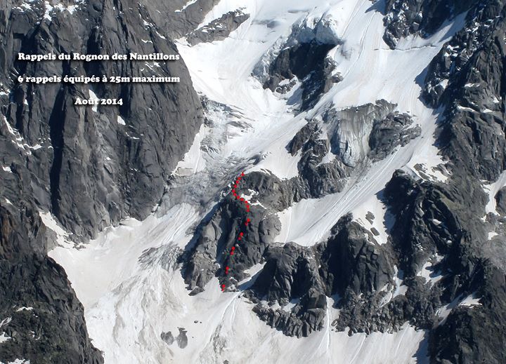
- Go onto the rognon (rock island) des Nantillons and climb northwards down it. At the end a 20 to 30m abseil brings one onto the glacier which is descended, avoiding some large crevasses until it is possible to get onto the S moraine.
- Follow a contour path through the Blatiere glacier moraine and passing the glacier snout to the Plan de l’Aiguille cable car station

The text and images in this page are available
under a Creative Commons CC-by-sa licence.

Download the Whympr App to view this route in 3D.
- Route search (100 000)
- Community returns
- Weather forecast
- Avalanche bulletin
- Race book
- Creation of tracks
- Topographic map (including IGN)