

Open this route in the app to prepare your next outing.

Details
Approach 45mins
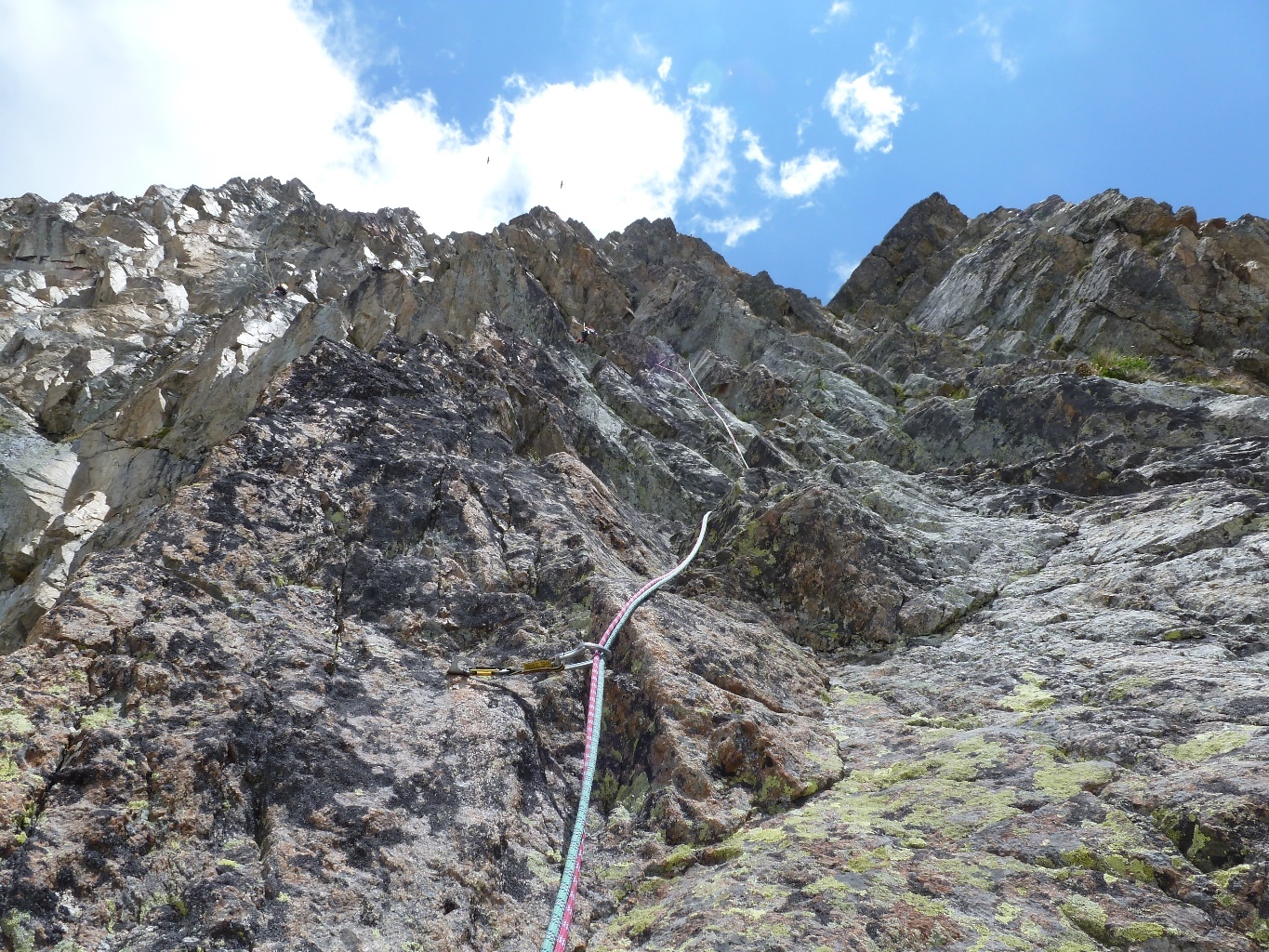
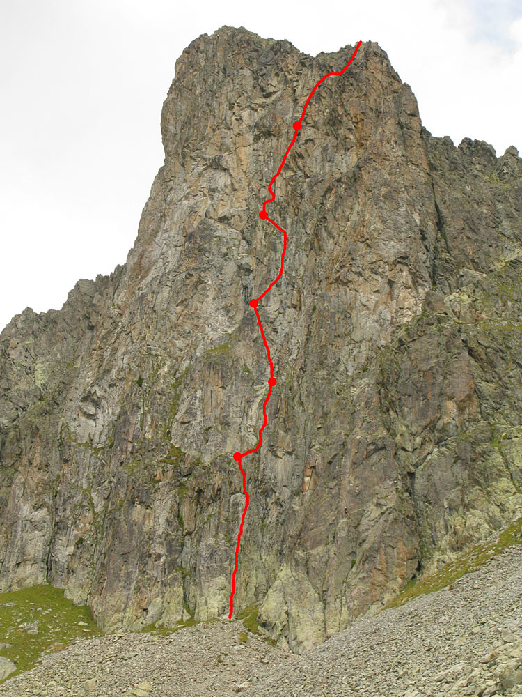
From the top station of the Index chairlift, follow the descending Lac Blanc path until it traverses the lower part of the Combe des Crochues. Take the faint path (cairns) on the left that leads to the foot of the Tour des Crochues. The start is at an obvious terrace 2m to the left of a large, very steep gully. (Wooden sticks.) Start up an open corner (peg visible at 6m).
Route
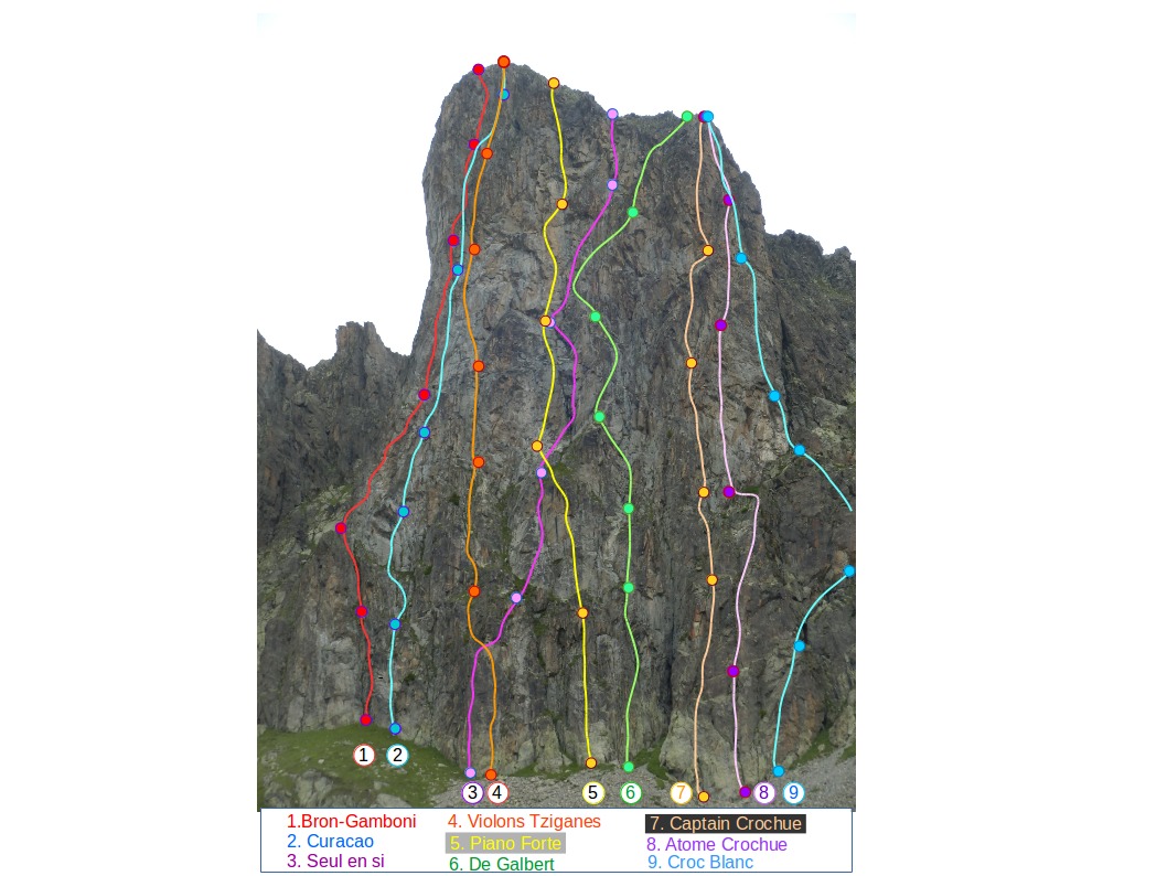
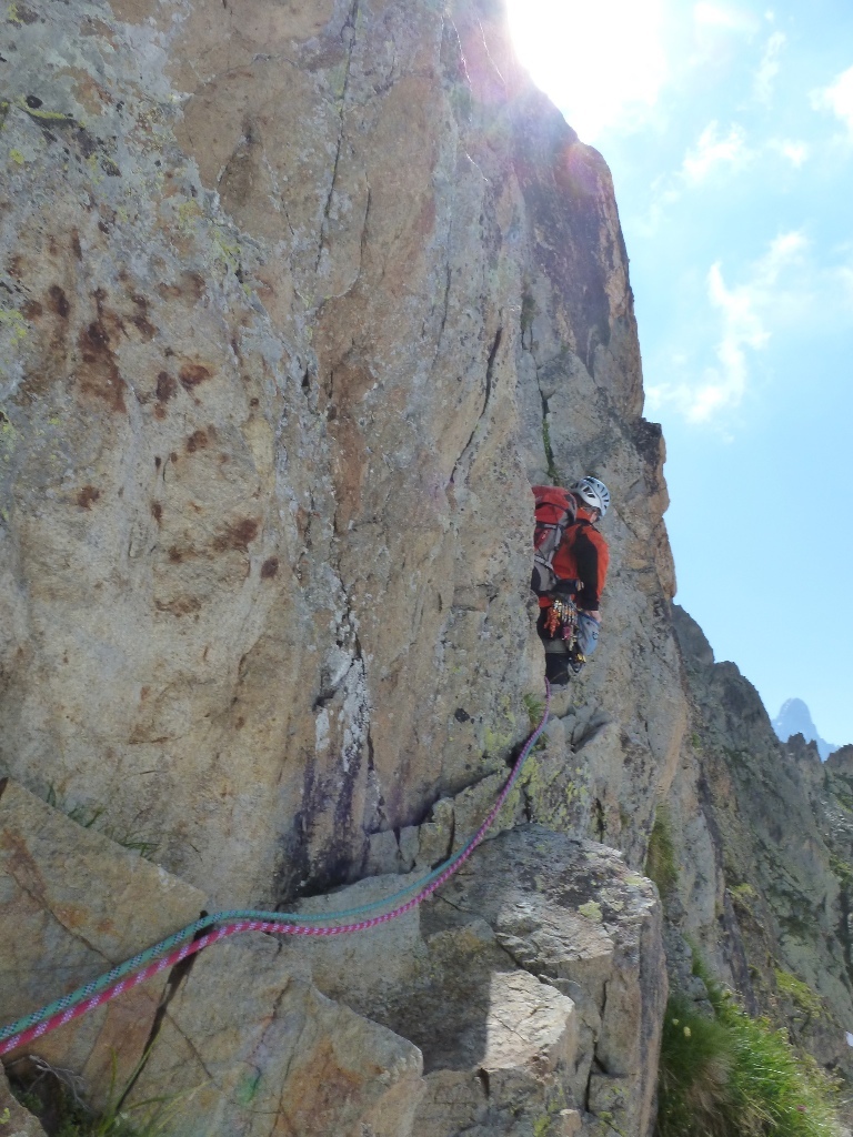
L# | 5a | | Climb the open corner towards the clearly visible deep corner/chimney. Go up this, passing the unsatisfactory belay at its foot, to reach a good terrace. (Stainless steel bolt and a peg for belaying.) L# | 5a | | Traverse rightwards several metres then climb a steep wall (bolt) to a peg belay. L# | 5b | | Climb up veering slightly leftwards and over a small overhang. Peg belay (Do not follow the stainless steel bolts on the right.) Possible to do pitches 2 and 3 in one (50m). L# | 4c | | By a slab move to the right, (old bolt), gain a series of small, open corners, taken on the left, (crossing the route with the s/s bolts.) A leftward slanting ramp. leads to a belay on good bolts with a chain, shared with « Violons Tziganes” and “Seul en Si”. (Optional belay at the foot of the ramp.) L# | 5a | | Pass through the gap 5m above the belay and to the right, climb a block and then upward more easily tending slightly to the right. Belay on pegs (45m). L# | 4a | | Continue trending to the right to the shoulder. Belay on a rock spike.
The pitches are about 40-45m. Protection is mainly in-situ pegs.
Descent
From the summit follow the south ridge and climb down a steep but easy gully, (cairn at the top of the gully,) to arrive at the start of the route. Keep to the left, looking down, to avoid a large, steep boulder in the middle of the gully.

The text and images in this page are available
under a Creative Commons CC-by-sa licence.

Download the Whympr App to view this route in 3D.
- Route search (100 000)
- Community returns
- Weather forecast
- Avalanche bulletin
- Race book
- Creation of tracks
- Topographic map (including IGN)