

Open this route in the app to prepare your next outing.

Details
Approach # Day 1 : to the Écrins Hut:
If the road is not open until Pré de Madame Carle, start by following it cutting across some bends until the meadow. Go past Cézanne refuge, following the summer trail and go up the southern slope on the right bank of the torrent of Glacier Blanc, primarily along the path of the summer trail. This slope dries quickly during the season, while the meadow may still be covered with much snow. Above the point 2163 a rock band cuts across the slope. Cross it via the trail if it is visible, if not slightly more to the east, be careful the slope is steep and exposed
By ascending traverses you then reach the broad flat area at the foot of the final arm of Glacier Blanc. This entire first part is exposed to avalanches due to strong snow cover.
Pass to the left bank of the dale and climb in the direction of Glacier Blanc refuge which is visible. Go back up the dale to near rock barriers dominated by the glacier seracs, and climb in a steep corridor to the NE emerging to the west of the refuge, it is sometimes more comfortable to climb on foot. (It takes 2 hours from the Cézanne refuge to the Glacier Blanc refuge).
Pass the Glacier Blanc refuge and go up via a corridor to the right of the summer trail, to top out from there to the west at the altitude of 2640 m. Via dales and croups, on the left bank of the glacier, you reach the glacier and take foot on a not very inclined area around 2850 m. Stay on the left bank of the glacier to surmount a crevassed area, pass the dale which rises in the direction of the Col Emile Pic to reach the foot of the bar which supports the Écrins refuge. You reach the refuge via an unrelenting slope to the east of it which passes the rocky steep pitch. (it takes 2 hours from the Glacier Blanc refuge, 4 hours from Pré de Madame Carle ).
Route # Day 2:
Descend to the glacier via the slope you went up the day before. Stay on the left bank of the glacier in the direction of the Écrins pass.
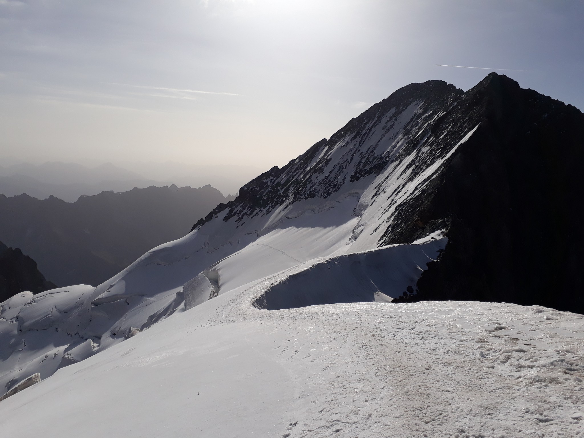
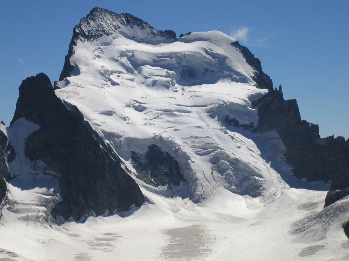
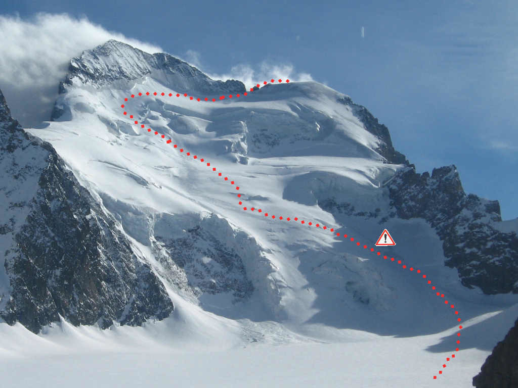
Do not go to the pass, stop around 3300 m. The trail on the NE face of Écrins starts from the left base of the face and traverses towards the SSE until under the bergschrund of Barre des Écrins, on the left in line with the summit, then returns in a long traverse to the west towards Dome des Écrins. Around the level of the Écrins pass, you go up via steep slopes under the large serac of the lower right part of the face. Try to remain as much as possible on a side slope on the left to be the least exposed to any ice falls. Leave the slope on the left around 3600m. at a slightly less steep area, avoiding the crevasses as best as you can, to reach a flatter area (3700m.) in line with Barre des Écrins summit. Continue moving towards the SSE on a steep slope (frequent risk of windslab avalanches) until below the bergschrund and then go diagonally to the west to reach the slope suspended under the bergschrund (3940 m.). Traverse until the Dome bergschrund, cross it as best as you can, generally slightly to the west of the plumb line of Lory notch (3974m.). If the snow cover is good it is possible to ski the summit, if not you can reach it on foot from the bergschrund. It takes 3 to 5 hours from the refuge to the summit.
Descent
Descend by the same route, being careful to avoid the crevasses you found during the ascent. For Skiers: On the flat area of Glacier Blanc, starting from 3250 m., it is possible to descend the right bank. Skirt close to the slopes of Pointe du Serre Soubeyran (3472 m.) and enter the right bank serac area. Avoid the seracs via a secondary corridor under the east face of Pointe du Serre Soubeyran. (entrance of the corridor at 2880 m. S3). Skirt the glacier to reach the flat area under final glacier arm (2300 m.). Be careful, be sure to locate this section during the climb to the refuge the first day, and make sure it has sufficient snow cover. The top out of the glacier between 2500 and 2300 m is very exposed to stone falls and is done on fresh ice covered with stones when the snow has melted.

The text and images in this page are available
under a Creative Commons CC-by-sa licence.

Download the Whympr App to view this route in 3D.
- Route search (100 000)
- Community returns
- Weather forecast
- Avalanche bulletin
- Race book
- Creation of tracks
- Topographic map (including IGN)