

Open this route in the app to prepare your next outing.


Details
Approach
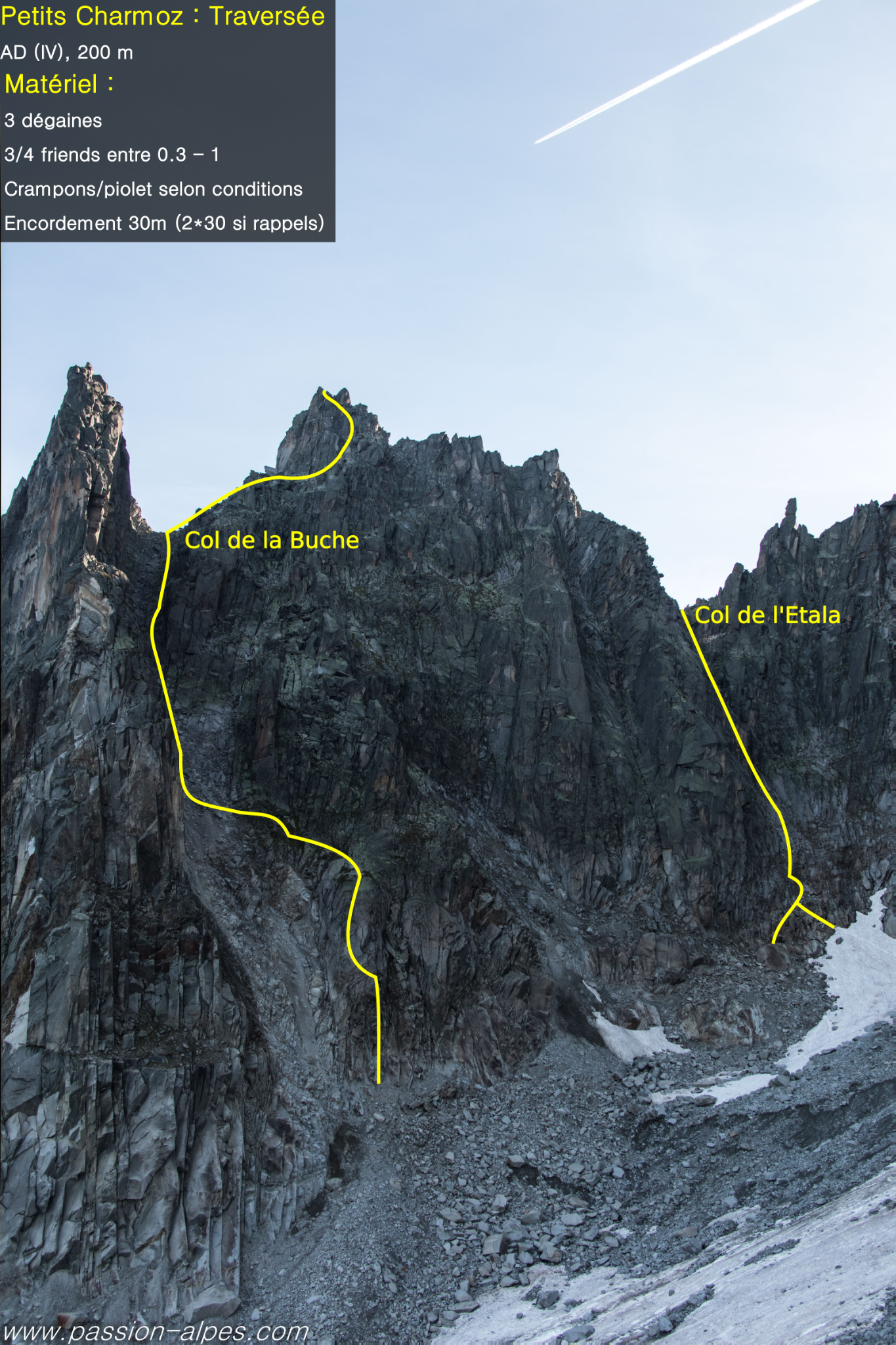
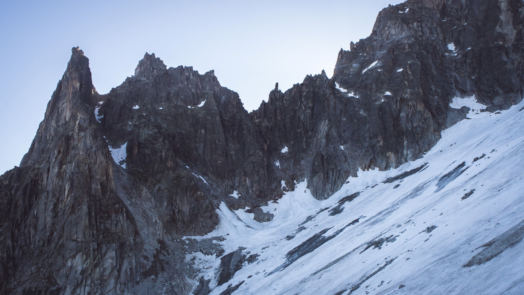
From the Plan de l’Aiguille, get to the Nantillons glacier by traversing under the Aiguilles on a good path that first goes towards the Lac Bleu. Under the Aiguille de Blaitière go up the glacier high enough to go along its edge and reach the moraine and then the Nantillons Glacier. From the glacier go up the Etala couloir, (between the Petite and Grand Charmoz,) snow and loose rocks, until it reaches a rock step with chimneys and cracks. It is also possible to reach here from Montenvers, following the route towards the Aiguille de l’M and then traversing to the right to reach the couloir.
Route
Climb the first slab to the left of the right hand chimney crack, (4b, 1 peg for 3m) then go to the double chimney crack. Climb this “à cheval” (3b, 1 peg) and reach a large terrace. Climb a crack on the right for 8m (3c, 1 peg,) and exit to the left on a sloping slab, (3m, 3b) to climb a 4m chimney (3c, 1peg,) awkward with a sack. Belay at the top of the difficulties.
By easy steps and ledges climb the couloir to reach the Col de l’Etala. From the Col go to the left (N) to a little triangular cliff with cracks. Start on the left of the ridge, climb obliquely right to reach the ridge and come back to the left, following a ramp leading to the foot of the “Livre Ouvert”, (Open Book), 3b (III). Climb the « Livre Ouvert », (4b, 2 pegs). Follow the ridge, or a path on the Mer de Glace face for about 50m. Overcome a vertical rock step on the crest of the ridge, (3c), then follow the ridge to a gap. Go around the step that follows to the left and continue along the crest of the ridge to the summit. At the level of the gap it is possible to escape by bypassing the summit on the Nantillons side. From the gap it is also possible to reach the summit by bypassing the step to the left. One arrives at a pitch of 4b which leads directly to the summit, (some pegs, belay on spikes.)
Descent
From the summit, descend on the Nantillons side by 2 short abseils (20 and 25m) or down climb a gully (3b, 50m), then a system of ledges and little steps lead to the Col de la Bûche. Go down from the col keeping at first to the true left bank, then to the right and finally back to the true left side again. Careful with stonefall.

The text and images in this page are available
under a Creative Commons CC-by-sa licence.

Download the Whympr App to view this route in 3D.
- Route search (100 000)
- Community returns
- Weather forecast
- Avalanche bulletin
- Race book
- Creation of tracks
- Topographic map (including IGN)