

Open this route in the app to prepare your next outing.

Details
Ascent
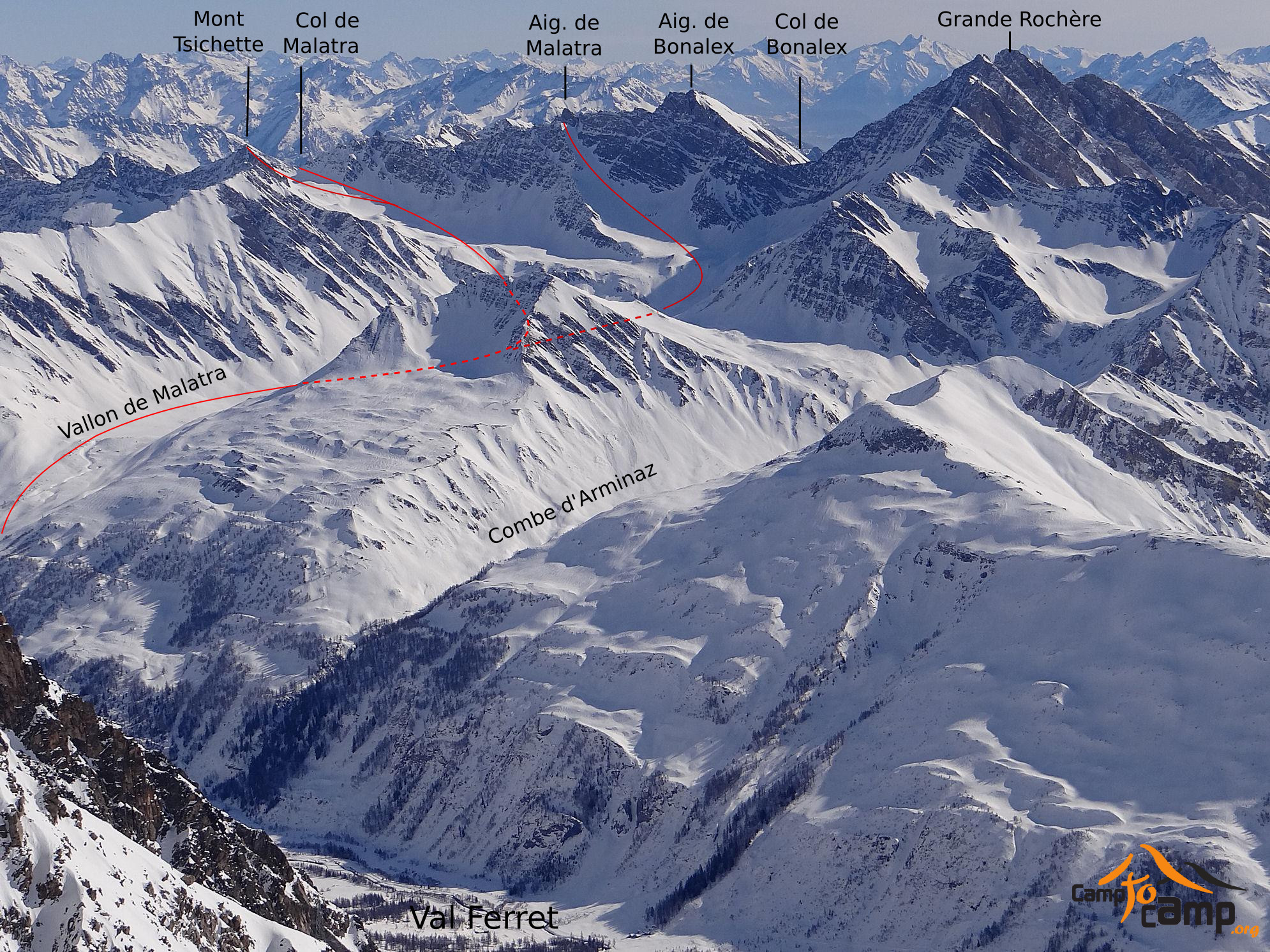
From Planpincieux, go along the true right bank of the river, following the path for pedestrians next to the Nordic ski pistes. At Lavachey, continue up the hairpins. After the 3rd one, (just before it crosses a stream and comes out of the forest at 1650m) follow the signpost “Col de Malatra” and “Rifugio Bonatti” on the right. Keep to the good path until the Walter Bonatti hut. From here follow the Malatra valley, passing buildings on your left, to the upper pastures of Malatra (2213m). Continue up the gradual slopes in the valley. There are then two options. Option 1: Head up left towards steepish slopes leading to a false col. This is in a little ridge above the valley descending from the col.
Option 2: Continue up the main valley until just before it steepens up to the rim of a little cirque at the lefthand end of the headwall. From here it is possible to traverse leftwards to reach the valley described in option 1.
After both options rejoin, follow the easy angled valley, over several humps, until it steepens for the final pull up to the little col.
Descent
By either option, depending on snow conditions. Alternatively, it is possible to traverse the Col des Deux Sauts and the col Col du Sapin to ski down the Sapin Valley to Villair above Courmayeur. From here, public transport is available to take you back to the parking at Planpincieux. However, the descent from the Col du Sapin and much of the Sapin Valley faces south, so check conditions first.
The tour can be done in a day from the parking. However to miss spending a night at the superb Bonatti hut on the way up, Tel. +39 01651855523 Mob. +39 3356848578, is to miss the best bit of the tour.

The text and images in this page are available
under a Creative Commons CC-by-sa licence.

Download the Whympr App to view this route in 3D.
- Route search (100 000)
- Community returns
- Weather forecast
- Avalanche bulletin
- Race book
- Creation of tracks
- Topographic map (including IGN)