

Open this route in the app to prepare your next outing.


Details
Ascent
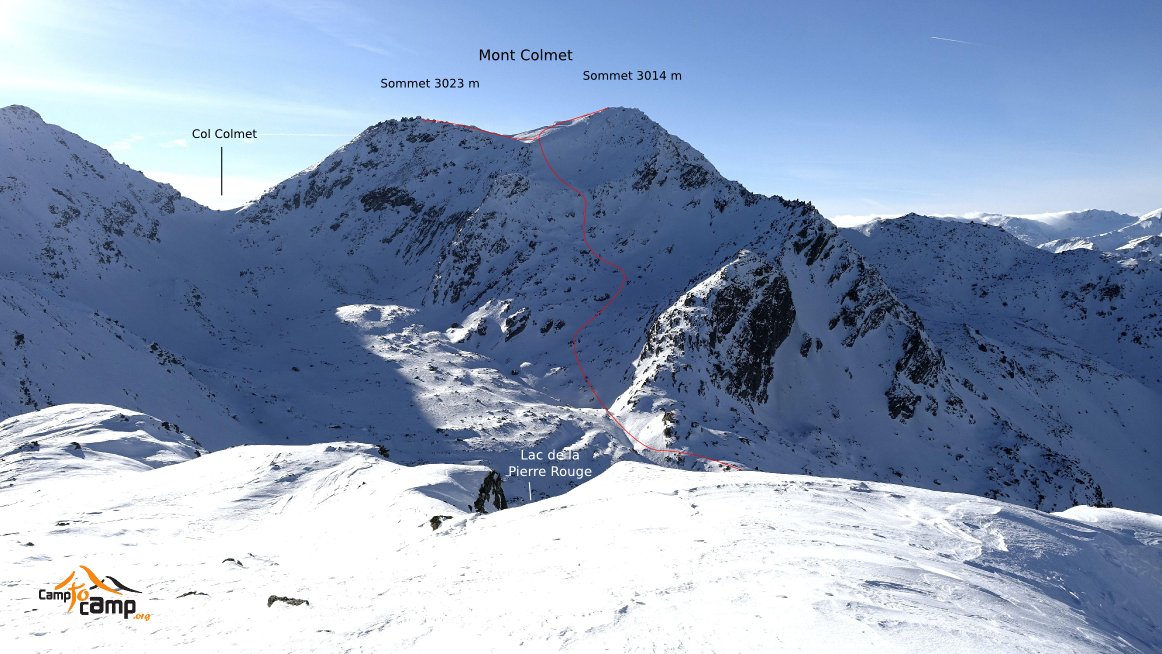
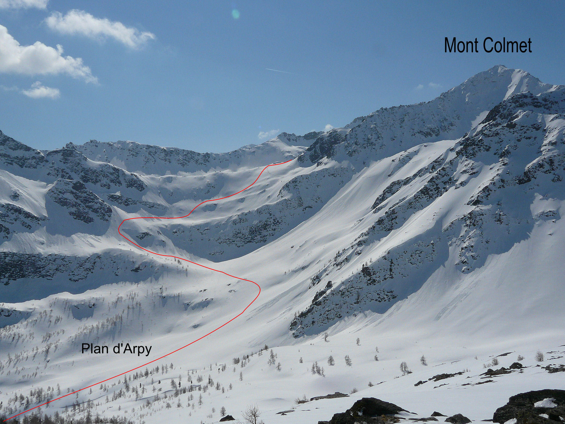
From Arpy 1670m follow the Nordic ski piste to the end of Arpy meadows 1760m and take the forest track on the true right bank of the river leading up towards the Arpy lake. At about 1850m cross to the true left bank and join the road coming in from the San Carlo col. After the Arpy lake and the flattish area beyond, (Plan d’Arpy ) go up to Pierre Rouge (Pietra Rossa) lake 2569m, via a steep passage exposed to avalanches, following the summer route. From the end of the lake go SW up a series of snow bowls and some steep passages to reach a little col between the ruin of the Lieutenant Chabloz hut and the summit. Continue up the ridge to reach the summit 3024m on foot or the more easily the fore-summit 3020m.
Descent
By the same route

The text and images in this page are available
under a Creative Commons CC-by-sa licence.

Download the Whympr App to view this route in 3D.
- Route search (100 000)
- Community returns
- Weather forecast
- Avalanche bulletin
- Race book
- Creation of tracks
- Topographic map (including IGN)