

Open this route in the app to prepare your next outing.

Details
Ascent
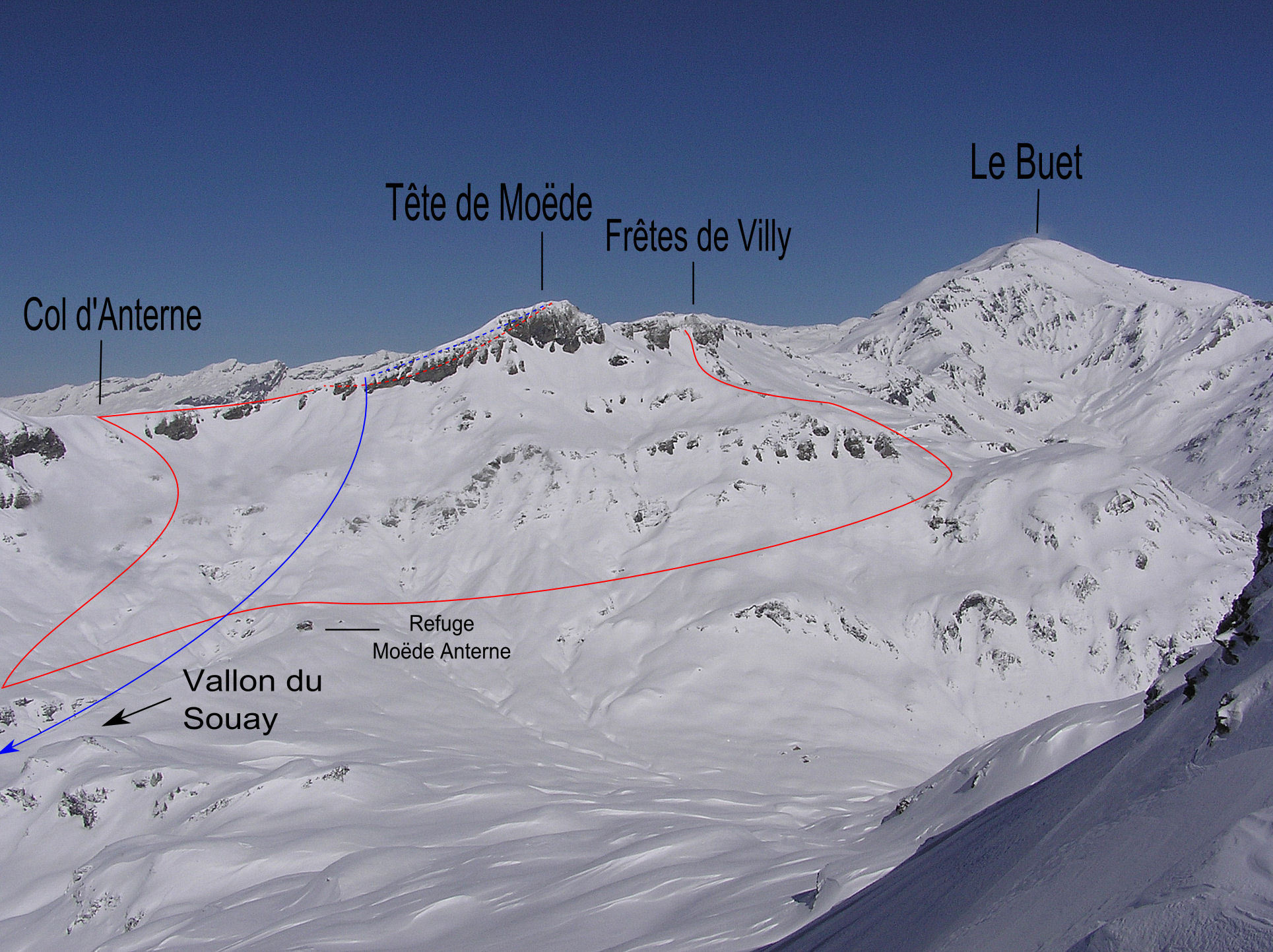
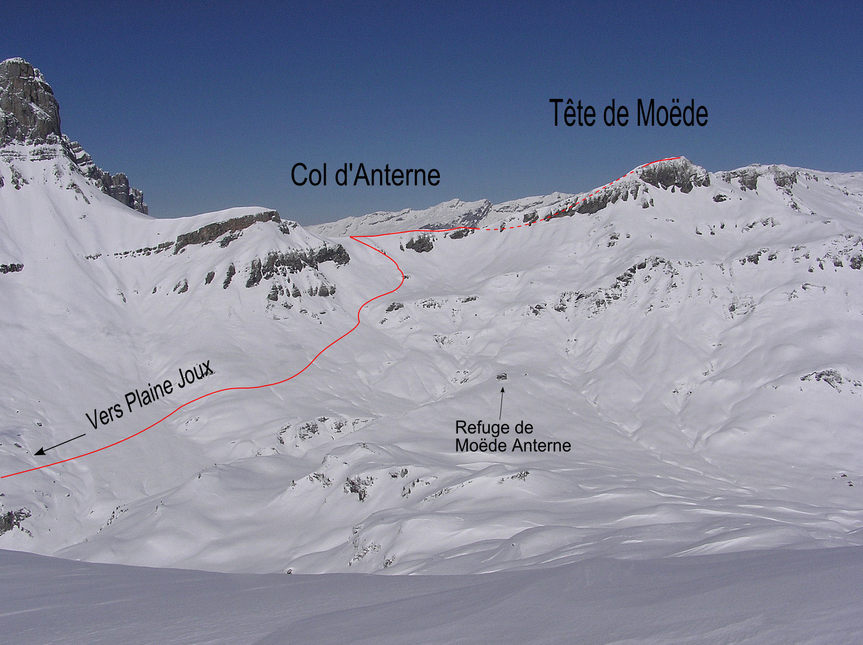
From Plaine-Joux you have two choices: 1. The high route using the Teleski du Barmus/ Tour, ski down the piste until it is possible to take a horizontal path on the right, (looking down) just above the bottom of the l’arc-en-ciel teleski. Follow this through the woods to the chalets at Ayeres des Pierrieres and go across the plateau underneath the Pointes d’Ayres to join the summer road leading to the Co d’Anterne hut. 2. The low route, (avoiding using a ski lift): Follow the road (cross country track in winter) to wards the Châtelet restaurant, then the chalets of Souay. Continue up the summer road leading to the Col d’Anterne hut.
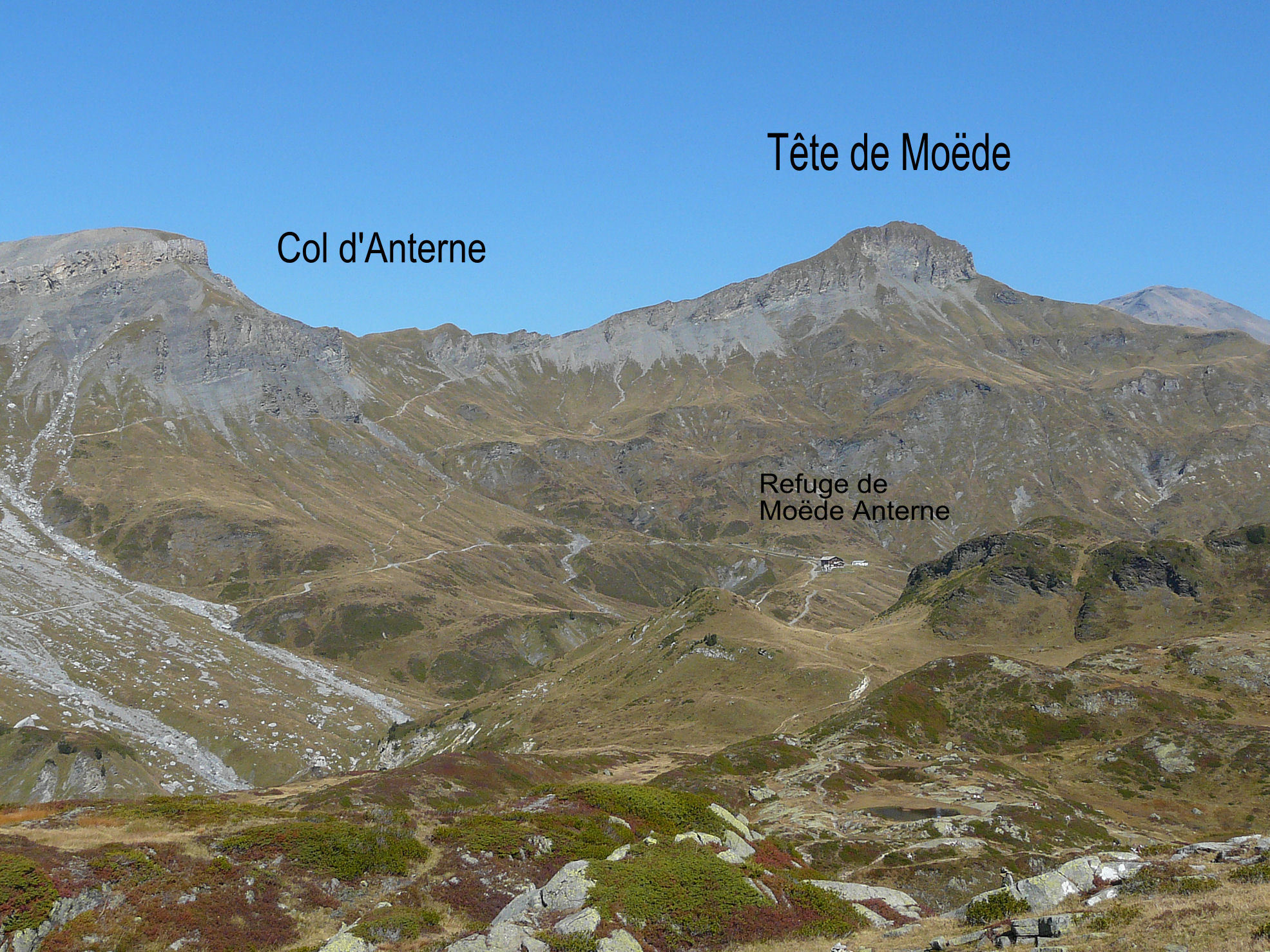
For both approaches at around 1900m cut off to the left towards the col d’Anterne (2257m). From the col, climb the W ridge of the Tête de Moëde to its summit.
Walking variation: Go up the Souay Torrent. some steps and cables at the start
Descent
Descend by the same route, (option 2) or by the Souay torrent, (check the exit from the gorge is in condition first!) Further left, looking down, is “La Chorde”, a short steep gully leading back Souay chalets

The text and images in this page are available
under a Creative Commons CC-by-sa licence.

Download the Whympr App to view this route in 3D.
- Route search (100 000)
- Community returns
- Weather forecast
- Avalanche bulletin
- Race book
- Creation of tracks
- Topographic map (including IGN)