

Open this route in the app to prepare your next outing.

Details
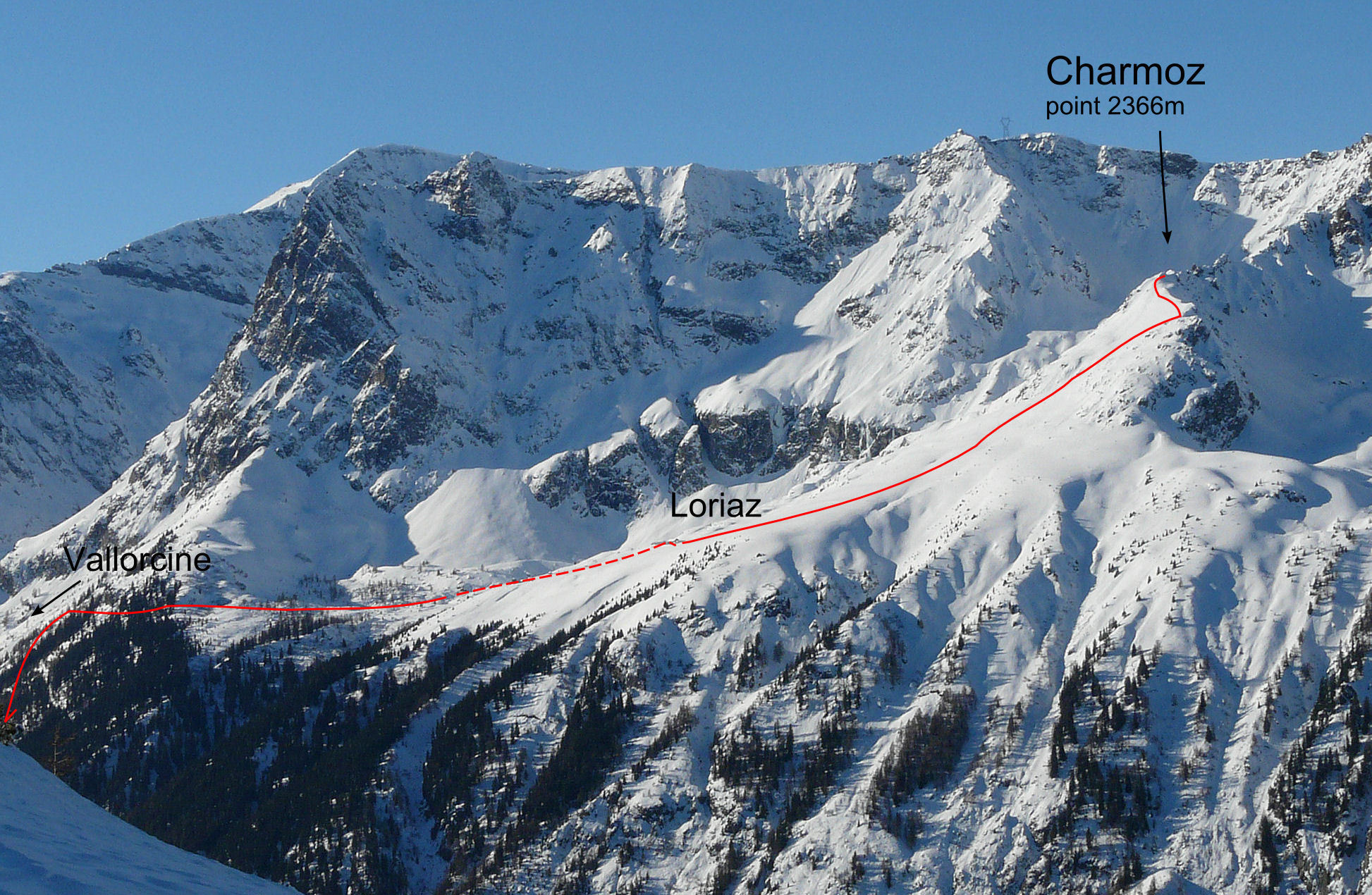
Route 1h45 to the chalets then 50 mins to the summit From the parking by the recycling bins in Couteray, if there is enough snow go directly up the field to join the forest track for Loriaz, if not walk up through Couteray to join it. After about 20 to 30 mins there is an option to take a narrower track, (summer footpath,) on the right, (at a hairpin bend with a signpost.) This path passes by Nant du Loriaz on the IGN map, (slightly more avalanche prone). From the chalets spot the obvious ridge above Loriaz and go up the pleasant slopes on the right before traversing diagonally back left to a little summit on the ridge. The summit has a small tree complete with solar powered Christmas lights (2020).
Descent From the summit it is possible to ski the N, W and S slopes, depending on the conditions. Then follow the forest track back to Couteray

The text and images in this page are available
under a Creative Commons CC-by-sa licence.

Download the Whympr App to view this route in 3D.
- Route search (100 000)
- Community returns
- Weather forecast
- Avalanche bulletin
- Race book
- Creation of tracks
- Topographic map (including IGN)