

Open this route in the app to prepare your next outing.
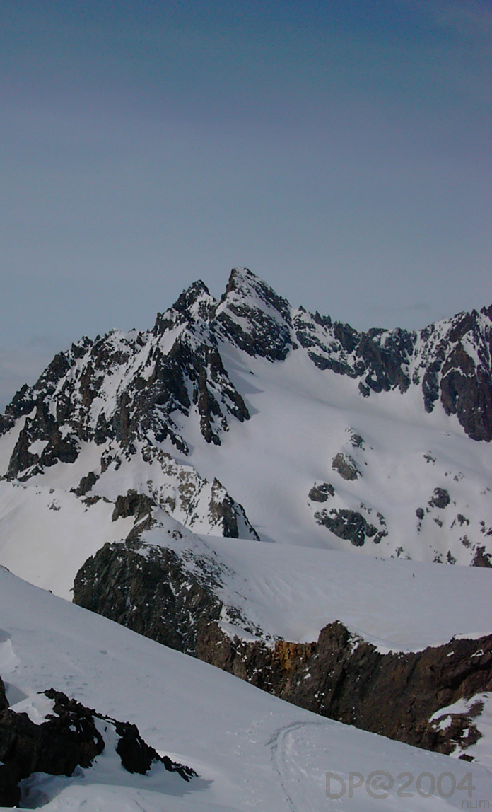
Col du Monêtier - W-E traverse of Col de Monetier from Glacier Blanc refuge to Monetier les Bains

Details
Day 1: If the road is not open until Pré de Madame Carle, start by following it cutting across some bends until the meadow. Go past Cézanne refuge (1874 m), following the summer trail and go up the southern slope on the right bank of the torrent of Glacier Blanc, primarily along the path of the summer trail. This slope dries quickly during the season, while the meadow may still be covered with much snow. Above the point 2163 a rock band cuts across the slope. Cross it via the trail if it is visible, if not slightly more to the east, be careful the slope is steep and exposed
By ascending traverses you then reach the broad flat area at the foot of the final arm of Glacier Blanc. This entire first part is exposed to avalanches due to strong snow cover.
Pass to the left bank of the dale and climb in the direction of Glacier Blanc refuge which is visible. Go back up the dale to near rock barriers dominated by the glacier seracs, and climb in a steep corridor to the NE emerging to the west of the refuge, it is sometimes more comfortable to climb on foot. (It takes 2 hours from the Cézanne refuge to the Glacier Blanc refuge-2550 m).
Day 2: Climb a hundred meters to the north from the refuge then head towards Glacier Jean Gauthier via morainic hills and valleys. Take foot on the glacier to reach a small cirque at the foot of Pic Jean Gauthier (3389 m.). In the cirque go up the steep slopes to the north between 3050 and 3250 m. which lead to a small suspended dale; go up it towards the right to reach the foot of the ledge of Col de Monetier 3320 m. traverse the ledge, which is generally snow covered and exposed (crampons are generally necessary). You arrive at Col de Monetier (3339 m.). 3 to 3 and a half hours from the refuge. From the pass, descend to the SE in the direction of a glacial plateau (3100 m.). Pass crevasses via the east descending a steep northern facing slope (S4) to reach the upper part of Vallon du grand Tabuc. Descend this dale on the left bank, until the junction with the Montagnolle “Champ Vieux”, at approximately 2100 m. You then reach the right bank via a trail, packed all winter by the wilderness skiers from Rocher de l’Yret via Vallon de la Montagnolle. This slope maintains its snow for a fairly long time. On skis or on foot depending on the snow, you can reach the base of the Monetier les Bains slopes and the rest area of Pré Chabert. It takes 1 and a half to 2 hours to descend.
Climb faces west, south and then southwest. The descent faces east, except for a steep north facing slope between 3050 and 2900 m.
Access: L’Argentière la Bessée > Vallouise > Pelvoux > Ailefroide > Le pré de Madame Carle. Generally the road is open until the entry of Pré Madame Carle in spring, just before the place called “camp des militaires”. The HD are indicated from this point. However, depending on the snow cover, the road may be closed at the Ailefroide exit (until around mid April, add an hour), or Claux à Pelvoux tunnel (until around the beginning of April, add two hours). For information call Pelvoux town hall at 04.92.23.31.07
Accommodation: Glacier Blanc refuge, open all year outside of attended periods, no bedding or kitchen, mount the heater, bedding at the refuge, normally attended from 10/15 April to 10/15 May and week ends with reservations, refuge tel 04.92.23.50.24, caretaker JJ Bonniot tel 04.92.20.11.15, CAF Briançon 04.92.20.16.52

The text and images in this page are available
under a Creative Commons CC-by-sa licence.

Download the Whympr App to view this route in 3D.
- Route search (100 000)
- Community returns
- Weather forecast
- Avalanche bulletin
- Race book
- Creation of tracks
- Topographic map (including IGN)