

Open this route in the app to prepare your next outing.



Details
From the top of the Aiguille du Midi tram, descend the well-marked ridge (east) well, used for access to Vallée Blanche. This first part is done carrying your skis, crampons may be useful. Descend a first slope (east), then via not very steep slopes (southwest), you reach the base of the southeastern wall of Aiguille du Midi and skirt it without losing too much altitude. The go up to Col 3593 located between the Simond shelter and Cosmiques refuge.
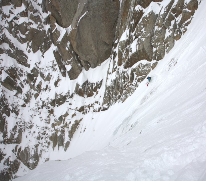
From the pass, head towards Simond shelter and approach the corridor in the north face behind the shelter. Depending on the conditions, it may be necessary to descend the first 20 meters in crampons (rocks, exposed start). Descend this first northwest facing slope, very steep at the beginning, then steep, until around 3300 meters (spot elevation 3290). Then leave this slope to take a second southwest facing corridor to the left. The start is narrow, the slope then widens. Follow this straight corridor until the bergschrund which can be crossed fairly well depending on the year. Take foot on the Bossons glacier.
Return to Plan de l’Aiguille: depending on the year and snow conditions the descent of Bossons Glacier can be more or less difficult. - If the glacier is closed, descend the right bank directly (large crevasses). -Otherwise, return in its centre (west) while possibly climbing and descending as best as you can between the crevasses (N). Around 2600 meters, return towards the right bank of the glacier. Leave it around 2530 meters to head (NE) under the north face of Aiguille du Midi (do not to remain too near the wall, stone falls and possible avalanches). Go up between fifty and one hundred metres (seal skins useful) then continue the traverse under Aiguille du Midi to take foot on Pélerins glacier that you traverse (N) towards the Plan de l’Aiguille tram station (2310 m).

The text and images in this page are available
under a Creative Commons CC-by-sa licence.

Download the Whympr App to view this route in 3D.
- Route search (100 000)
- Community returns
- Weather forecast
- Avalanche bulletin
- Race book
- Creation of tracks
- Topographic map (including IGN)