

Open this route in the app to prepare your next outing.

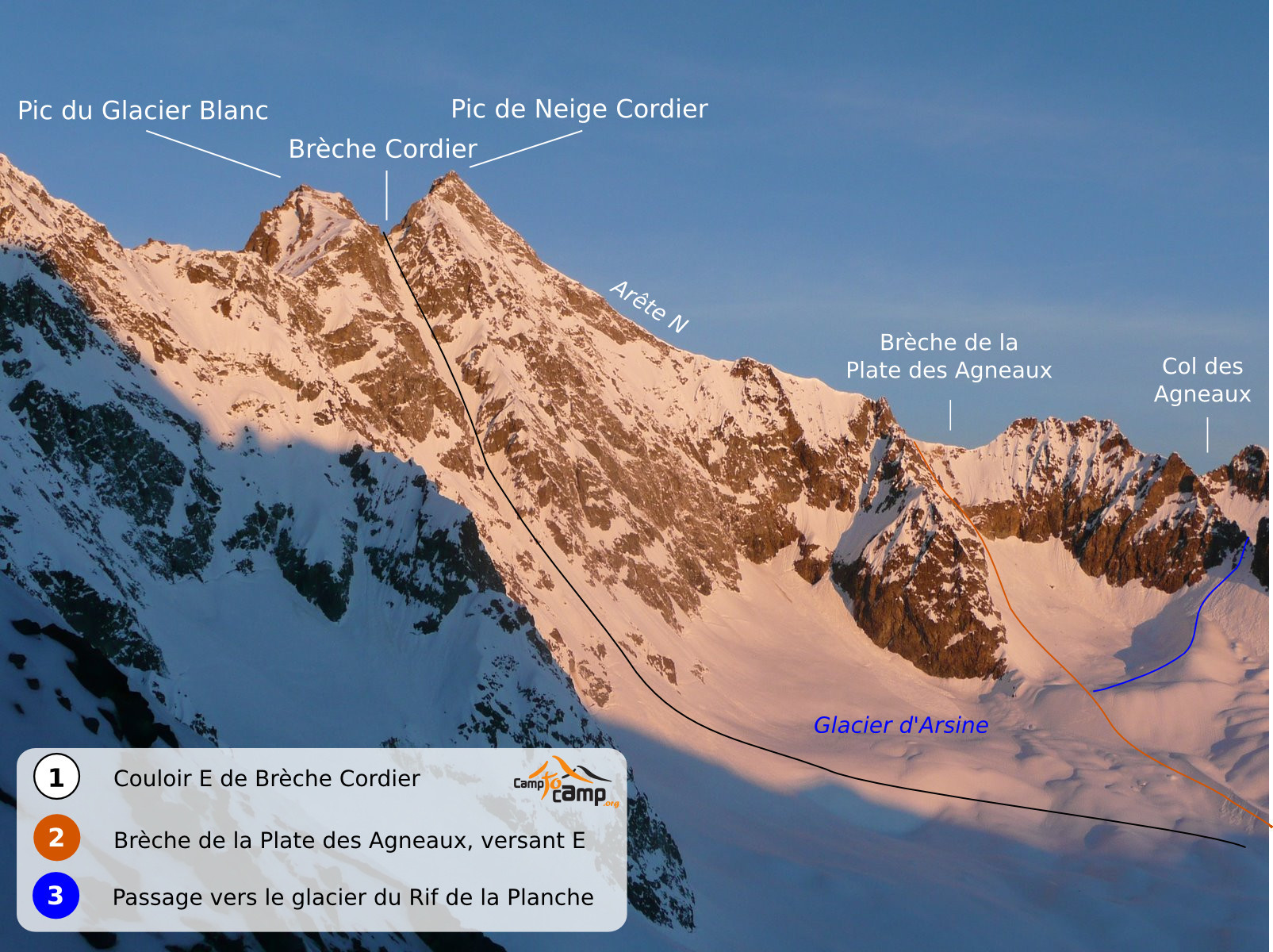
Pic de Neige Cordier, Traverse of Glacier d'Arsine-Arête Nord - Glacier des Agneaux,

Details
Day 1: From the parking lot go up the dale on the right bank via Pas d’Anna Falque’s, primarily following the summer trail, passing to the E of the weather station (at point 2055 m.) to reach Alpe du Villar d’Arène refuge (2077 m.).
Day 2: Go up the reigel to the SW of the refuge to reach the broad not very inclined dale in the direction of Col d’Arsine (2340 m.). Do not go to the pass, but climb to the S from 2300m. towards the moraines of the Arsine glacier. Avoid a rock rognon via E to continue along the small dale bordering the left bank moraine of the Arsine glacier to the W. Then go around the foot of the NE ridge of Pic d’Arsine via the SE. Around 2750 m. you reach broad slopes in a cirque at the foot of Pic d’Arsine. You reach the foot of the E slope corridor resulting from the notch of Plate des Agneaux. Go up this corridor (40/45°) until the notch (3217 m.). Stabilised snow is necessary, sometimes there is a cornice at the top. The slope gets the full force of the rising sun, do not climb it late„, 3 to 4 hours from the refuge. The go up the N ridge of Pic de Neige Cordier, being careful of the monstrous cornices which can dominate the E slope. Around 3520 m. the snowy ridge butts against the NW mixed or rocky ridge. You reach the summit via this ridge, or via a corridor on the W slope 100 m. further to the S. 1 hour 30 approximately from the Brèche, 5h30 to 7 hours from the refuge. It is possible to avoid the summit in bad conditions or if it is late by traversing the W slope from 3520 m. towards Col Emile Pic. Descent: from the summit, you reach Col Emile Pic or its surroundings. Take the Agneaux glacier, being careful of the crevasses. This route is difficult because you will not have located it during the ascent. Moreover the indications given below are subject to change because of the movement of the glaciers. Descend by the centre of the glacier, then right bank around 3200 m. Skirt the rocks on the right bank to leave the glacier. To reach the Romanche springs, cross a rock band mostly on the right descending via a corridor between 2450 m and 2350 m. Then follow the dale, not very inclined, towards Valfourche then until 1995 m. under the refuge. You can climb up to the refuge in 20 minutes. Finish the descent via the ascent route taken the day before. 2h30 to 3 hours of descent.

The text and images in this page are available
under a Creative Commons CC-by-sa licence.

Download the Whympr App to view this route in 3D.
- Route search (100 000)
- Community returns
- Weather forecast
- Avalanche bulletin
- Race book
- Creation of tracks
- Topographic map (including IGN)