

Open this route in the app to prepare your next outing.


Details
Ascent
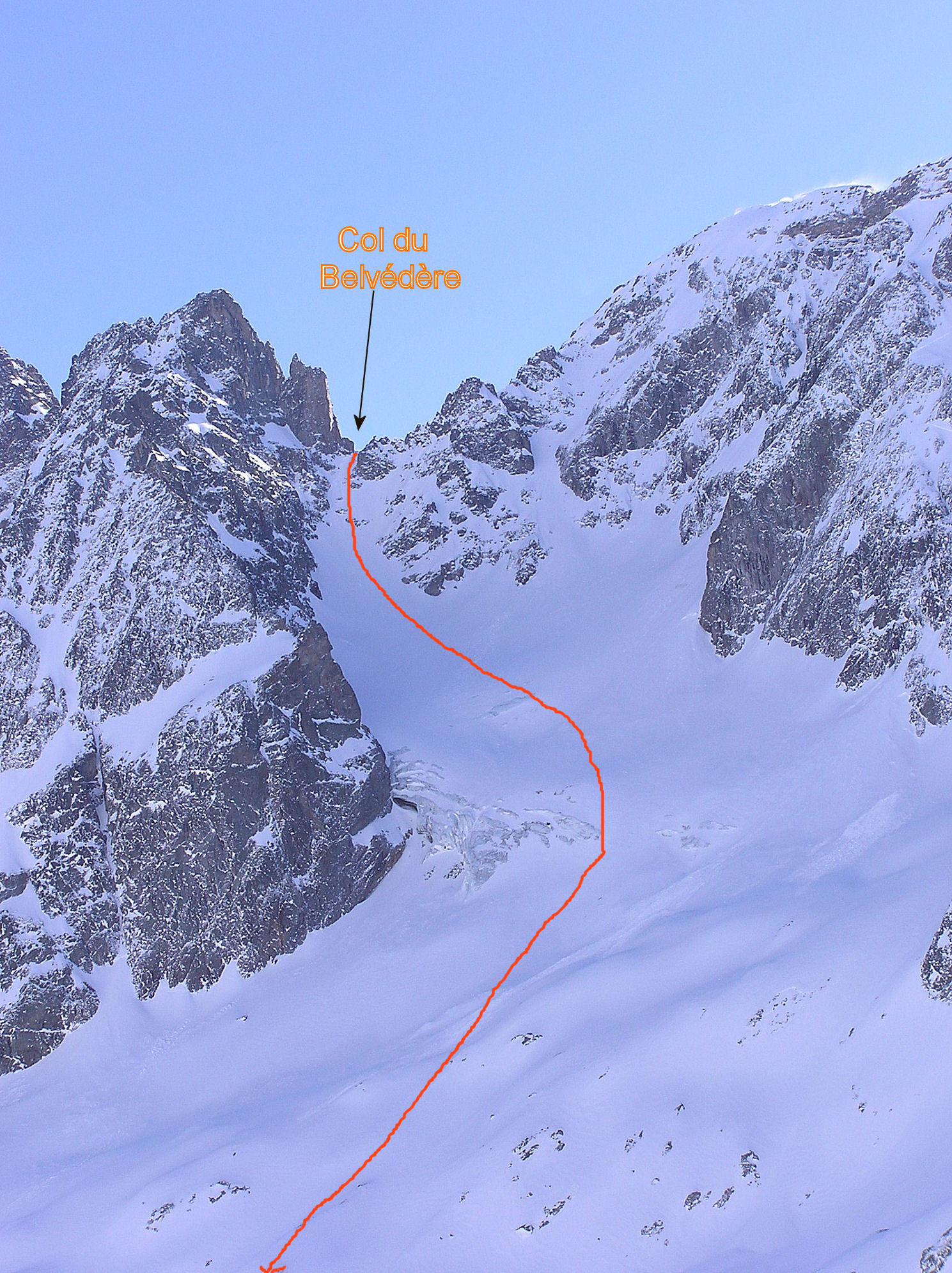
From the top of the Floria ski tow, above the Index telecabin traverse NE to pass under the foot of the ridge coming down from the Crochues. Continue onto Lac Blanc and go up the cwm to the Col de Belvedere.
If coming from the col des Montets (500m below the col on the Buet side) there is a lot of height to be gained. From the road traverse the steep slopes until a flat area. Continue by traversing the S side of the Aiguilles Rouges until you reach the cwm below the col de Belvedere and the route from Flegere.
Descent
Descend the NW gully, steep and narrow (S5 for about 50m), then less sustained (S4 for another 50m) before arriving at the pleasant slopes of the Belvédère glacier. An abseil point at the col. A second abseil point 50m lower down on the left, often buried. Go to the Berard valley by keeping to the left of the Bélvédère glacier, (to the right there are crevasses and ice.) Follow the valley back down to Buet, keeping to the true right bank lower down.

The text and images in this page are available
under a Creative Commons CC-by-sa licence.

Download the Whympr App to view this route in 3D.
- Route search (100 000)
- Community returns
- Weather forecast
- Avalanche bulletin
- Race book
- Creation of tracks
- Topographic map (including IGN)