

Open this route in the app to prepare your next outing.

Details
This description is primarily for a ski descent, but also valid for those on foot.
Approach Day 1: # To the Argentière Hut 1h30
From Col des Grands Montets, descend the piste for a short distance and leave it on the right to descend Rognons glacier to the NE towards Argentière glacier. (Classic wilderness ski area with numerous variants. You generally cross the ropes via a small opening with a warning sign). The safest way is probably to pass to the right of the Rognon (3000m.) Keep descending until it is possible to traverse to the right, and then down onto the Argentière glacier. Put on skins. Go up Argentière glacier with the Argentière refuge in sight which you reach via a traverse ascending towards the east. Some years, if the snow cover is good, it is possible to traverse the Rognons glacier under Aiguille Verte to pass above the Rognon 2866 and directly reach the base of Améthystes glacier. (complex route, very crevassed and exposed to serac falls from Verte)
Route Day 2: # 5 to 6 h (ascent - descent from the refuge)
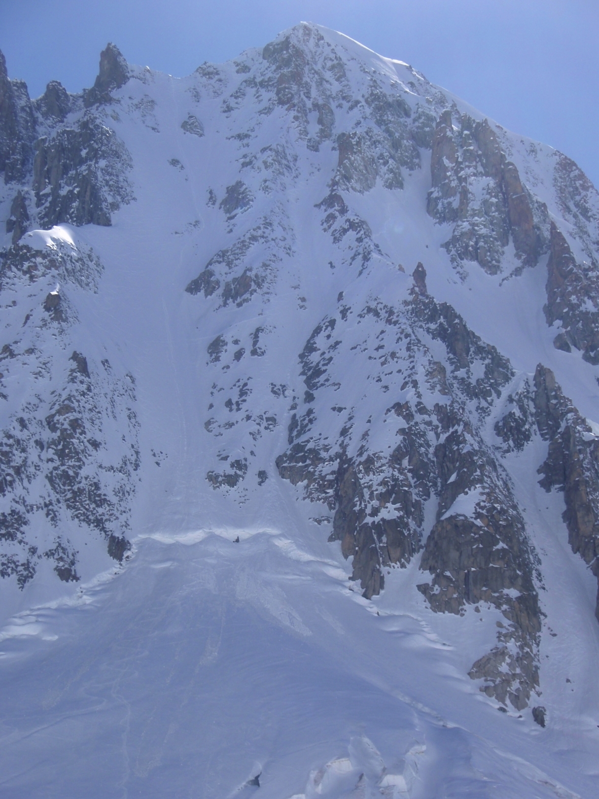
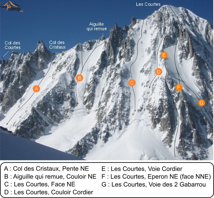
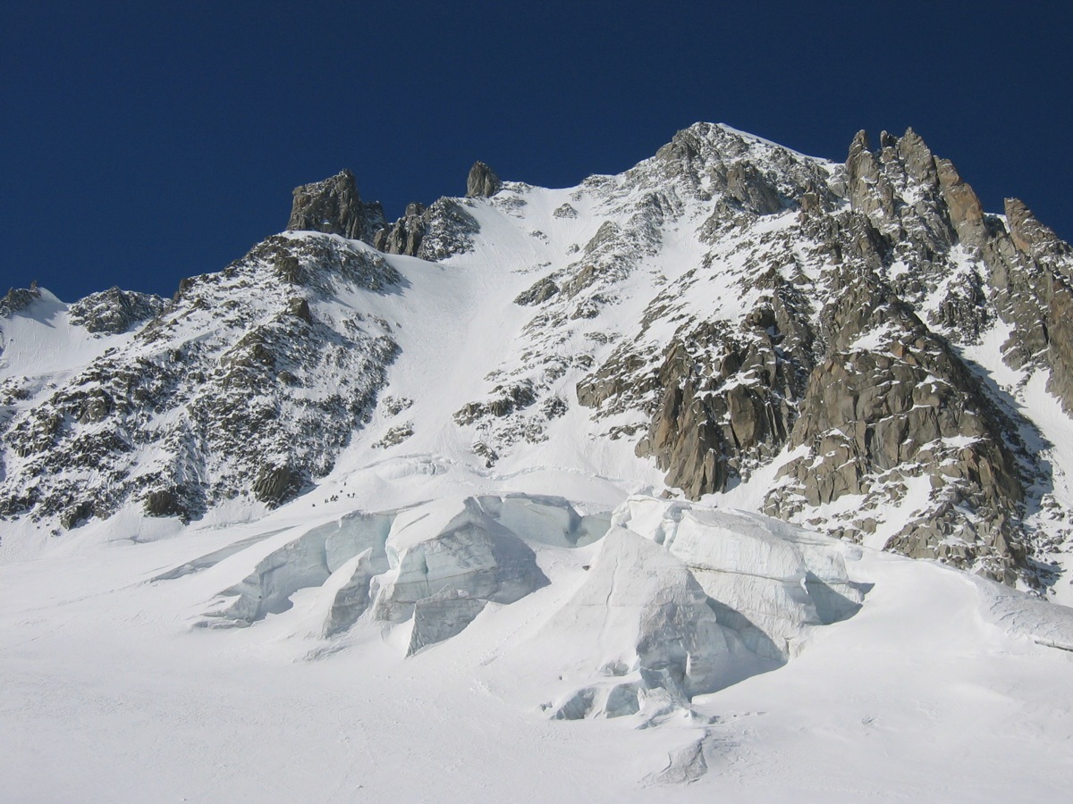
From the refuge, descend on Argentière glacier and traverse it to go up the slope that leads to the bergschrund. Cross it as best as you can (primarily to the right) then go up the slope in the middle. About 100m below the summit go diagonally to the right in a gully which becomes steeper and ends up on the ridge around 3830m. You can also go to the left, it depends on the conditions. Generally, the left bank (i.e. right when ascending) has better conditions because the snow sticks better.
Descent
On Skis, the same way. Check the day before and when descending for ice slabs! You reach Argentière glacier which you descend following its true left bank to reach the Grands Montets wilderness skiing area. Stay on the left bank of the glacier (the route is sometimes crevassed and narrow before opening back out onto the glacier.) Before the glacier steepens into a chaotic icefall, traverse out on the left bank, going around a little ridge to reach the piste returning to the mid station. On Foot, By the Normal Route (Col de la Tour des Courtes and the WNW ridge) or by the Traverse of the Courtes. See http://www.camptocamp.org/routes/54082/en/les-courtes-normal-route-and-traverse#traversee-par-l-arete-se-col-des-cristaux

Download the Whympr App to view this route in 3D.
- Route search (100 000)
- Community returns
- Weather forecast
- Avalanche bulletin
- Race book
- Creation of tracks
- Topographic map (including IGN)