

Open this route in the app to prepare your next outing.
Details
Approach # to the Britannia Hut, 30mins
Cable car to Felskinn 2989m, take the horizontal track, (piste basher track) to the Egginerjoch then cross a scree slope to the SE to the hut.
Route
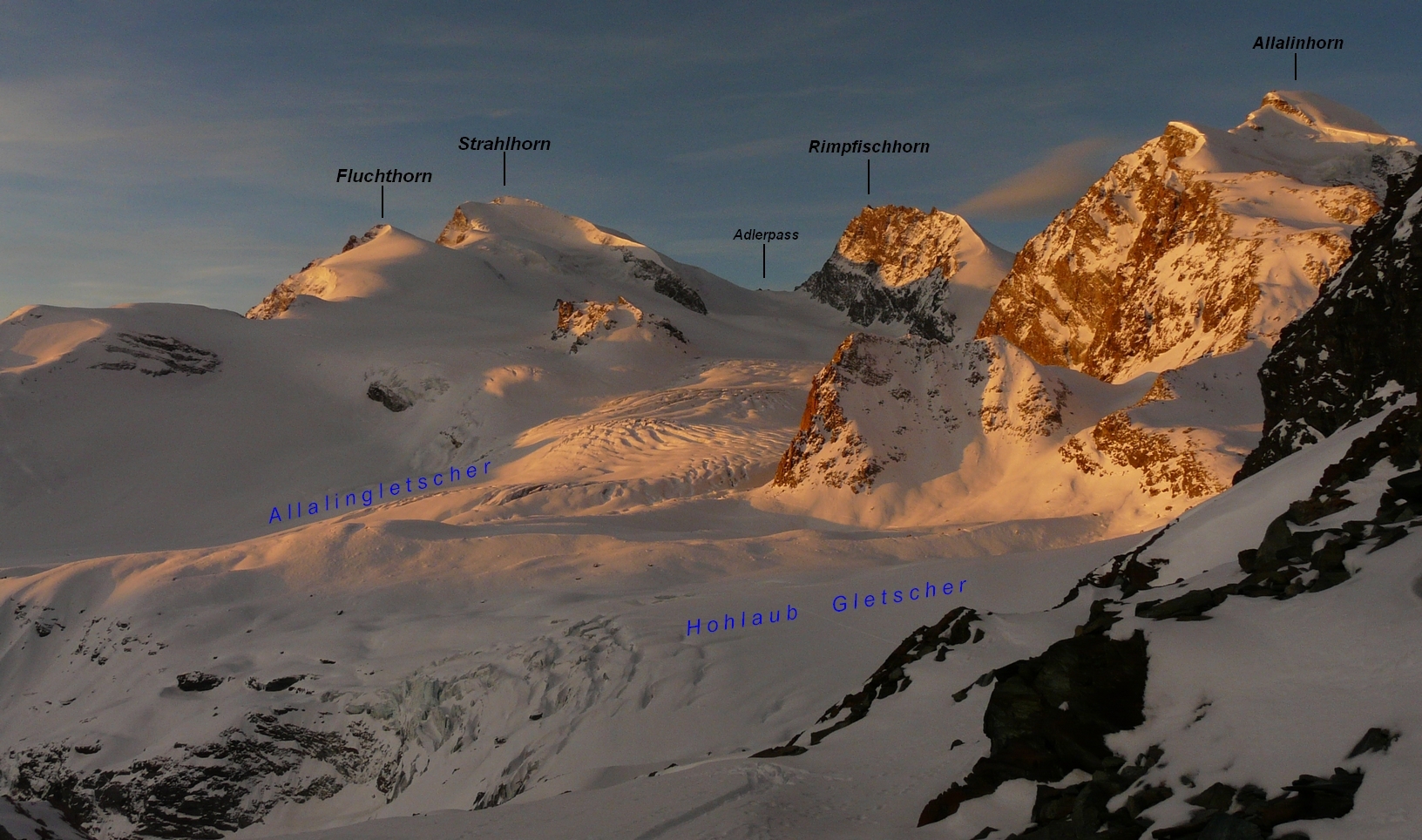
Descend to the SW of the hut to go onto the Hohlaub glacier and cross this to the foot of the spur coming down from Allalinhorn, vertically below Pte 3144m. Get past the spur, (either to the left and below or the right,) and go up the true left bank of the Allalin glacier, (W at first, then SW). Always keeping to this side of the glacier, (the route towards the Adlerpass/Strahlhorn traverses off across the glacier at about 3150 m). On reaching a plateau around 3250m, climb up more steeply to the Allalinpass (3564 m). From here traverse SW and pass underneath a first, square rock band coming from the N ridge of the Rimpfischhorn. (It is also possible to traverse at 3660 m). The glacier is heavily crevassed in this area. Go to the second square, rock band passing it at its lowest point, (Pte 3662 m). Go diagonally up a steeper slope, (firstly SE then S,) to reach an obvious saddle at almost 4000m. In Winter There is a snow dome (4009m) on the right, accessible by ski. In Summer Climb the steep gully on the right hand face, (looking towards the summit ridge) mixed, 50m, 1 bolt on the left at half height, and two points at the top, high on the left. (N.B. in May 2013, none of these fixings were visible.) After the 50m go onto the rocks on the left to make a traverse of about 50m to the summit ridge. This leads more easily (II max) to the main summit. Exposed, a rope still useful. There is some gear in place, (two iron spikes, 1-2 pitons and bits of sling.) Keep to the left of the crest of the ridge and traverse to the left to reach an airy, level ridge (15m) leading to the summit cross.
Descent
By the same route. (On ski you have to put the skins back on to climb the 50m back up to the hut and the way to the Egginjoch is flat. After that it is pistes all the way back to Saas Fee.)

Download the Whympr App to view this route in 3D.
- Route search (100 000)
- Community returns
- Weather forecast
- Avalanche bulletin
- Race book
- Creation of tracks
- Topographic map (including IGN)