

Open this route in the app to prepare your next outing.
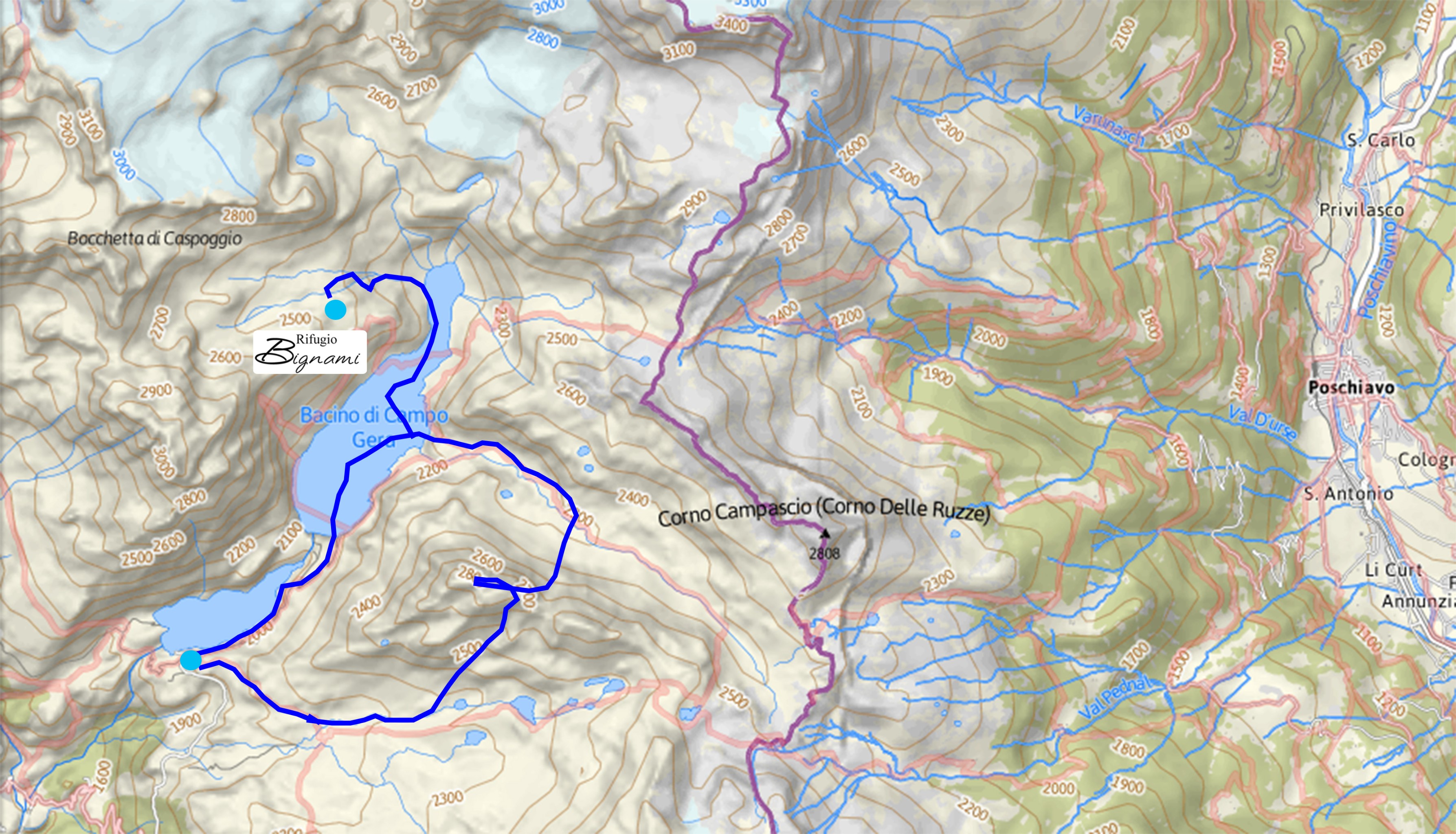
Min / max altitude2401m / 2867m
Main facingS
Route typeLoop
Source
Details
Wegbeschreibung:
Vom Rifugio Bignami durch die Talmulde im Rücken des Rifugios zum Gera See hinabfahren. Am See Felle aufziehen und über diesen Richtung O zur Val Poschiavina fortsetzen, in das Tal einbiegen und bis zu 2290m besteigen. Dann rechts Richtung S abbiegen und den Kanal der zur Kuppe des Monte Spondanscia führt in Angriff nehmen. Von hier ist der Gipfel über einen leichten Hang zu erreichen.
Abfahrt:
Vom Gipfel des Monte Spondanscia 2867m wieder auf die Kuppe gelangen und südlich in Richtung der Alpe Campagneda und der Rifugi Zoia e Ca’Runcasch abfahren.

The text and images in this page are available
under a Creative Commons CC-by-sa licence.

Download the Whympr App to view this route in 3D.
- Route search (100 000)
- Community returns
- Weather forecast
- Avalanche bulletin
- Race book
- Creation of tracks
- Topographic map (including IGN)