

Open this route in the app to prepare your next outing.

Details
Route # 3 to 4h
A new metal bridge is now in place further up the valley, saving up to half an hour. Drive past La Vachey, up the hairpins, past the parking for the Bonatti hut and continue until the valley levels out. The bridge is on the left, (there used to be a tyrolean there.) just before a small parking on the right, with waste bins? At the signpost “Bivouac Gervasutti 3h30” cross the bridge and follow the path directly to join the old path on the true right bank of the torrent.
If the bridge is not in place, use one of the two old starts:
- From Lavachey, go left before the Doire bridge, through the Frébouze chalets to find red and white waymarkers leading up gently through the forest.
- From the Frébouze bridge, take the path NE on the true right bank of the Doire De Ferret to reach the waymarkers.
- After several hundred metres, pick the best way up the true right bank of the Frébouze valley to reach a path with cairns and yellow markers.
- At about 1950m, cross the torrent (careful if there is a lot of water) and the valley to reach the true left bank.
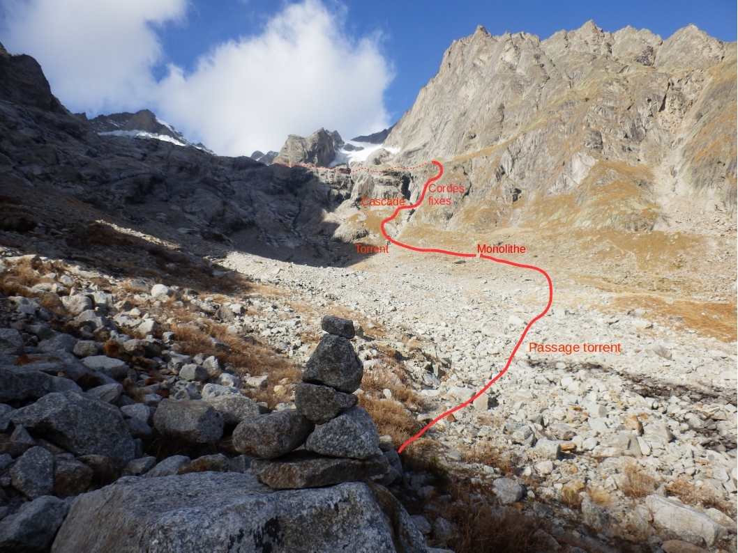
- The path (yellow markers) goes up the true left bank, (passing a standing stone).
- Around 2080m, the path crosses back across a branch of the stream, (easier,) coming from an obvious waterfall. e
- Go up the steep grassy slopes, between two streams.
- At about 2240m, under some rock bands, cross back over the same stream, (easy) close to the waterfall. s
- Climb the rock band, fixed ropes.
- Reach the grass slopes above. Pass in front of the Frébouze bivouac (2 places in the shelter of a boulder) and follow faint paths on a long, rising traverse, (yellow markings), crossing boulders and smooth rocks.
- 2-3 small snow patches to reach a second rock band with fixed ropes.
Descent
Same way.
Contrary to what is shown on the maps, there is no longer a glacier to cross. No need for crampons. The approach is awkward in places but never extreme. The way is poorly marked in places. If you have to rock climb, then you are going the wrong way. There is a “hand rail” just before the hut. Depending on the season, crossing the Frébouze torrent can be difficult, (snow bridge, large water flow.)

The text and images in this page are available
under a Creative Commons CC-by-sa licence.

Download the Whympr App to view this route in 3D.
- Route search (100 000)
- Community returns
- Weather forecast
- Avalanche bulletin
- Race book
- Creation of tracks
- Topographic map (including IGN)