

Open this route in the app to prepare your next outing.

Details
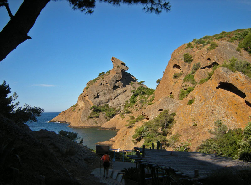
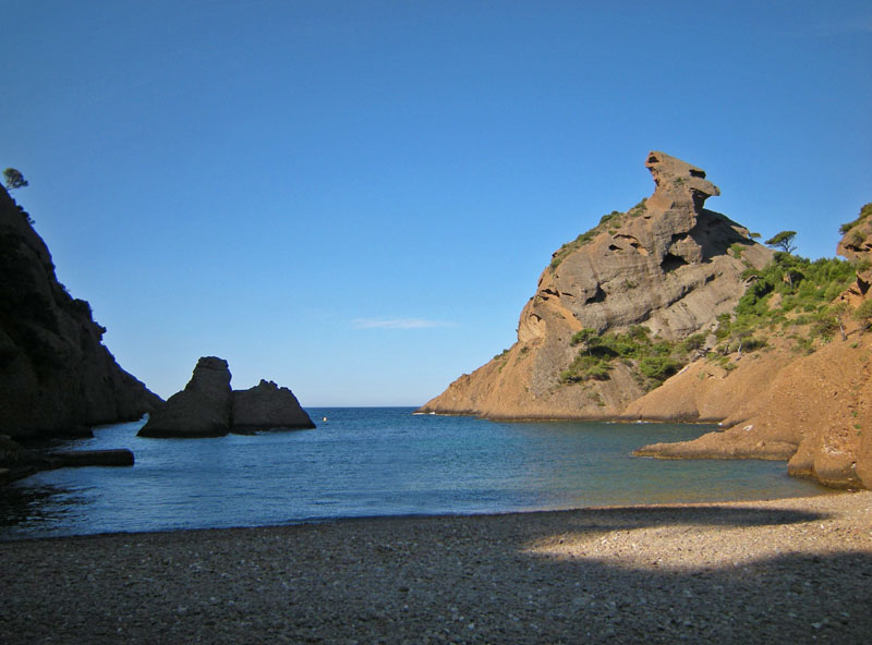
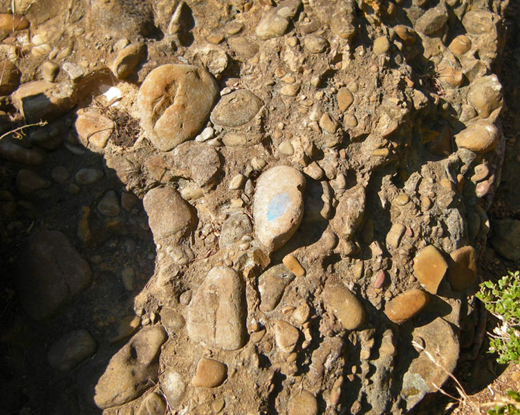
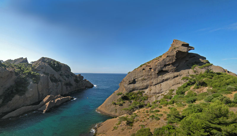
Wonderful little adventure on the most interestingly-shaped peak higher than 50 meters along the coasts of France. Dramatic views of rocks and sea. Complicated route. Climbing with many good holds on puddingstone rock. Much climbing at difficulty 2+.
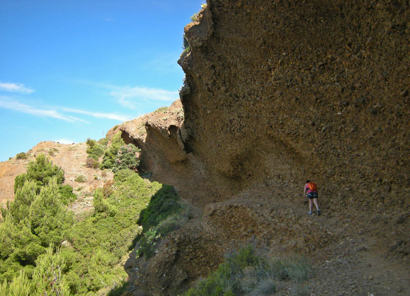
From the entry (GPS latitude/longitude ~ N43.16743 E5.59867) to the sea inlet of the Anse de Figuerolles (or Calanque de Figuerolles), walk W then SW about 150m down to the pebble beach (lat/long ~ N43.1667 E5.5972). From the NW side of the beach start climbing up steeply (2 bolts) near an old metal spike protruding 15cm, for about 25m. Then horizontal a few meters, then down thru a small notch, steeper down 5m. Up a gully (N) on dirt about 10m. Then sharp Left to go roughly South roughly horizontally on dirt to the base of the Figuerolles">http://www.camptocamp.org/sites/442303/en/figuerolles-ecole-d-escalade">Figuerolles ecole crag (see small semi-circles of old steel embedded in the rock). Next climb up W on rock about 100m going under an overhang - (some blue paint marks). Near the end of overhang, turn S about 70m toward the Capucin peak, at first roughly horizontal on dirt trail, then go down steeply on rock - find some steps cut into the rock. Next continue S gentle on dirt with some narrow sections through bushes.
Now the idea is to make a spiral counter-clockwise around and in toward the summmit … Climb up S about 70m toward shoulder on W side of Capucin peak - up a rock face, then another rock face with a steeper move Left (2 bolts with missing hangers) up to a col (2-bolt anchor, pitch less than 25m). Next S about 20m down the other side of the col on rock (2 bolts), soon turn E about 60m, down then up on dirt trail, then a short ways N on dirt trail. Then W on rock (some blue paint marks) up to a steep move (difficulty 3a - though one guidebook says 3c) - (2 bolts with missing hangers, can protect with slings around horns instead, then an intact bolt). Next, a more direct finish SSW to summit has more interesting climbing (and at least one bolt). Easier is to go SW up to 2-bolt anchor (pitch less than 30m). Finally S to the summit (1 bolt anchor, pitch less than 20m).
Descent: Return the same way.
Alternate return: After climbing N back up the steps cut into the rock, continue N about 30m up to another set of steps, then flat another 60m to meet a dirt trail at (N43.1672 E5.5950). Turn right on trail (blue paint markings) and walk 200m roughly ESE then ENE and finish down to about 50m N from the beach of Figuerolles (at first gentle than down steep, finish steeper) – but this finish is forbidden as of 2013.
Or to visit a quiet chapel with some additional pretty views (and perhaps some more different climbing) … After meeting the dirt trail, instead turn left and go WSW about 350m, first across a gully, then a rising traverse, to a wooden fence. Cross that to the chapel of Notre-Dame de la Garde (N43.1665 E5.5922). Then it is easy to go to the top of the “dome” de la Garde (just West above the chapel). . . (Could also try some fun scrambling on the Aretes de la Garde: The ridge SE from the “dome” has more interesting climbing moves. The ridge NW from the “dome” has bright orange lichen and overhanging views). Return to Figuerolles on that same trail. Or walk down a wide path NNE from the chapel to meet the street at (N43.1701 E5.5942), then turn right and walk E on the street 500m, finally turn right and walk SSW for 250m to arrive back at Figuerolles entrance.

The text and images in this page are available
under a Creative Commons CC-by-sa licence.

Download the Whympr App to view this route in 3D.
- Route search (100 000)
- Community returns
- Weather forecast
- Avalanche bulletin
- Race book
- Creation of tracks
- Topographic map (including IGN)