

Open this outing in the app to prepare your next outing.

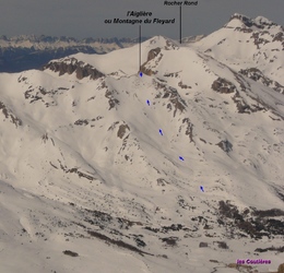
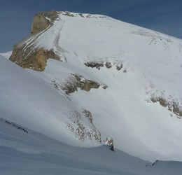
L'Aiglière / Montagne du Fleyrard
France • 2258 m

Extrémité NE de la Crête des Aiguilles de Lus.
Sur les cartes IGN au 1:25000, le sommet est orthographié à tort “Fleyard”. La bonne orthographe est “Fleyrard”
Panorama
Vue">https://www.toporandosmontagne.com/05/devoluy/chauvet-merlant-arres/pano-tete-jas-arres-vierge.JPG">Vue de la Tête du Jas des Arres par toporandosmontagne.com Vue">https://www.toporandosmontagne.com/05/devoluy/chauvet-merlant-arres/pano-tete-merlant-vierge.JPG">Vue de la Tête de Merlant par toporandosmontagne.com Vue">https://www.toporandosmontagne.com/05/devoluy/chauvet-merlant-arres/pano-le-chauvet-vierge.JPG">Vue du Chauvet par toporandosmontagne.com Vue">https://www.toporandosmontagne.com/05/devoluy/tete-garnesier/pano-tete-ormans-vierge.JPG">Vue de la Tête des Ormans par toporandosmontagne.com

Routes

Download the Whympr App to view this POI in 3D.
- Route search (100 000)
- Community returns
- Weather forecast
- Avalanche bulletin
- Race book
- Creation of tracks
- Topographic map (including IGN)