

Open this outing in the app to prepare your next outing.

Refuge de l'Aigle
France • 3440 m
Source
Pedestrian access
6h walk from Pied du col
Start of the approach: La Grave ou Pied du Col Ascent - height difference: 1800 m Ascent time span: 6h Road access: La Grave - Pied du col
Details
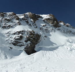
The highest hutte in Écrins area (3450m).
One of the last old fashion way to rest in mountains. The refuge de l’Aigle is famous for beeing on the way back from the Meije Traverse.



Download the Whympr App to view this POI in 3D.
- Route search (100 000)
- Community returns
- Weather forecast
- Avalanche bulletin
- Race book
- Creation of tracks
- Topographic map (including IGN)