

Open this route in the app to prepare your next outing.

Details
Approach Day 1 3h30 From the parking at Fer à Cheval, (end of the road, 4€ ) follow one of the many paths leading gently up the valley until it is possible to cross the river just before the Chalet du Tonkin, (cafe). In front of this chalet there is a signposted path which leads very steeply to the Chalet du Boret (cafe), (some chains, metal steps). From here, the path turns NW, up the pastures, to avoid a rock band then traverses back rightwards beneath some cliffs and then up to the Vogealle hut.
Approach Day 2 2h Follow the main path from the hut that leads up the left side of a gorge to a level area and a turn off to the right, (signposted). Follow this fainter path across the river and climb steeply up grassy slopes to a col just below the Tête de Pérua. There is now a long traverse to the col du Sageroux, (care needed early season in case of hard snow). Follow the frontier ridge eastwards. A path on the S side of the Tete des Ottans, bypasses this rocky summit and leads to the Col des Ottans (large cairn, signpost). From here the main path descends towards the Susanfe Hut down cables and metal steps, and which provides an alternative approach to the Col des Ottans from Champery
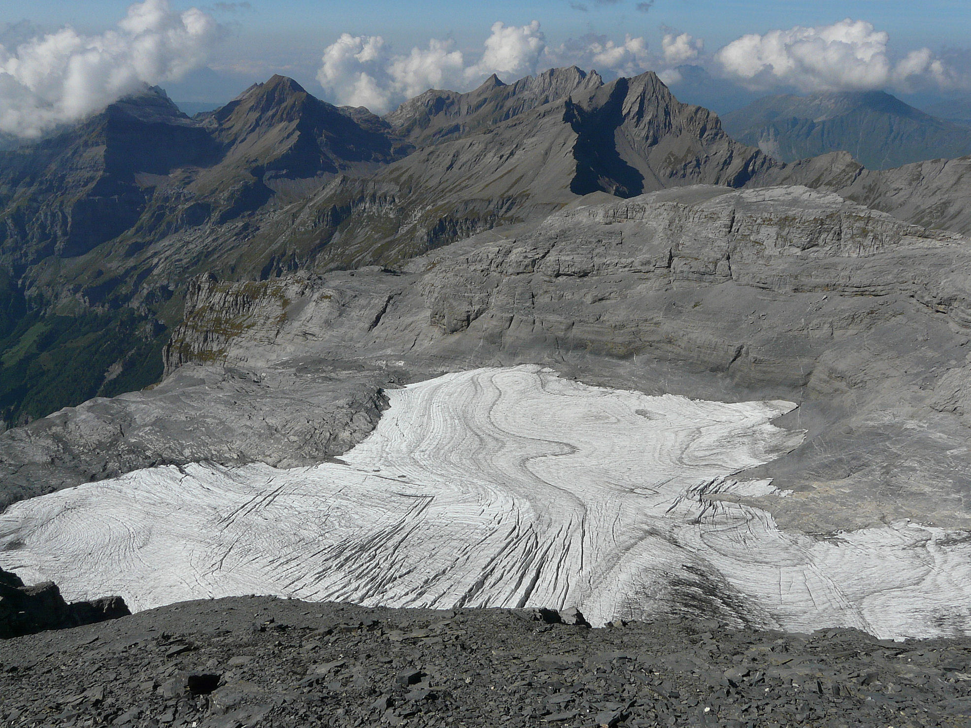
Route 2h30 Follow a faint path, (some cairns,) to the south of the ridge leading up Petit Mont Ruan, across shaley scree and through a loose rock band, (difficult when covered in snow!). Traverse more or less horizontally a zone of loose shale and boulders, following cairns, to reach a zone of more solid limestone. Continue traversing, some cairns, until you can downclimb a ramp/fault line to reach the rocks on the Ruan Glacier. (II-III). Take note of this spot for the return journey!
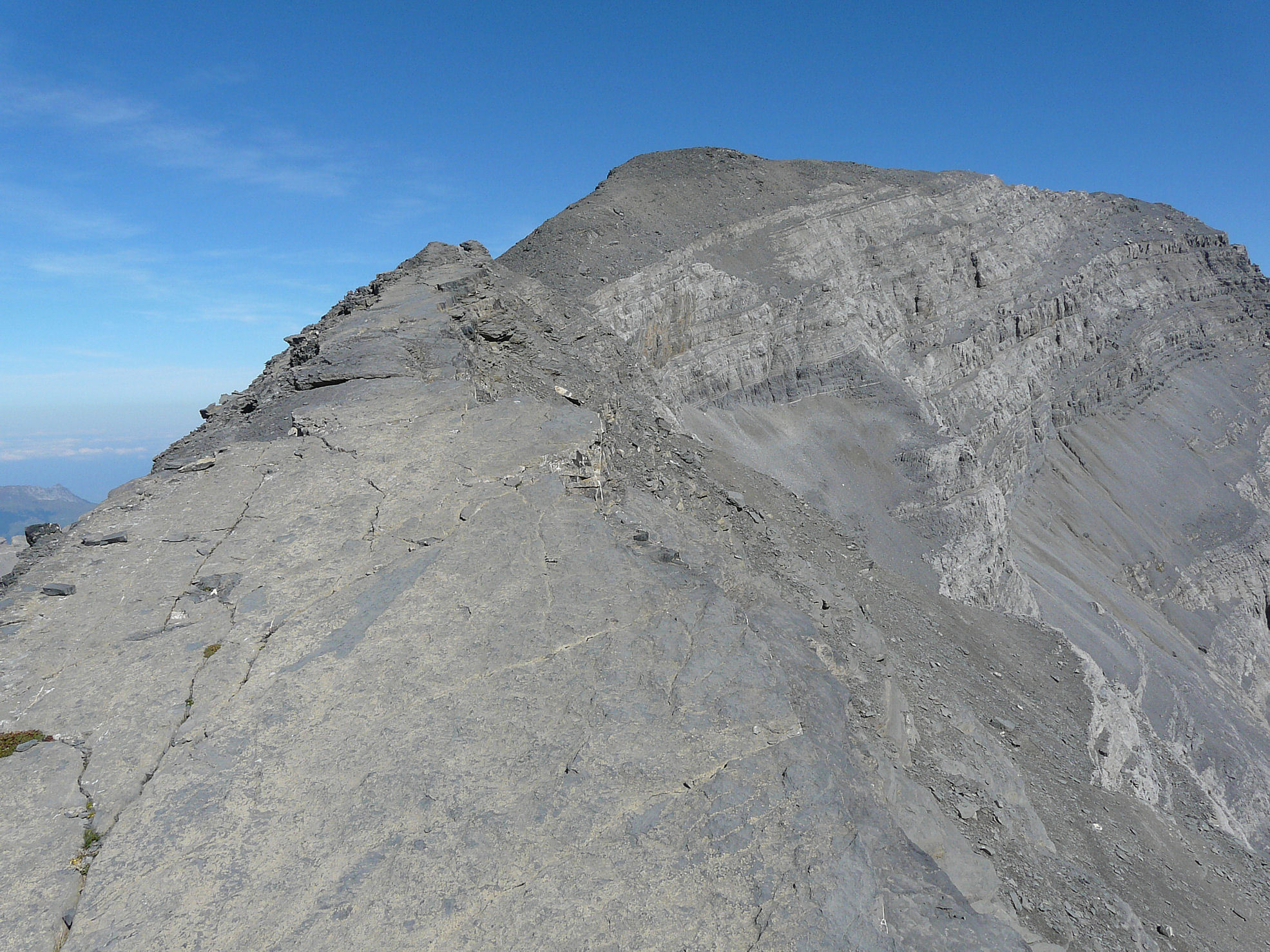
Follow the cairns to the NE, over the boulders, to reach the glacier at the highest point of the moraine and above the crevasse zone. Go horizontally across the glacier towards the large gully which splits the Ruan cliff, (not immediately obvious as it is at right angles to the line of vision). Climb the gully, which will have various amounts of snow depending on the season/ time of year. It may be necessary to climb the rocks in places, taking time to find the best line, (II-III). Exit onto the ridge. The summit is straight in front. Follow the crest, cross easily a little col and go up the final slope of loose stones to the top. Descent 3h30 (to the hut) Return by the same route. The state of the snow or rocks may be problematical in descent. It is possible to avoid the steepest section of the gully by a 30m chimney to the W. The top is marked with a cairn and is reached by a quick, horizontal traverse across rock steps overlooking the glacier. There is a belay to set up an abseil. From the base of the chimney it is easy to rejoin the ascent route.

The text and images in this page are available
under a Creative Commons CC-by-sa licence.

Download the Whympr App to view this route in 3D.
- Route search (100 000)
- Community returns
- Weather forecast
- Avalanche bulletin
- Race book
- Creation of tracks
- Topographic map (including IGN)