

Open this route in the app to prepare your next outing.

Details
Approach
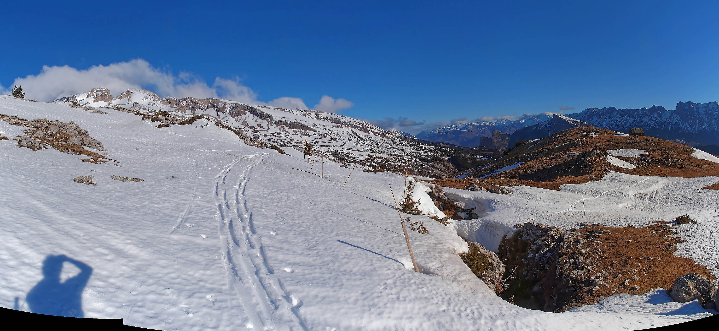
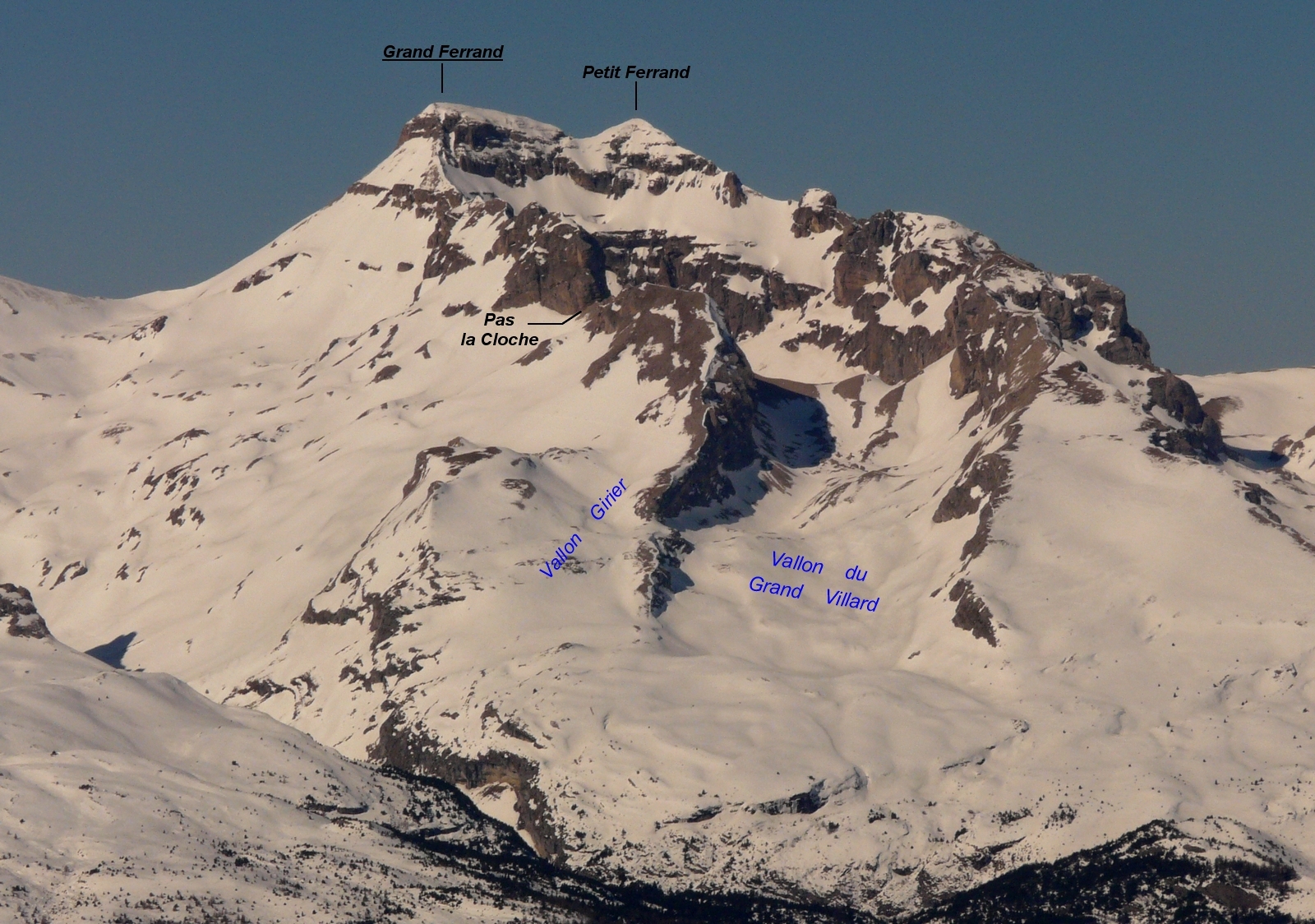
Several accesses to enter the Grand Villard valley: 1. From the Grand Villard hamlet (1209m): follow the car track up to the pastoral hut (1515m). Then pursue to the W to reach the Grand Villard valley. It is the most straight access. 2. From the Pertusets bridge (right-turn, 500m at the N of Grand Villard, 1207m): go up-valley along W slopes up to about 1600m. From there, begin a long S aspect crossing to enter in the Grand Villard valley. 3. From Lachaup burg]] (1392m): reach the “Pas la Cloche” by the [[routes/155279|normal route of its S face]], then cross by descending its [[routes/114814|N slope. You are now in the upper part of the Grand Villard valley in front of the Olympic Chourum.
Go up the Grand Villard valley until Gouturier hollow (2174m) at the base of the Grand Ferrand E face.
E face
Olympic Chourum
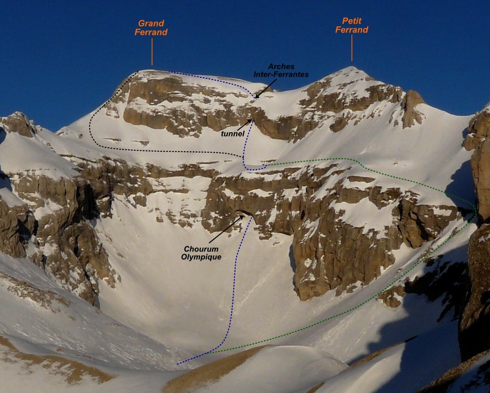
Cross the Gouturier hollow and aim at an obvious big hole in the rock barrier which closes the upper valley. This is the Olympic Chourum whose entrance is at around 2420m and which leads on a large horizontal snow ramp: the Olympic ramp. Go inside the cave and climb up the couloir on about 100m. The lower slope is 45°, the couloir narrows (2m width) at the middle, and the upper slopes become steeper (about 47-48°).
Option to reach the Olympic ramp
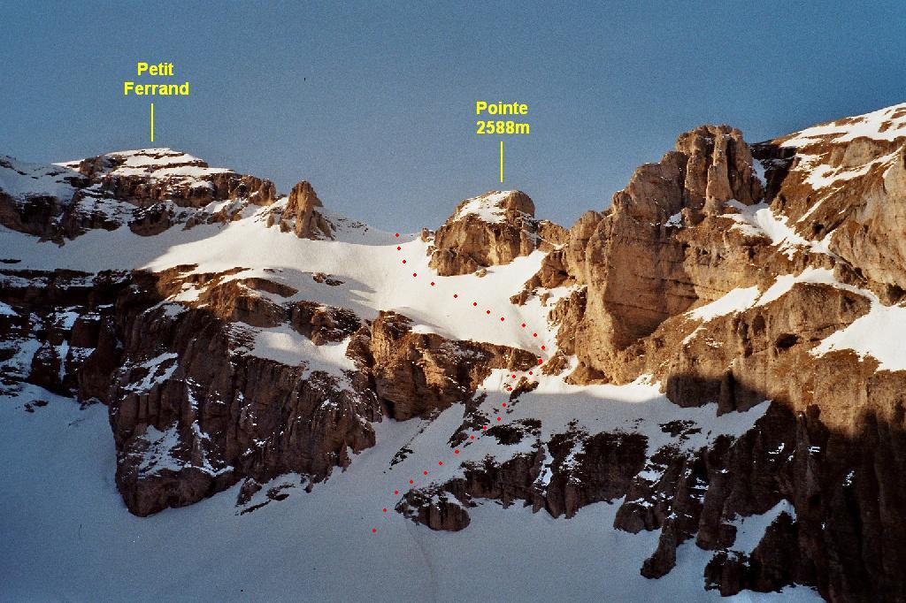
In case of bad snow cover the Chourum may be impassable (vertical rock wall with mixed part). It can be avoided by following a S steep couloir (45° sections) from the Gouturier hollow towards the “Pas de l’Etoile”. The latter tops out on wide suspended snow slopes above the rock barriers. From there, the route is very exposed! Cross south-east the snow ramp, and reach the impressive upper entry of the Olympic Chourum where the straight route is met.
“Inter-Ferrantes” arches
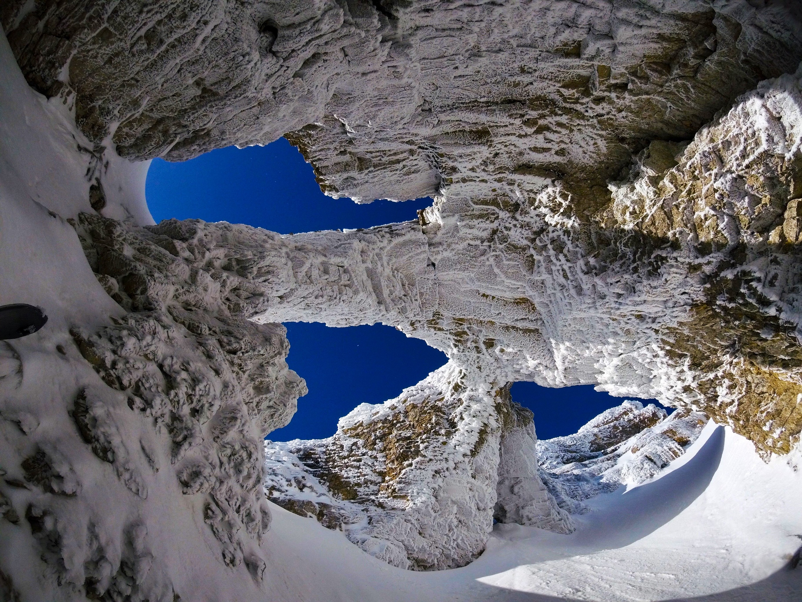
The next part of the route is a bit worrying as located just above the big hole of Olympic Chourum. Climb up westward above the Chourum to reach the entry of a new tunnel, and cross it. A very steep mixed section (short, 10m) may be present in the middle of the cave (a relay is present on the above pillar between arches, but the passage is almost unprotectable). At the end of winter, it may be completely covered by snow. The tunnel is closed by two beautiful arches which have been named the “Inter-Ferrantes” Arches (as they make the link between the two summits: Petit Ferrand and Grand Ferrand). Just after the belay turn on left, cross a small arch (big cornice just above) and top out a steep diagonal snow ramp (about 50° with 15m at 55°). From the top of the ramp the summit is met quickly and easily by softer slopes.
Note
If the tunnel crossing is too tricky, then the snow ramp may be followed until its left extremity where the normal route is joined
Descent
- By the same route: especially interesting if you have skis (but good conditions are rarely met, and ski is better by the south face). Possible abseil (3 anchors linked by a webbing) or tricky downclimb in the tunnel.
- By the normal route (S aspect) up to 2200m. Then cross by remaining on the left side to reach the Girier valley. The latter leads to the bottom of Grand Villard valley.
- By “Pas la Cloche”]]: it is the longest option. Descend the [[routes/49115|south-facing summit slope]] until about 2200m. Then ascend the [[routes/155279|S face of “Pas la Cloche”]], and descend its [[routes/114814|N face to reach the Grand Villard valley.

The text and images in this page are available
under a Creative Commons CC-by-sa licence.

Download the Whympr App to view this route in 3D.
- Route search (100 000)
- Community returns
- Weather forecast
- Avalanche bulletin
- Race book
- Creation of tracks
- Topographic map (including IGN)