

Open this outing in the app to prepare your next outing.

Grand Ferrand
France • 2758 m

Géographie
- Col associé à la proéminence : Col de Drouillet (2235 m)
- Plus proche parent et parent principal : Obiou (2789 m)
- Rayon de dominance : 6,15 km
- Point de limite de dominance : arête SW de l’Obiou (2789 m)
Randonnée
Plusieurs possibilités de bivouacs plus ou moins abrités vers le sommet. Une boîte à messages est disposée au sommet
Bibliographie
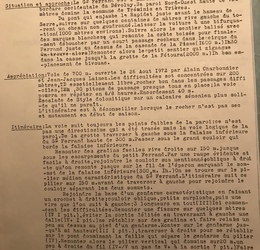
Itinéraire du Grand Ferrand par l’arête Sud, au départ de Tréminis par Jean Escarra, La">https://gallica.bnf.fr/ark:/12148/bpt6k9764730z/f119.image">La Montagne, 1923, no160, p.85-86
Panorama
Vue">https://www.alpen-panoramen.de/panorama.php?pid=16863">Vue de la Tête de l’Aupet par Bertrand Mandon Vue">https://www.alpen-panoramen.de/panorama.php?pid=921">Vue du Jocoupar Bertrand Mandon Vue">https://www.toporandosmontagne.com/05/devoluy/tete-oriol/pano-tete-oriol-annote.JPG">Vue de la Tête d’Oriol par toporandosmontagne.com Vue">https://www.toporandosmontagne.com/05/devoluy/pic-pierroux/pano-pic-pierroux-annote.JPG">Vue du Pic Pierroux par toporandosmontagne.com Vue">https://www.toporandosmontagne.com/05/devoluy/rocher-rond/pano-rocher-rond-annote.JPG">Vue du Rocher Rond par toporandosmontagne.com Vue">https://www.toporandosmontagne.com/05/devoluy/tete-vallon-piarra/pano-tete-vallon-piarra-annote.JPG">Vue de la Tête de Vallon Pierra par toporandosmontagne.com Vue">https://www.toporandosmontagne.com/05/devoluy/tete-aupet/pano-tete-aupet-annote.JPG">Vue de la Tête de l’Aupet par toporandosmontagne.com Vue">https://www.toporandosmontagne.com/05/devoluy/g-ferrand/pano-g-ferrand-annote.JPG">Vue du Grand Ferrand par toporandosmontagne.com

Routes
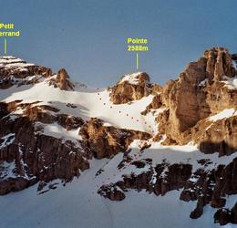
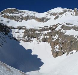
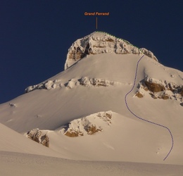

Download the Whympr App to view this POI in 3D.
- Route search (100 000)
- Community returns
- Weather forecast
- Avalanche bulletin
- Race book
- Creation of tracks
- Topographic map (including IGN)