

Open this route in the app to prepare your next outing.

Details
Approach to the Grands Mulets hut
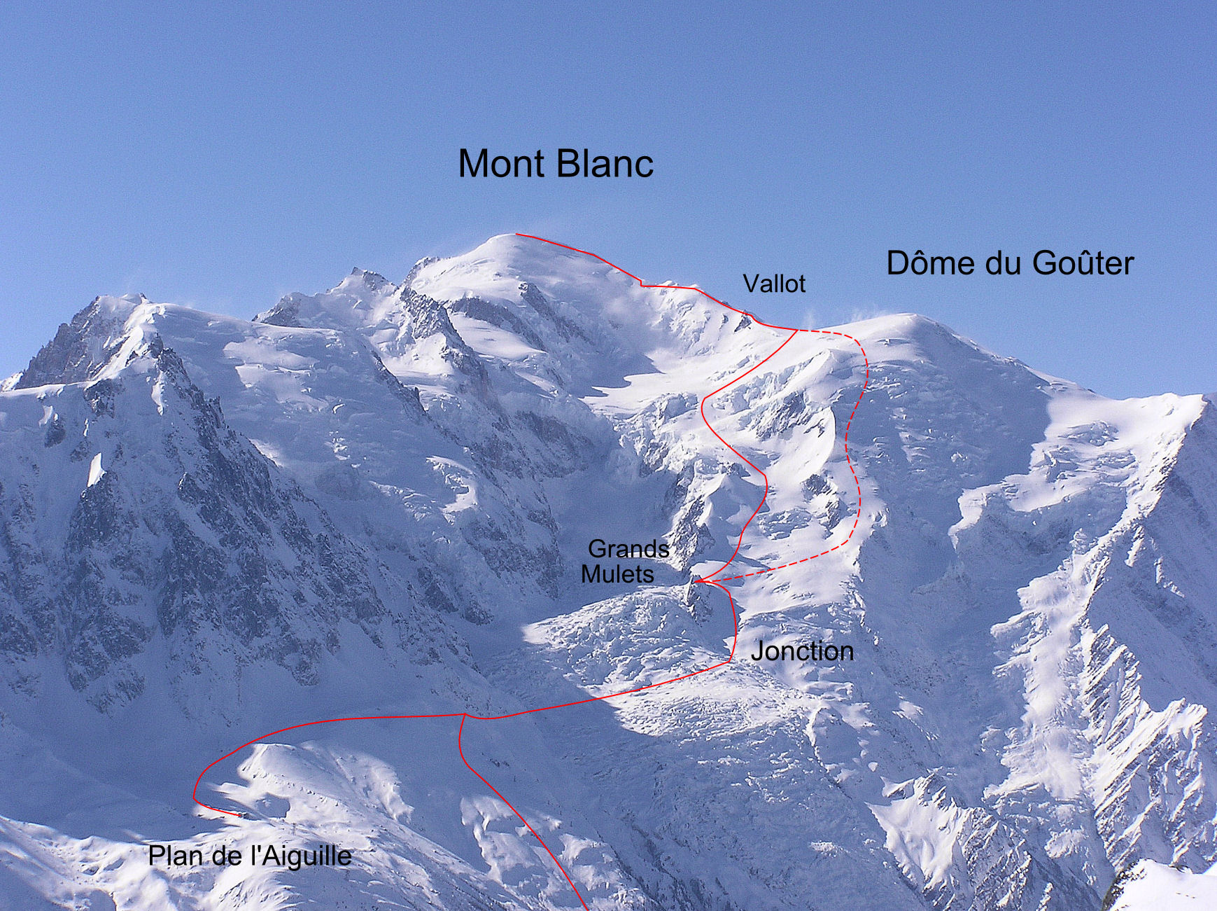
From the Plan de l’Aiguille, (mid station of the l’aiguille du Midi cable car,) go onto the Pèlerins glacier and head towards the Bossons glacier by contouring under the cable ca. Continue traversing under the line of the old cable car and the Rond glacier, (serac fall risk). From the Bossons glacier, traverse through the maze of seracs and crevasses until the Jonction, directly below the Grands Mulets hit (3051m). Go up the snow slope leading to the hut.
Alternate without using the lift
Start form the Cerro parking (1270m) next to the Mont Blanc tunnel entrance. Take the path on the true right bank of the torrent. Go up the path to the old cable car station, (La Para), and then traverse towards the Bossons glacier, without losing height. Follow the above route to the hut, (1760m height gain.)
Route
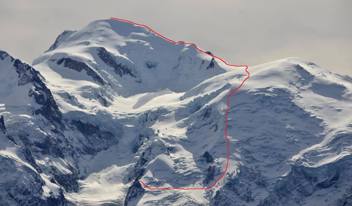
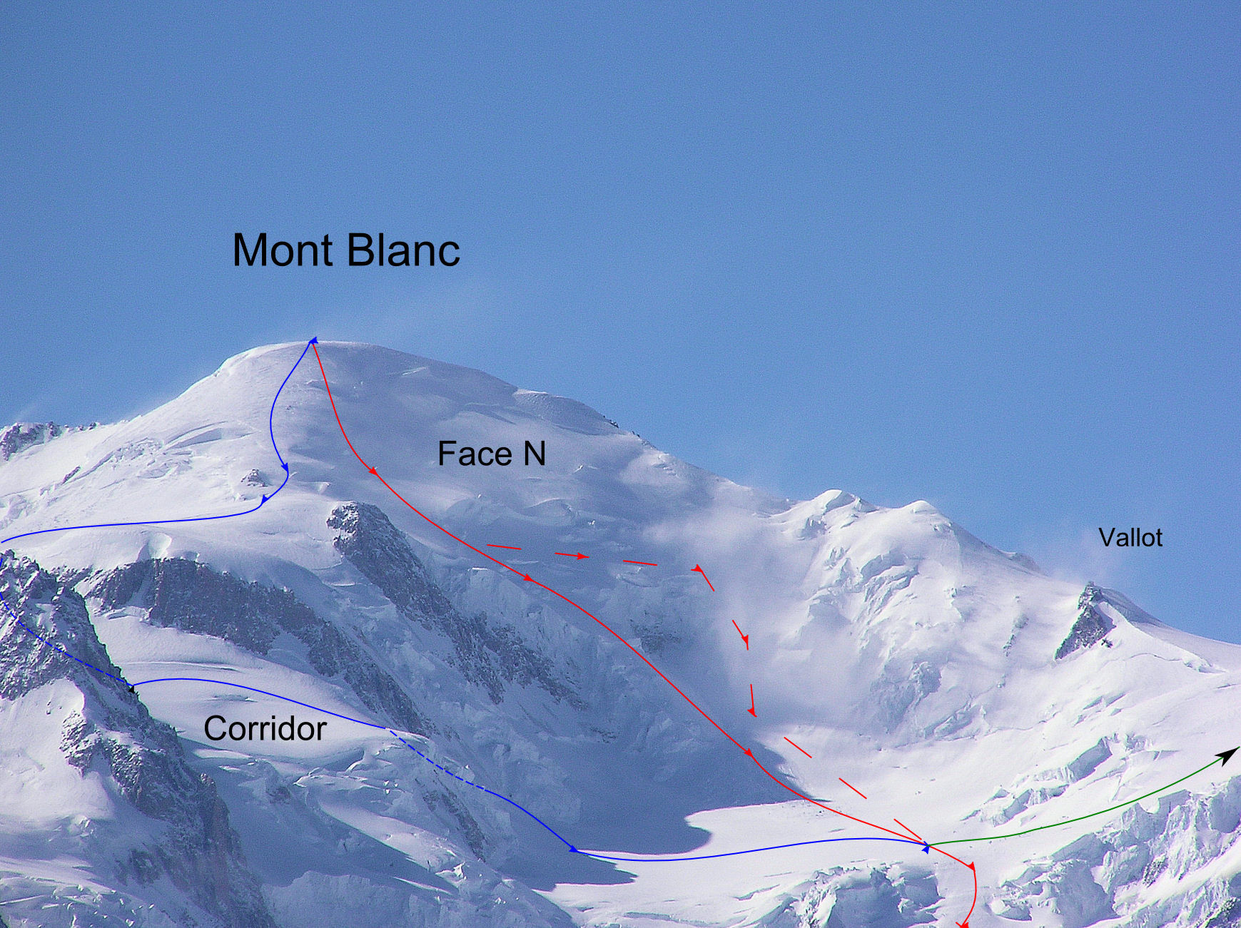
From the hut go onto the true left bank of the glacier, and go up this passing the Petites Montées, the Petit Plateau (serac dnager), the Grandes Montées to the Grand Plateau. Reach the Vallot hut (4367m) by the Col du Dôme (4200m). The rest of the route is obvious évident (in good weather) : les Bosses and the summit ridgeet Skiers can chose either to leave their skis at the Vallot or carry them to the summit for a descent by the N face.
Alternate
It is strongly recommended to go up by the N shoulder of the Dôme du Goûter, It is steeper but is not exposed to serac fall like the « classic » route at the Petit et Grand Plateau. It is reasonable for skiers to descend the « normal » route as the time they spend in the danger zones is very limited.
Descent
By the same route or one of the other Mont Blanc Classic routes for example down to the Gouter or the 3 monts to the Aiguille du Midi
For information on a ski descent please see the French version.

The text and images in this page are available
under a Creative Commons CC-by-sa licence.

Download the Whympr App to view this route in 3D.
- Route search (100 000)
- Community returns
- Weather forecast
- Avalanche bulletin
- Race book
- Creation of tracks
- Topographic map (including IGN)