

Open this route in the app to prepare your next outing.

Details
Approach
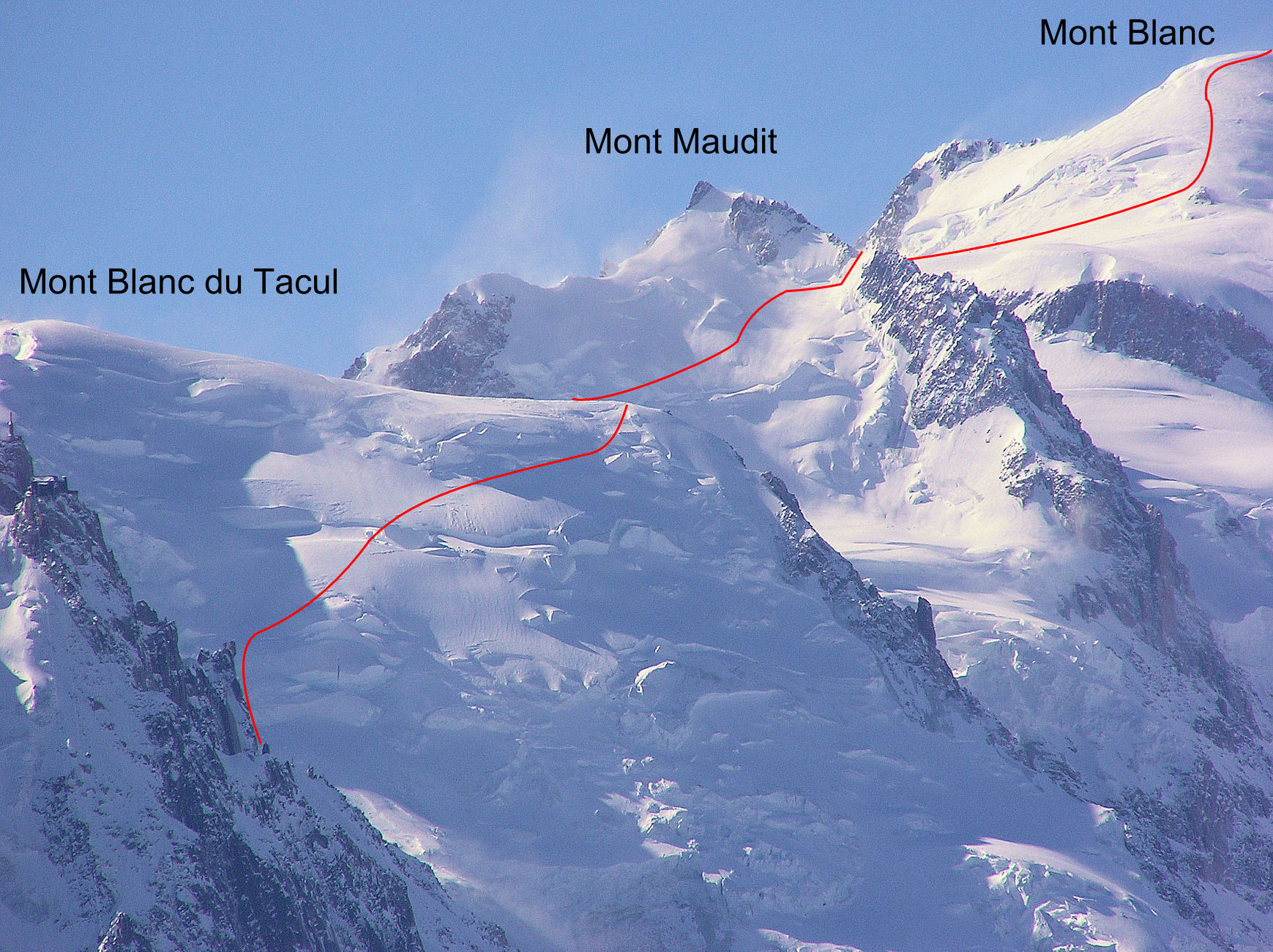
From the top station of the Aiguille du Midi, go down the ridge, (usually equipped with safety ropes) and ski down to the Col du Midi (and so to the Cosmiques hut, 3613m).
Ascent
N face of Mont Blanc du Tacul
Climb up the N face of the Mont Blanc du Tacul until its shoulder, (at about 4070m). The precise route changes, depending on the state of the bergschrunds and seracs.
N Face of Mont Maudit
Mak a short descent towards the Col Maudit, then climb up diagonally to the right the N face of Mont Maudit. At the bergschrund, climb a short, steep slope, (snow or ice,) leading to the Col du Mont Maudit (4345m).
“Mur de la côte” & Mont Blanc
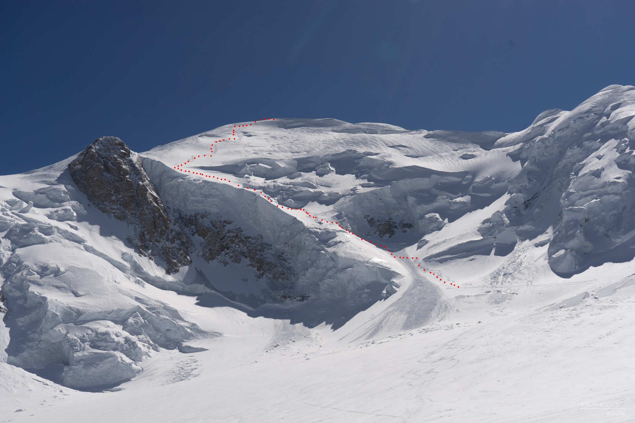
Make a descending traverse to the Col de la Brenva (4303m) (exposed in places). Go up NE to the summit of Mont Blanc, firstly by a steep section (Mur de la Côte) then next to the Petits Rochers Rouges.
Descent
Depending on the conditions:
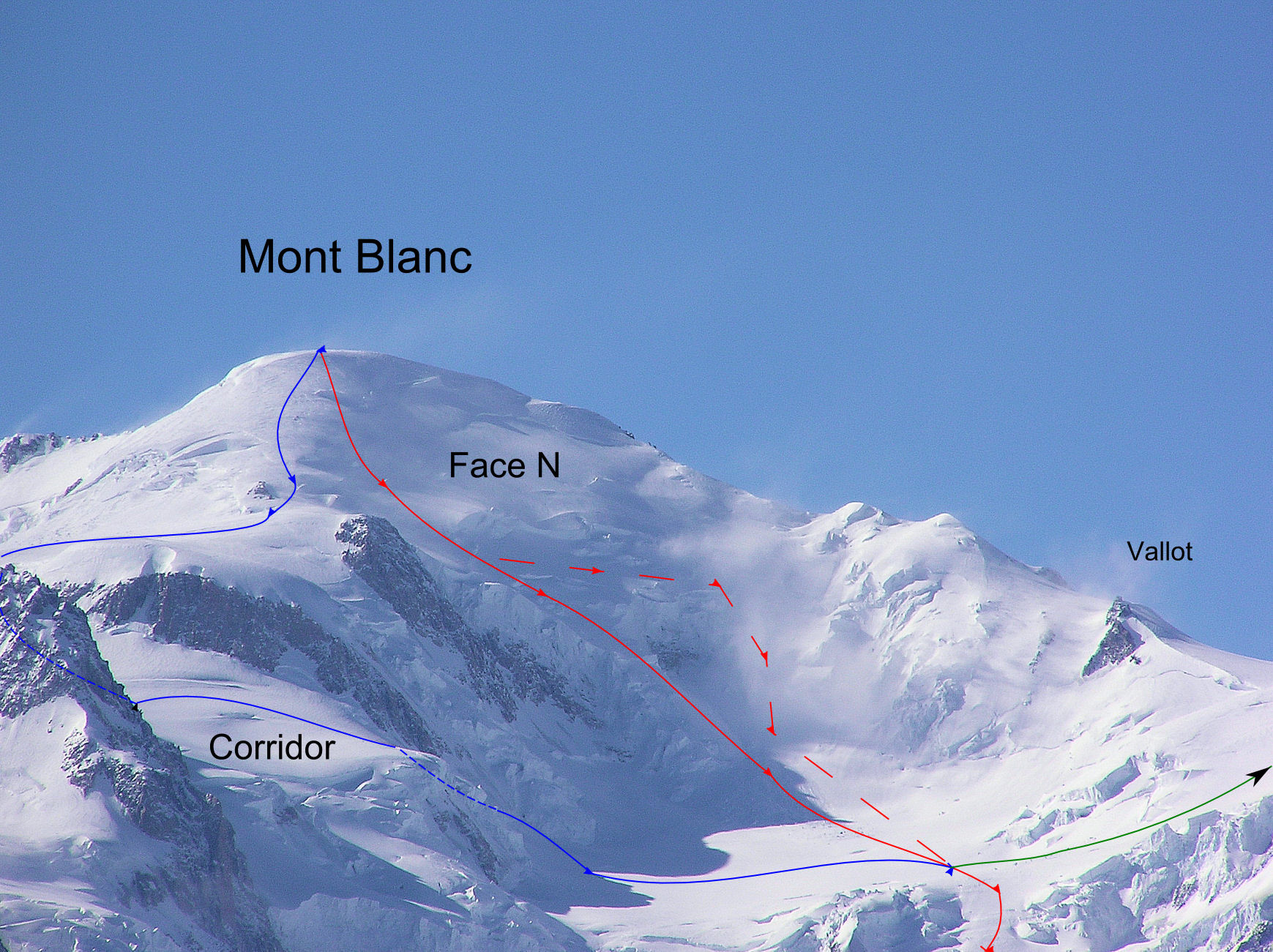
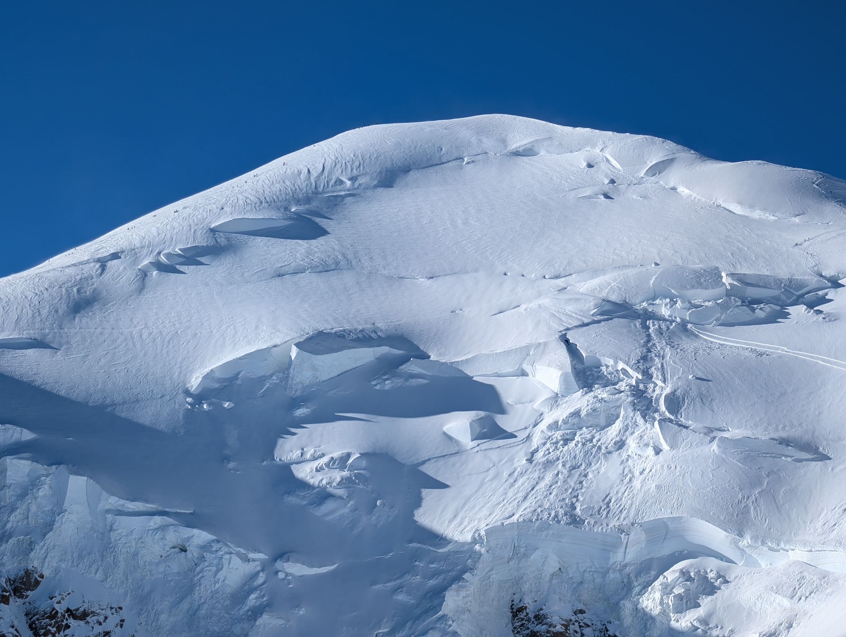
- Either start directly down the N face from the summit, keeping to the right side, (looking down.)
Or go down the ascent route until level with the Rochers des Petits Mulets (4690m), then onto the N face. From here there are two routes possible :
- Keep to the right side of the glacier. Some years this goes (check it out first), but there are a lot of seracs, it is very exposed and finding a good line difficult. It is often necessary to make an abseil.
- Pass on the left side by making an almost horizontal traverse towards the Bosses Ridge. This allows one to bypass a chaotic part of the glacier, then descend to the right by a narrow ramp. Do not hang about, the suspended seracs are immense!
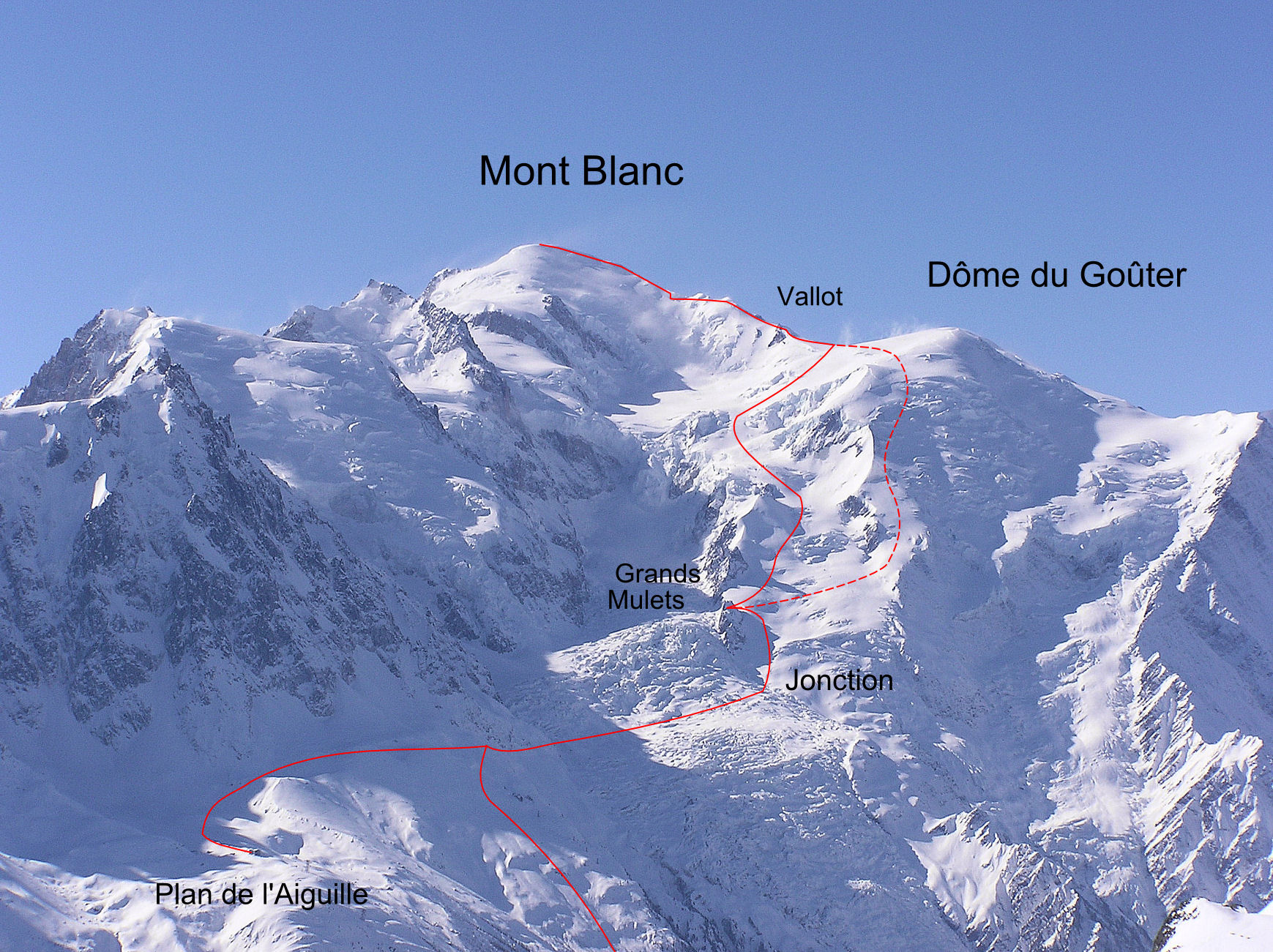
Once at the foot of the face go to the N to reach the Grand Plateau. The next part passes by the Grandes Montées and the Petit Plateau. There are two options depending on the state of the glacier. Normally one goes to the left by the Côte des Cerisiers (to reach the slopes above the Grands Mulets), but if it is too crevassed after the Petites Montées, it is sometimes possible to traverse more to the right towards the Pic Wilson (steeper and more exposed). To finish, descend below the Grands Mulets hut, cross the Jonction and Plan Glacier (chaotic; the route varies), and make a rising traverse (40m height gain) a long the slopes under the Aiguille du Midi, until it is possible to reach the mid-station of the cable car.
Variant by the Corridor
If the N face is impractical ( or in retreat before the summit), it is sometimes posibleto ski down the Corridor route. Descend to the Col de la Brenva by the Mur de la Côte, (ascent route). Traverse under a rock band (“rochers Rouges inf.”) until the “Corridor” (varies depending on the state of the crevasses, the slope steepens to 40-45° +/- depending on the year). this leads to the Grand Plateau.
Variant by the N face of Dôme du Goûter
From the Grand Plateau go to the Point 4057( Pointe Bravais on some maps). From this point stay on the right hand side of the ridge to avoid a first bergschrund, then take a line more to the left down the steep but wide slopes. At about 3800m a bergschrund cuts across a large part of the slope; possible to bypass on the left or jump at its lowest point. Leave the slopes at around 3150m and traverse the Grands Mulets to join the normal route.

The text and images in this page are available
under a Creative Commons CC-by-sa licence.

Download the Whympr App to view this route in 3D.
- Route search (100 000)
- Community returns
- Weather forecast
- Avalanche bulletin
- Race book
- Creation of tracks
- Topographic map (including IGN)