

Open this outing in the app to prepare your next outing.

Arbizon
France • 2831 m
Source
Historique
- Première ascension : inconnue.
- Signal sommital visé en août 1825 par Paul-Michel Hossard et Pierre Peytier.
Bibliographie
- Ascension et vue du pic d’Arbizon par Pierre Toussaint de La Boulinière, Itinéraire">https://books.google.fr/books?id=a5IOAAAAQAAJ&pg=PA294&hl=fr&source=gbs_toc_r&cad=3#v=onepage&q&f=false">Itinéraire Descriptif et Pittoresque des Hautes-Pyrénées Françoises, 1825, tome II, p. 294-297 : première description des itinéraires d’ascension (par le Col du Montfaucon, depuis la Hourquette d’Ancizan).
- Massif de l’Arbizon, par Georges Ledormeur, La Montagne, 1921, no147,">https://gallica.bnf.fr/ark:/12148/bpt6k9764272k/f197.image">no147, p.170 et no148,">https://gallica.bnf.fr/ark:/12148/bpt6k9764272k/f243.image">no148, p.198 : géographie et itinéraires.
- À propos du Pic d’Arbizon, par Pierre Soubiron, La">https://gallica.bnf.fr/ark:/12148/bpt6k9764272k/f242.image">La Montagne, 1921, no148, p.197 : itinéraire du Couloir du Cirque N.
- Le Pic d’Arbizon par Maurice Gourdon, Bulletin">https://gallica.bnf.fr/ark:/12148/bpt6k9628135v/f13.image">Bulletin Pyrénéen, 1928, no187, p.385-387 : récit d’une traversée (montée versant S, descente Diagonale N) en octobre 1880.
Panorama
Vue">https://www.panorama-photo.net/panorama.php?pid=15061">Vue du Pic du Midi de Bigorre par Arnaud Gendre

Routes
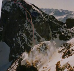
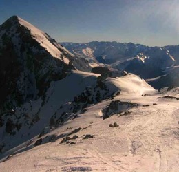
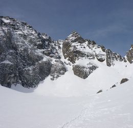
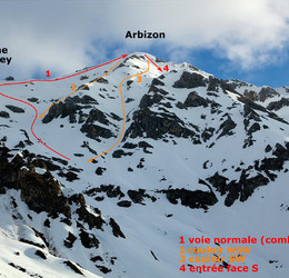
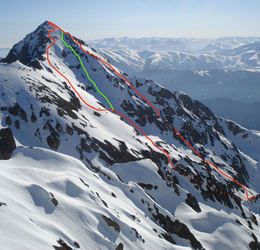

Download the Whympr App to view this POI in 3D.
- Route search (100 000)
- Community returns
- Weather forecast
- Avalanche bulletin
- Race book
- Creation of tracks
- Topographic map (including IGN)